Alachua County Bike Pathway Study
Project Concept Statement
Transporting Ecologies engages design to integrate infrastructural, social, civic, public health, natural, technological, and economic priorities that are typically parsed into solipsistic command and control bureaucracies. Innovative and emergent strategies for urban, suburban, and rural conditions, both proposed and applied, are developed through case study research, observation, analysis, and representation that mediate landscape, transportation infrastructure, and architecture to cultivate civic space in Alachua County. Nets, Braids & Loops conceptualizes modal scales of the neighborhood, arterial connector, and rural routes to organize investment priorities, design protocols, and intervention strategies to transition from policies of segmentation to interconnection.
The Transporting Ecologies studio explores placemaking through ecologically sensitive integration of landscape civil infrastructure and community as the architecture of civic space. Alternative design proposals for specific bicycle and multi-modal events emerge that apply conceptual strategies in response to the local landscape, hydrology, flora, streets, planning morphology, materials, culture, and climate. Visioning of latent potentials emerging from a connected bicycle-pedestrian network integrating civil infrastructure, natural ecologies, and civic space promotes a healthier, more social, and sustainable quality of life.
Nets, Braids, and Loop Concept
Project conceptualization was required to develop appropriate strategies and protocols appropriate to the scales of context that bicycles encounter in the Alachua County region. Nets, Braids, and Loop rationalizes these environments to simplify recommendations and to recognize the benefits that are in place and in some cases, not yet utilized.
Nets: Neighborhood Connectivity
Nets characterize the street grid system and networks of neighborhood streets that organize most housing and in the case of the downtown commercial and public locations as well. This infrastructure is suitable as-is in most locations providing alternate bicycle routes and typically good connectivity.
Recommendation for Nets attempts to connect more problematic high proximity-low connectivity neighborhoods via new short connecting paths (bicycle pedestrian-only) through renovations via new short connecting paths (bicycle pedestrian-only) through renovations of existing emergency right-of-way, stormwater, and utility easements or through purchase-easement creation-sell programs. Nets strategies promote short-cut bicycle/ pedestrian-only routes, support the safe routes to school program and greatly reduce travel distances for cyclists and pedestrians by encouraging more routinized use.
Braids: Local Connectivity
Braids are the arterial linkages that include existing streets, roads, and paths (green spaces and recovered utility corridors) linking residential areas with commercial and employment destinations. These primary routes promote routinized cycle commuting as the most direct routes and need to be continuous between key destinations in Gainesville – residential areas and the University of Florida and the Downtown.
Recommendation strategies utilize existing right-of-way or easements from roads, rail, or utility corridors to achieve a highly connected network optimizing high-use destinations such as the University of Florida. The existing segment analysis is compiled into logical destination-based “braids” and recalculated for weighted cost benefits prioritization as complete systems rather than individual segments.
Project Design
Considering population concentrations conjoined with the linear structure of destination distribution, linkages could be made that leverage existing infrastructure rather than propose new routes. Much of the population lives within 5 miles of the core (UF) and significant portions are within 3 miles. Based on our surveys (discussed in the Public Disposition Section) people would ride on average 25 minutes through well-designed infrastructure – an equivalent distance of 4+ miles.

Existing arterial connectors in the core of the urbanized area organize destinations like a string of pearls. To advance routinized use, optimize bicycle connectivity, and create the shortest possible routes, a similar linear structure is required allowing cyclists to pass the most alternate destinations between routine destinations such as school or work.
Latent demand models from the 2001 Master Plan report were included in this analysis. The demand scores for arterial connectors were in the 90 to 100 range (100 highest possible). Cost benefits analysis from the 2001 report was also included as part of the Braid prioritization factors discussed in the Prioritization and Recommendations section later in this report.
With the majority of the population density distributed to the north and south favoring the west side of town, linages that string these locations to the most visited destinations would require both north-south and east-west connectors. Linking residential areas with destinations via existing arterial auto connectors utilizes the natural density building-up along these corridors. Although these may not be the simplest projects to implement, they offer the most potential for increased cycling as a viable routinized transportation option.
University Avenue and West 13th Street (US 441) act as threads stringing together a large number of businesses. Additionally, these streets provide the shortest distance connectivity between large residential zones and key destinations such as the University of Florida. They also provide the most logical connectors for park-n-ride or park-n-bike facilities – a facility that could formalize the underground system currently ongoing. The city of Gainesville Comprehensive Plan, in the Transportation Mobility Element Objective 1.1 (Policies 1.1.1 & 1.1.3) calls for these arterials (University Avenue ad 13th street) to be modified to provide transportation choice, multi-modality, and livability.
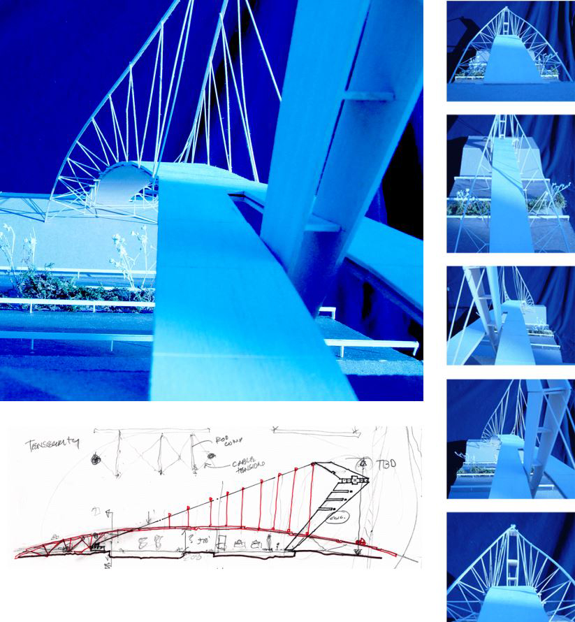
Kanapaha Gateway: Linking Gainesville
Jason Elmer – Undergraduate Senior
A bicycle-pedestrian bridge is proposed to connect west Gainesville across Interstate 75. The bold and innovative tensegrity structure integrates high-efficiency structural design minimizes materials and engenders a visually open and dynamic structure — establishing Gainesville as an important location on the national interstate highway system. Protection for automobiles and safety rails will be included as a visually transparent system such as a web mesh (not shown) to maintain the open feel.
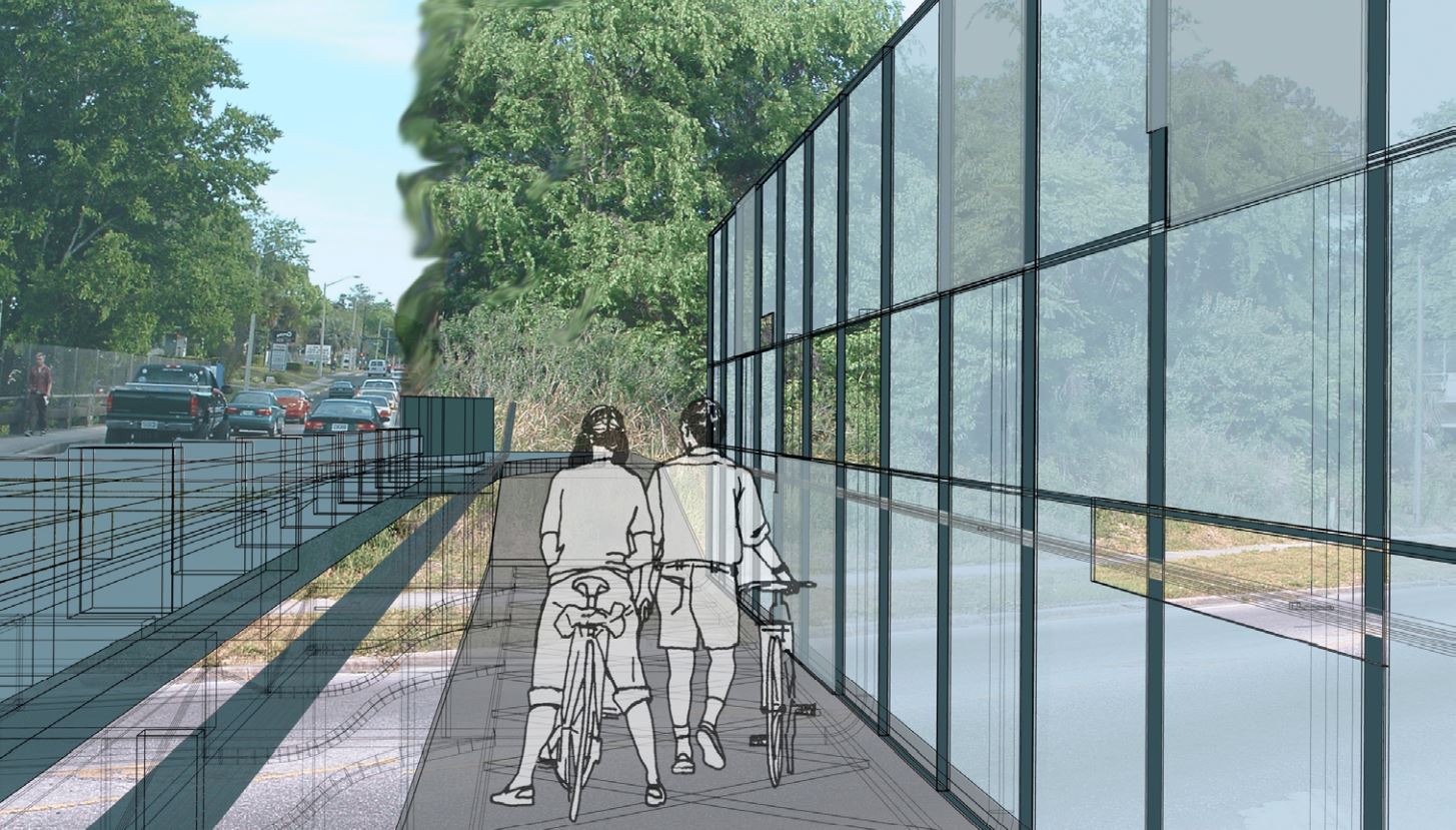
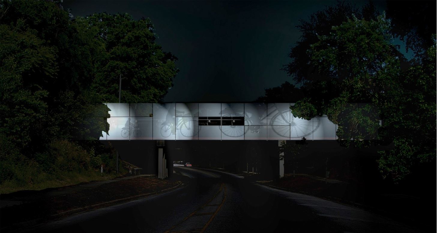
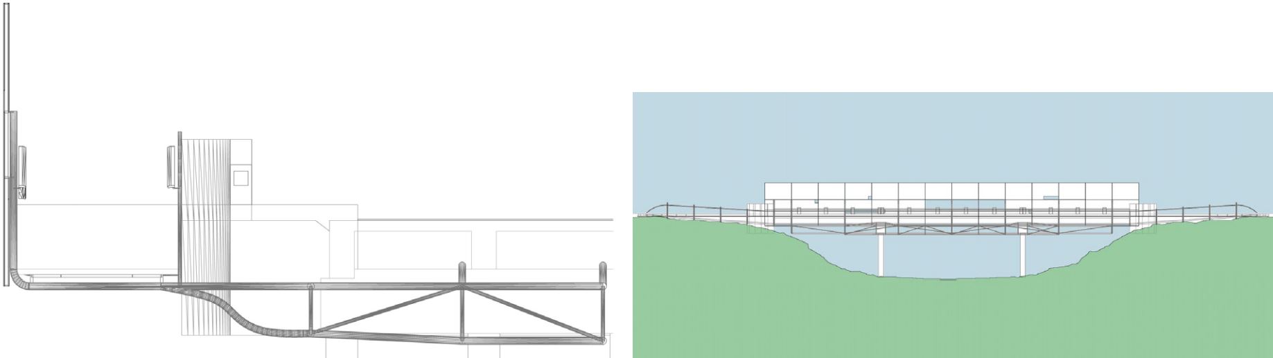
Shadow Screen: NW 13th Street & NW 8th
Travis Orr- Undergraduate Senior
Cycle screen utilizes the cycling movement to activate the NW 13th Street overpass at NW 8th Avenue — currently a cycle and pedestrian hostile zone. The adaptation of shadow screen tectonics portrays various scales of cycle and pedestrians crossing the bridge. Separated cycle paths are provided to connect cycle lanes across the narrow bridge. Cycle pedestrian links to NW 8th Avenue below are provided that integrate stormwater catchments and vegetation to define circulation paths and public space.
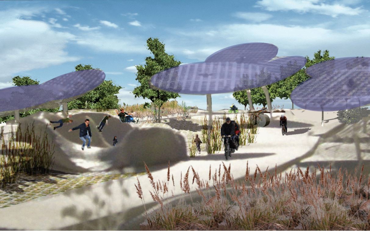
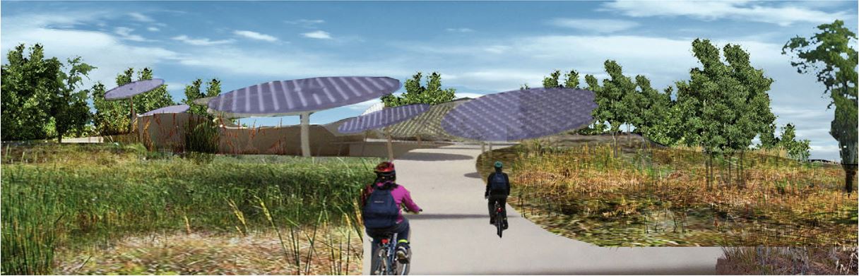
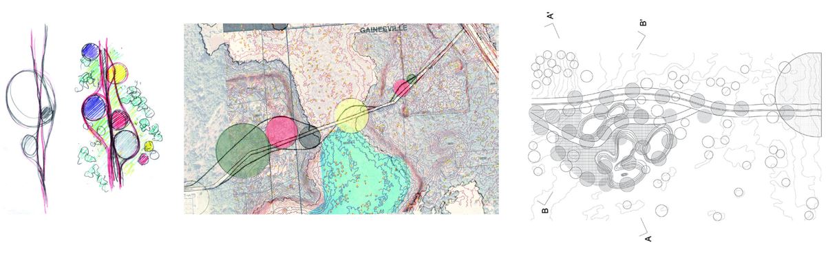
Concretized Fluidity: Kanapaha Skate Pavilion
Koyel Sikdar – Graduate Student
Youth are engaged in healthy activities near the vital wetland recharge area of Kanapaha. Photovoltaic and tree canopies are interchanged to provide shade and electric power utility corridor. The project promotes both individual health through social physical activity (skate park) and environmental health through social physical activity (skate park) and environmental health through awareness and stewardship.
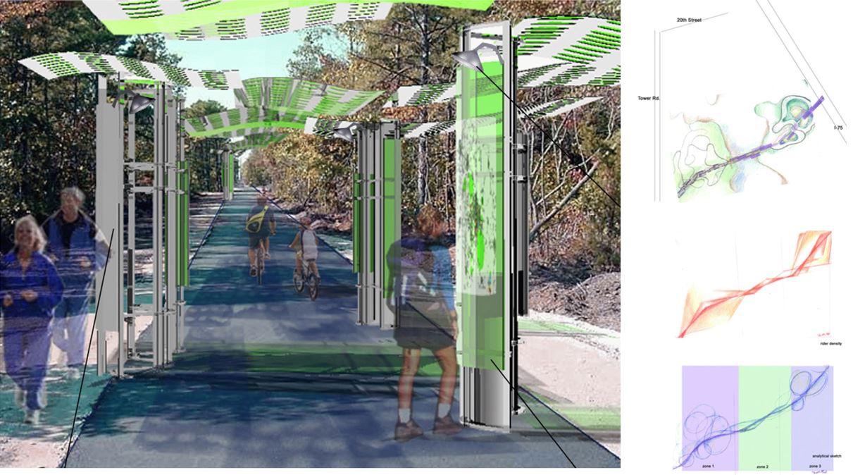
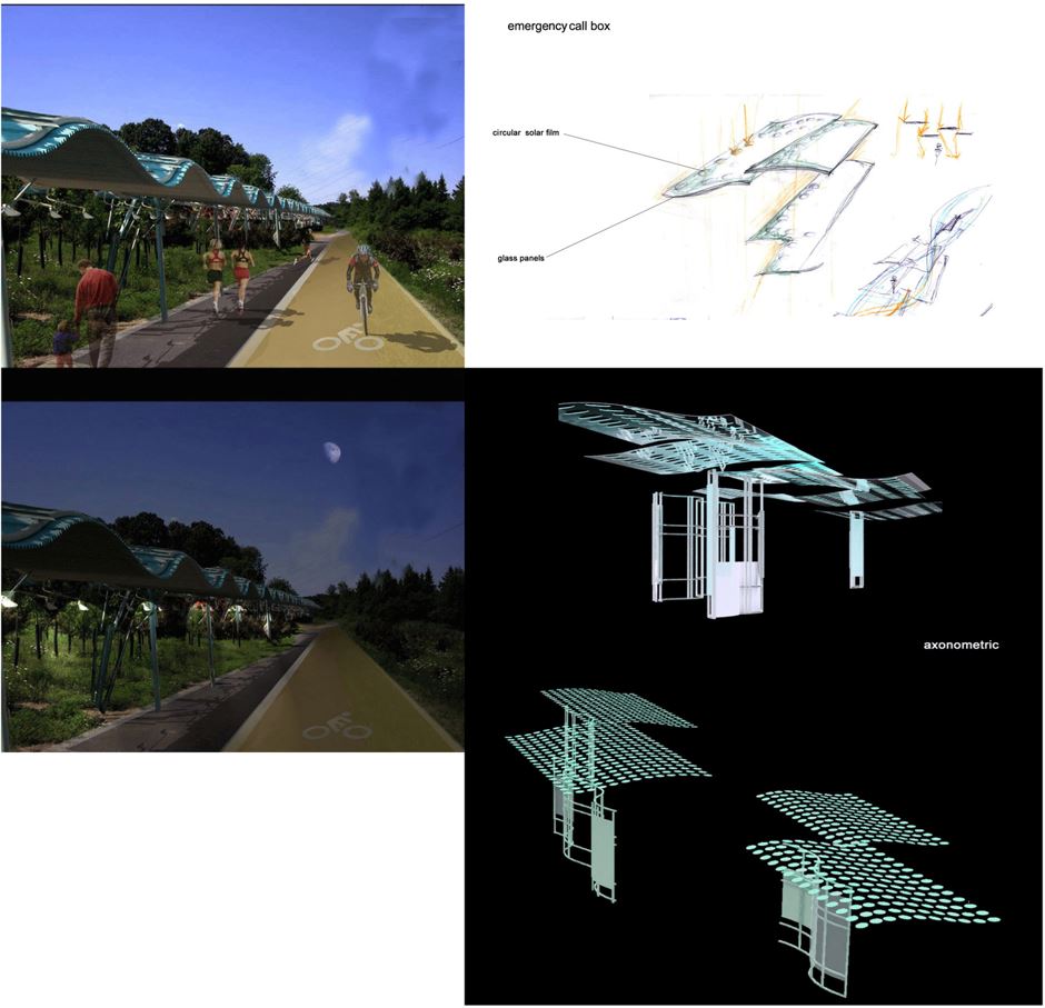
Solar Garden: PV & Educational Kiosks
Dara Huang – Undergraduate Senior
The Solar Garden optimized the use of photovoltaic devices to provide energy to the community while shading the trail. The promotion of ecology and health is supported through kiosks and rest pavilions along the rail. Kiosks might monitor health (heart rate) or other indicators and/or monitor energy generation. Stopping is promoted as a destination encouraging communal interaction.
Parking Garden: Bicycle, Auto, Bus, and Multi-modal Center
Ximena Valle- Undergraduate Senior
The parking garden proposed a formalization of the “satellite” parking around campus. Integrating a “green” parking lot with support businesses and infrastructure to store bicycles allows a park-n-ride model to exist for cyclists to get in and out of campus more easily. It
does rely on a well-developed network of paths to campus. Stormwater and vegetative islands are used to provide hydrologic infrastructure, shade, and habits for birds.