The spring of 2008 marked the commencement phase of the Sustaining Chipley project. Professor Martin Gold led an Architectural Studio of 12 students that initiated field research, held and documented a stakeholders meeting, and conducted precedent studies of housing typologies that might be adapted for the Chipley context.
Project Objective
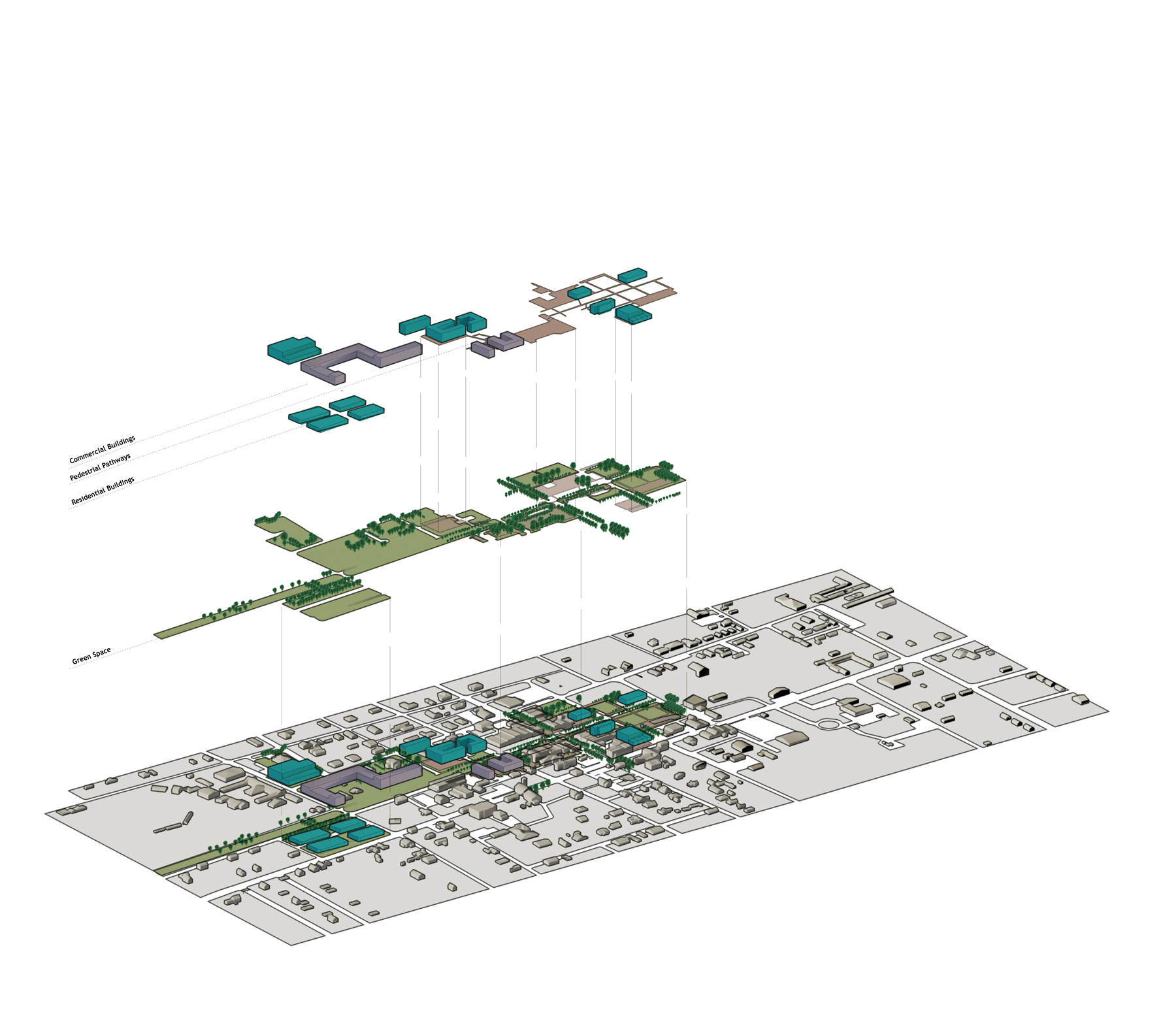
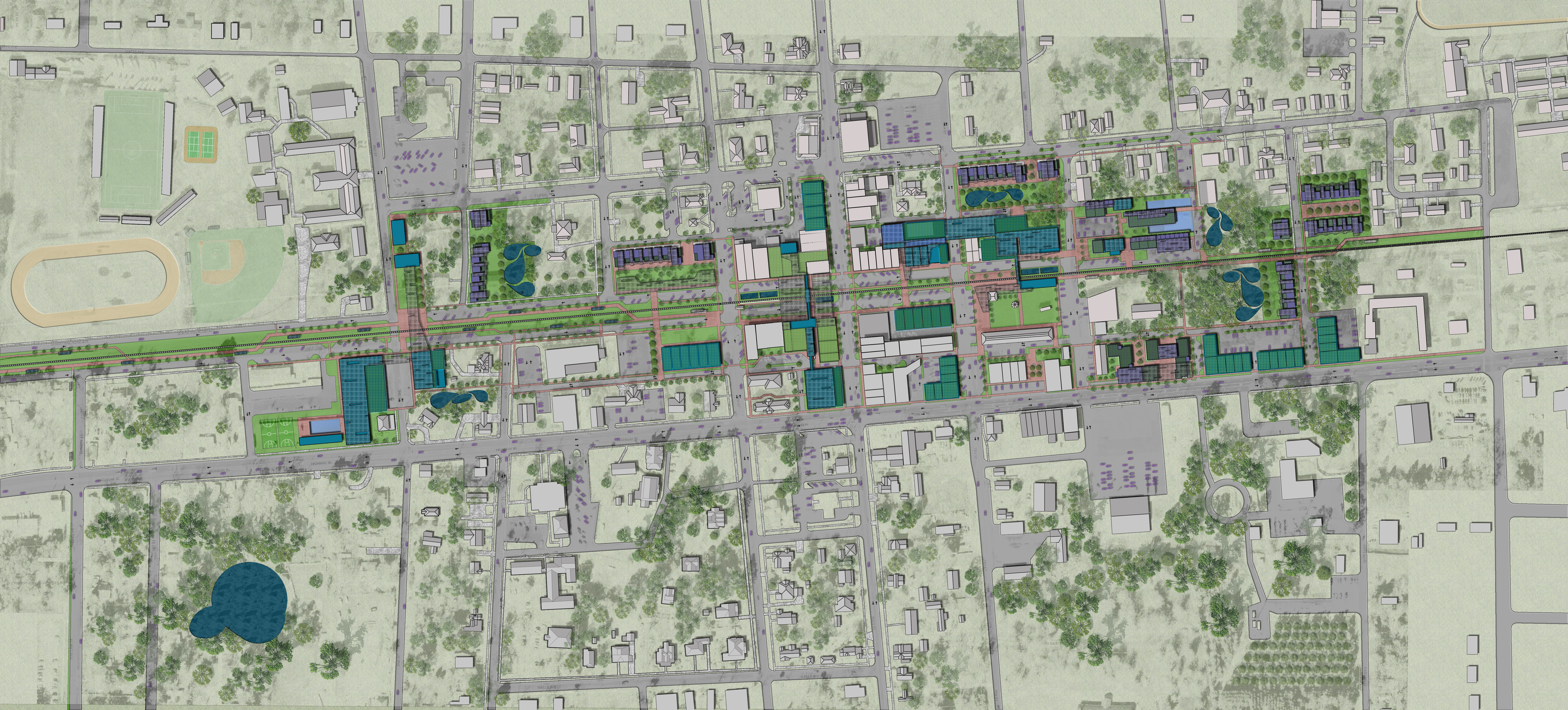
From the initial field studies and research, the project team developed five alternative master plan strategies that incorporate the needs and expectations expressed by stakeholders.
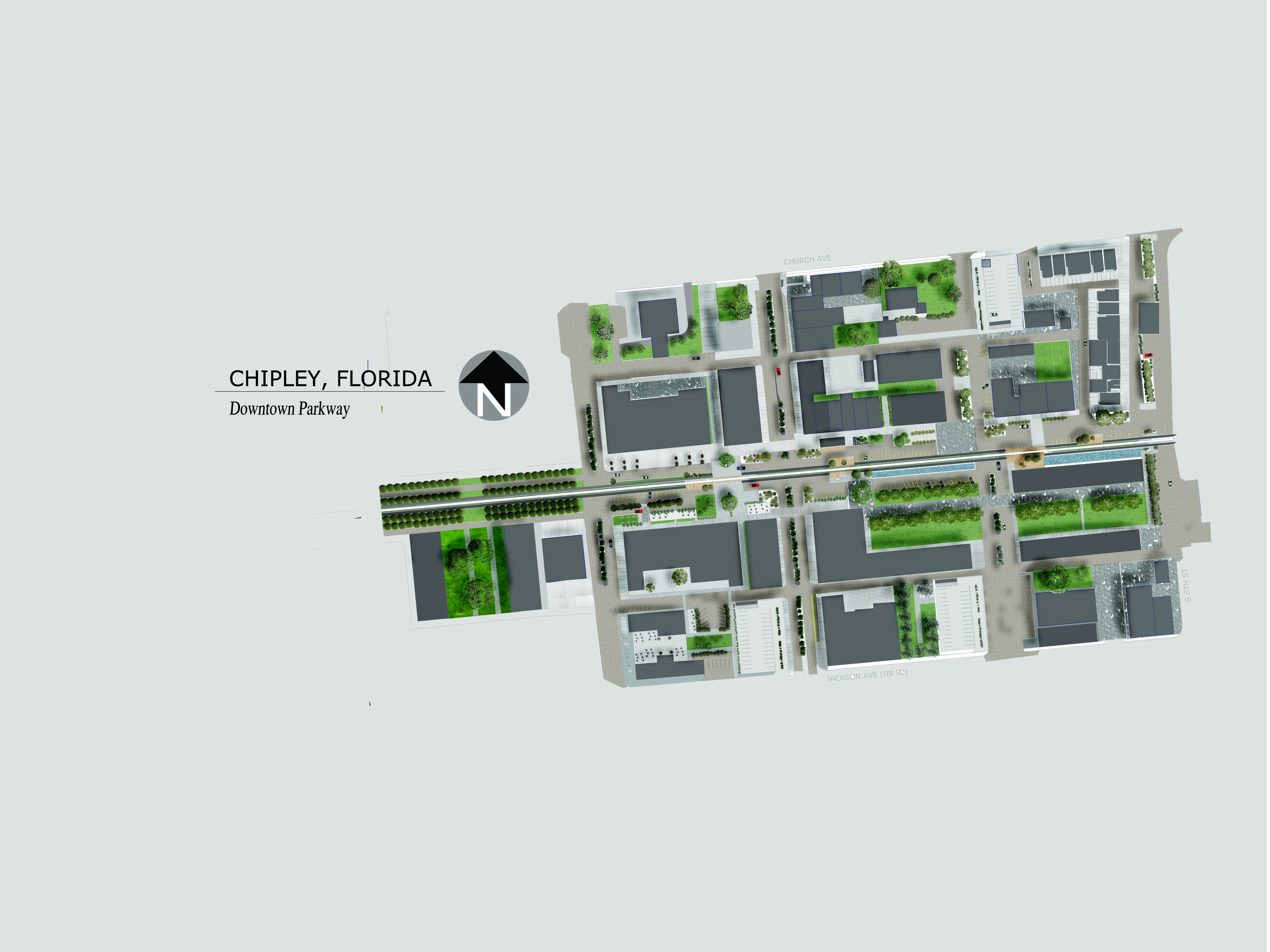
The schemes take slightly different approaches toward capitalizing on the present amenities such as the CSX railroad that splits the main street downtown (a true railroad town); the historic fabric and scale of the early 20th Century buildings, and the pedestrian-orientated core fabric; and the available vacant land in the downtown.
The team traveled to precedent cities in Florida’s Panhandle including Panama City (recently redeveloped Main Street) and Seaside (model New Urbanist development) on February 3rd, 2008.
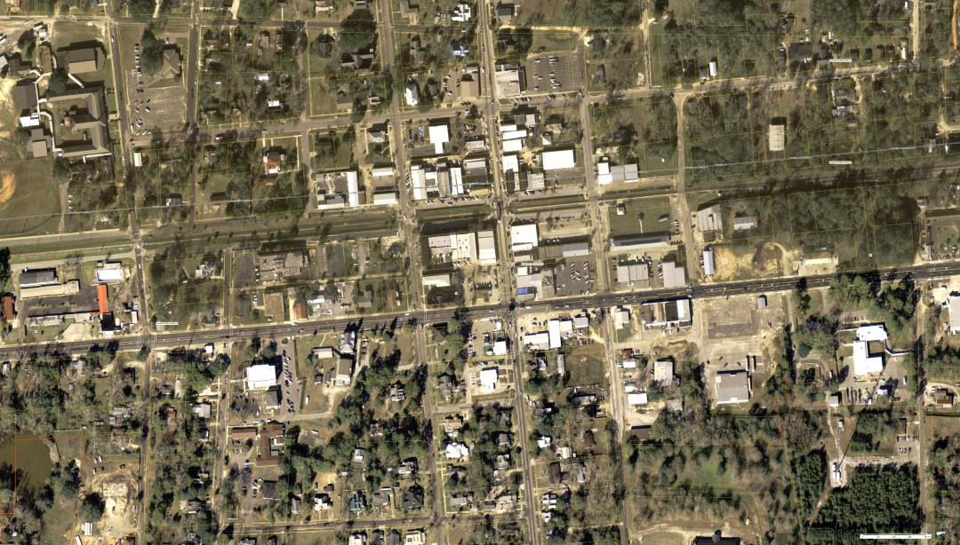
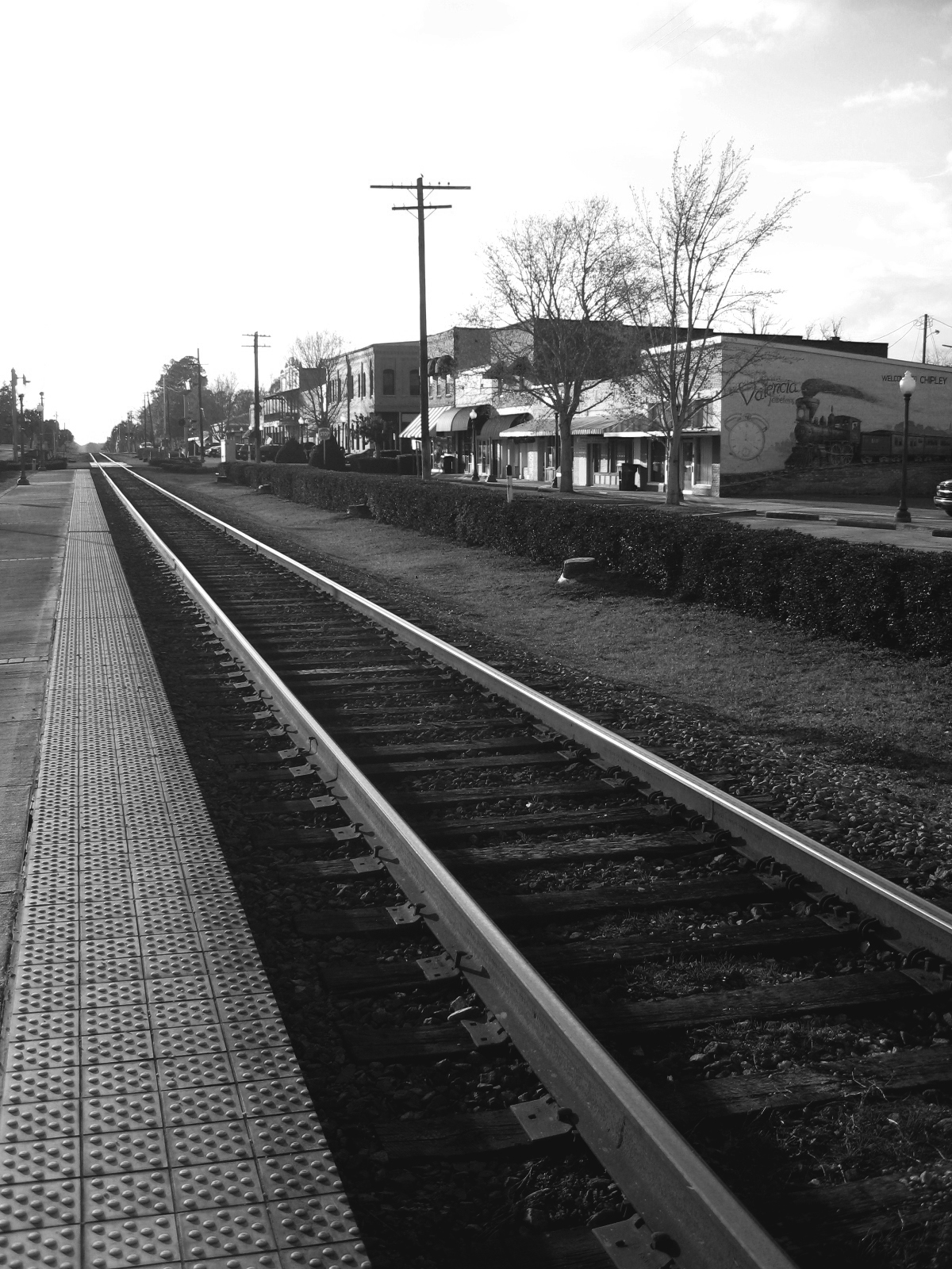
Field documentation and measurements were conducted with regard to urban scale, amenity, pedestrian-only designations and the mixing of pedestrians and automobiles and viable building uses. On February 4th, 2008, the project team photo documented each block of Chipley’s core downtown area and made key measurements of urban infrastructural elements.
The project team met with the Board of Directors of the Chipley Community Redevelopment Agency, members of the Chamber of Commerce, and downtown merchant stakeholders to survey perceptions of the community in terms of desirable and undesirable aspects of economic and urban development. Many comments and issues were raised. Three themes were consistent throughout the dialogue — (1) there was a desire for rehabilitating historic buildings that would likely require new structural systems; (2) additional parking for downtown customers was perceived as strongly needed; and (3) more residential units were desperately needed in the downtown to support commercial activity.
Our preliminary work focused on addressing the primary concerns as noted above in addition to linking the downtown to regional amenities, developing a sustainable infrastructure (power generation and stormwater filtration/ reuses), providing needed shade in the downtown, capturing residual space for commercial (revenue-generating) uses and developing a unifying syntax for urban design to integrate the quality historic buildings with new buildings that would be affordable and integrate sustainable construction methods and materials.
The project team met with the Board of Directors of the Chipley Community Redevelopment Agency, members of the Chamber of Commerce, and downtown merchant stakeholders on February 4th, 2008. The team met with stakeholders to survey perceptions of the community in terms of desirable and undesirable aspects of economic and urban development. Many comments and issues were raised which are summarized in detail below. Comments ranged from specific desires such as more parking to general characterizations of the family orientated and slow pace of the town that is considered highly desirable. The three themes were consistent throughout the dialogue — (1) there was a desire for rehabilitating historic buildings that would likely require new structural systems; (2) additional parking for downtown customers was perceived as strongly needed; and (3) more residential units were desperately needed in the downtown to support commercial activity.
Teams Tackling Potential Development
Long-range planning requires man facets to align in a particular fashion over a long period of time to achieve a singular master plan. A single vision is useful in the early phases to get the first projects initiated but can quickly become a hindrance if markets, tourists, employers, or natural disaster events change the context for better or for worse.
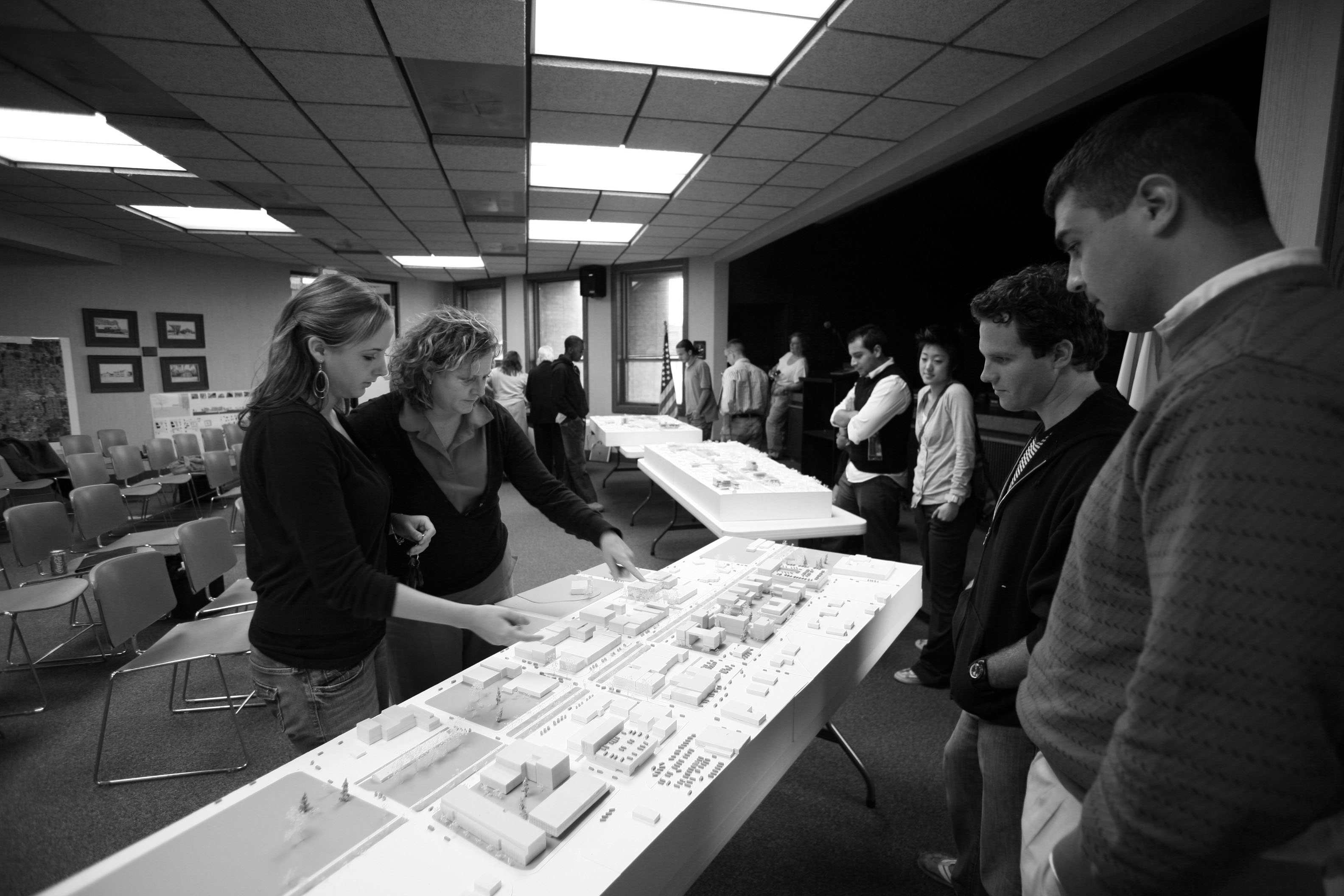
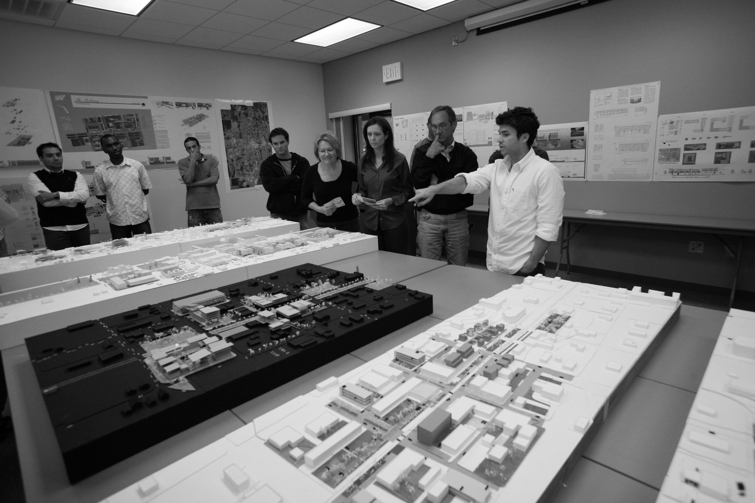
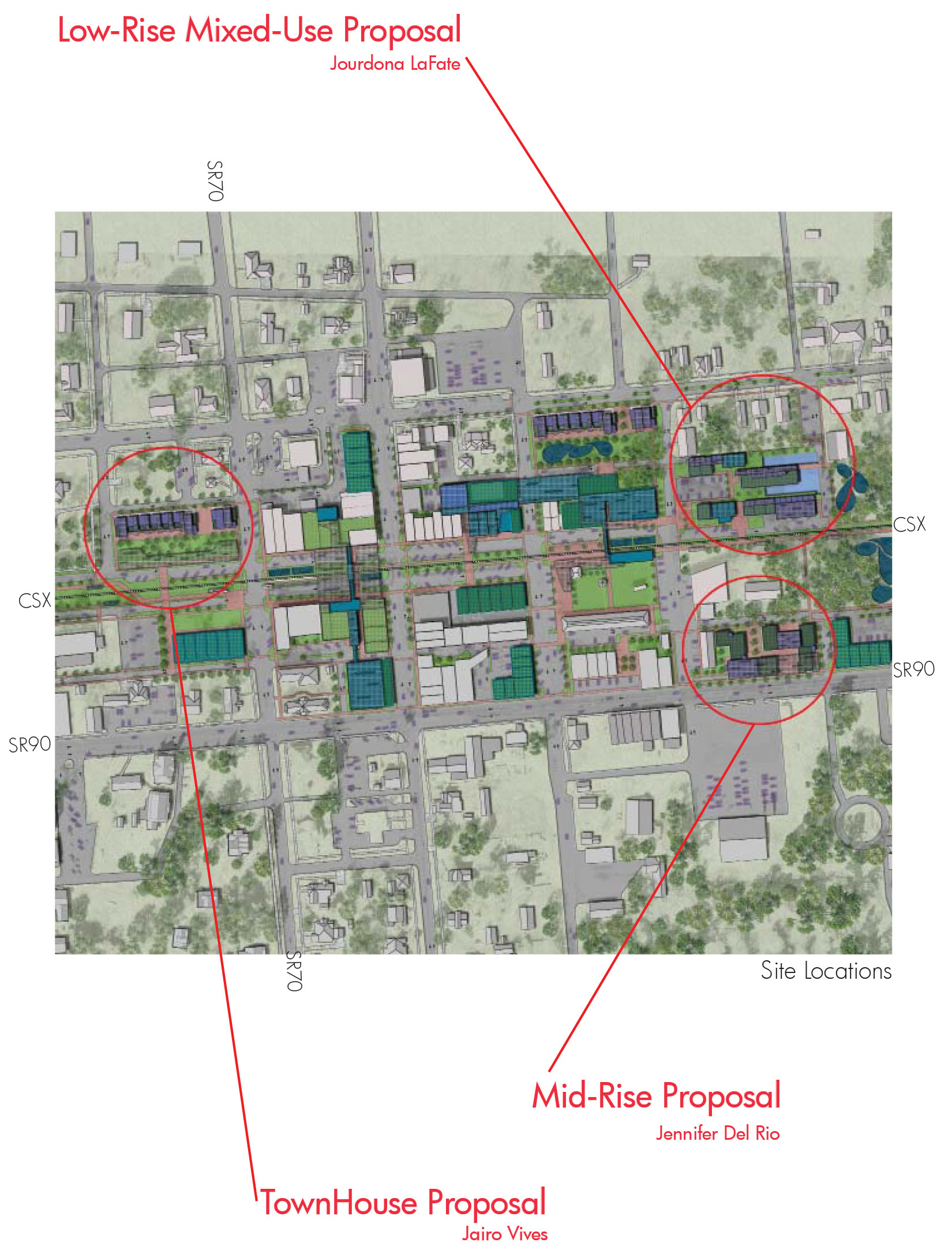
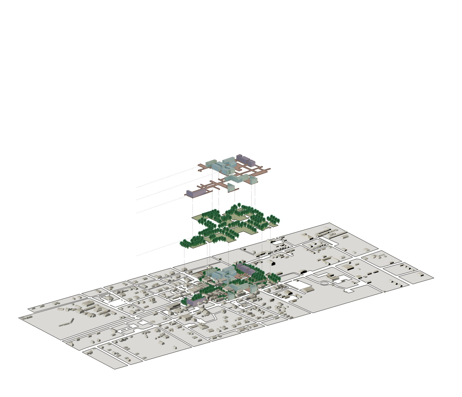
Also, given the many possible opportunities for Chipley, the project team will study five alternate schemes to move toward a set of high-priority recommendations and visualizations of alternate outcomes. The project team was divided into five urban planning groups. Each group developed a conceptual approach to counterposing weaknesses and opportunities that draw on a combination of field and archival research.
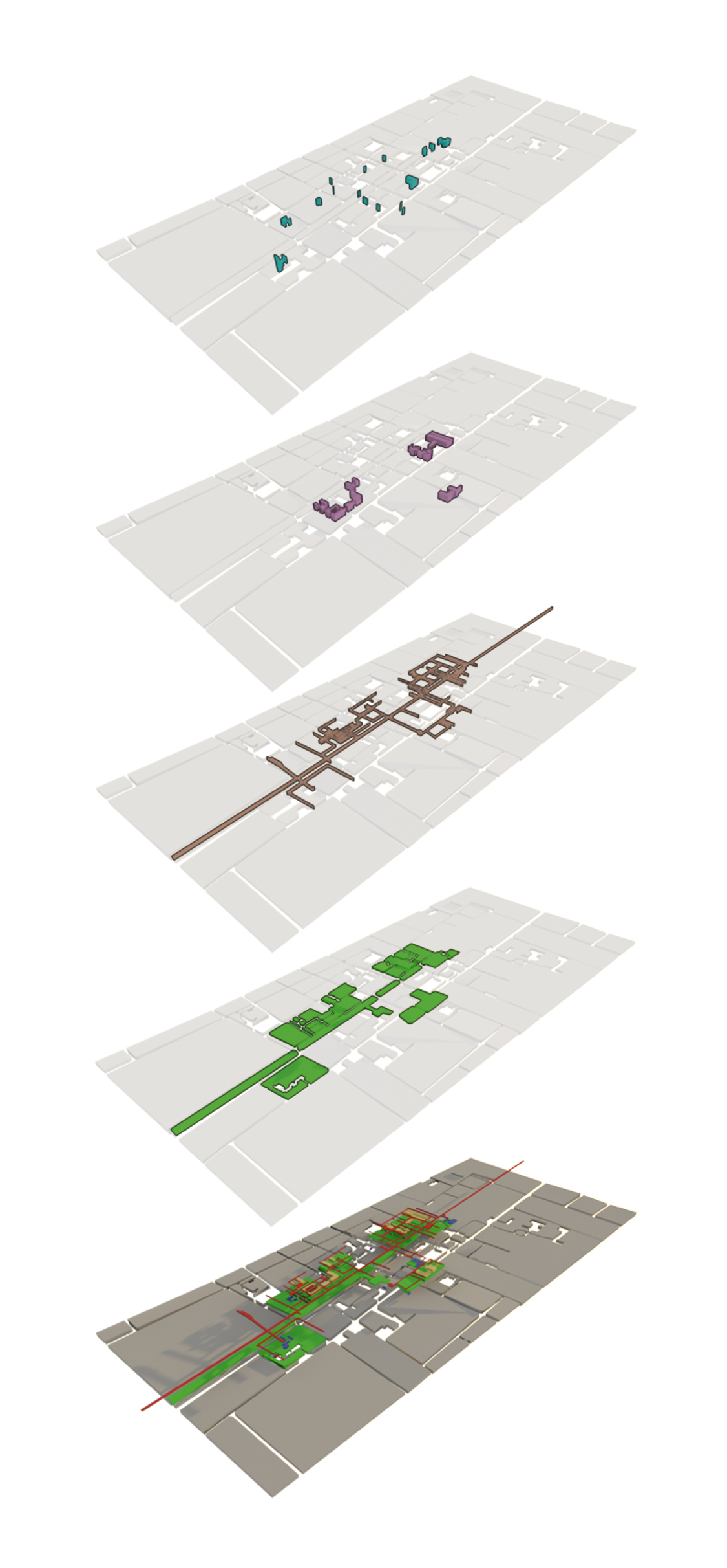
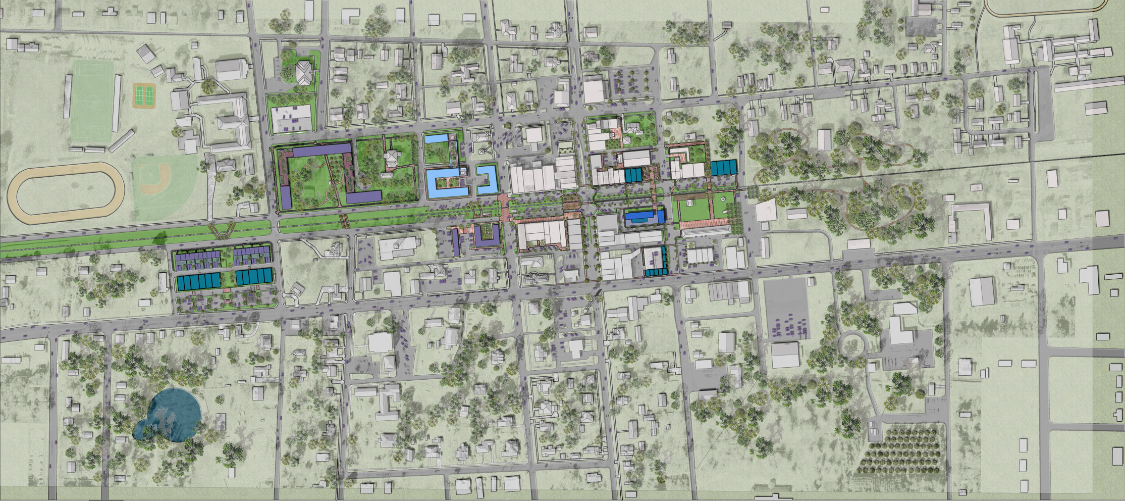
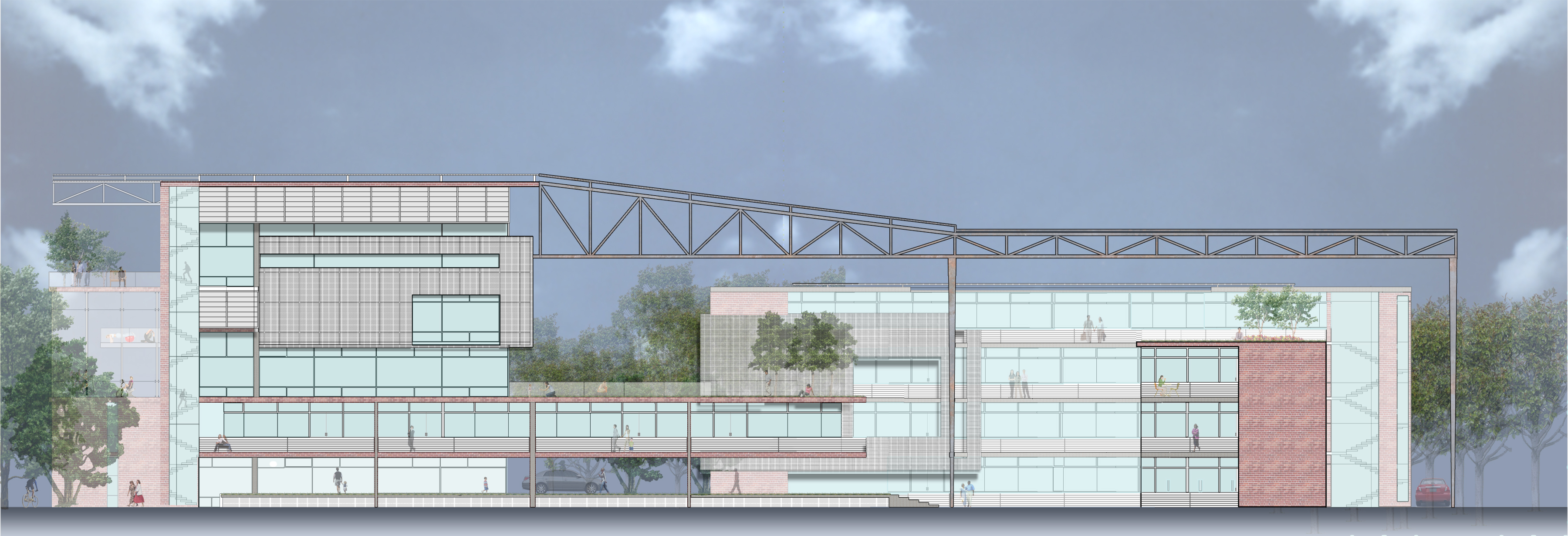
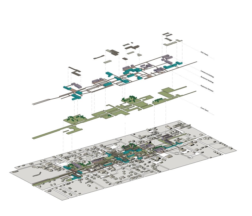
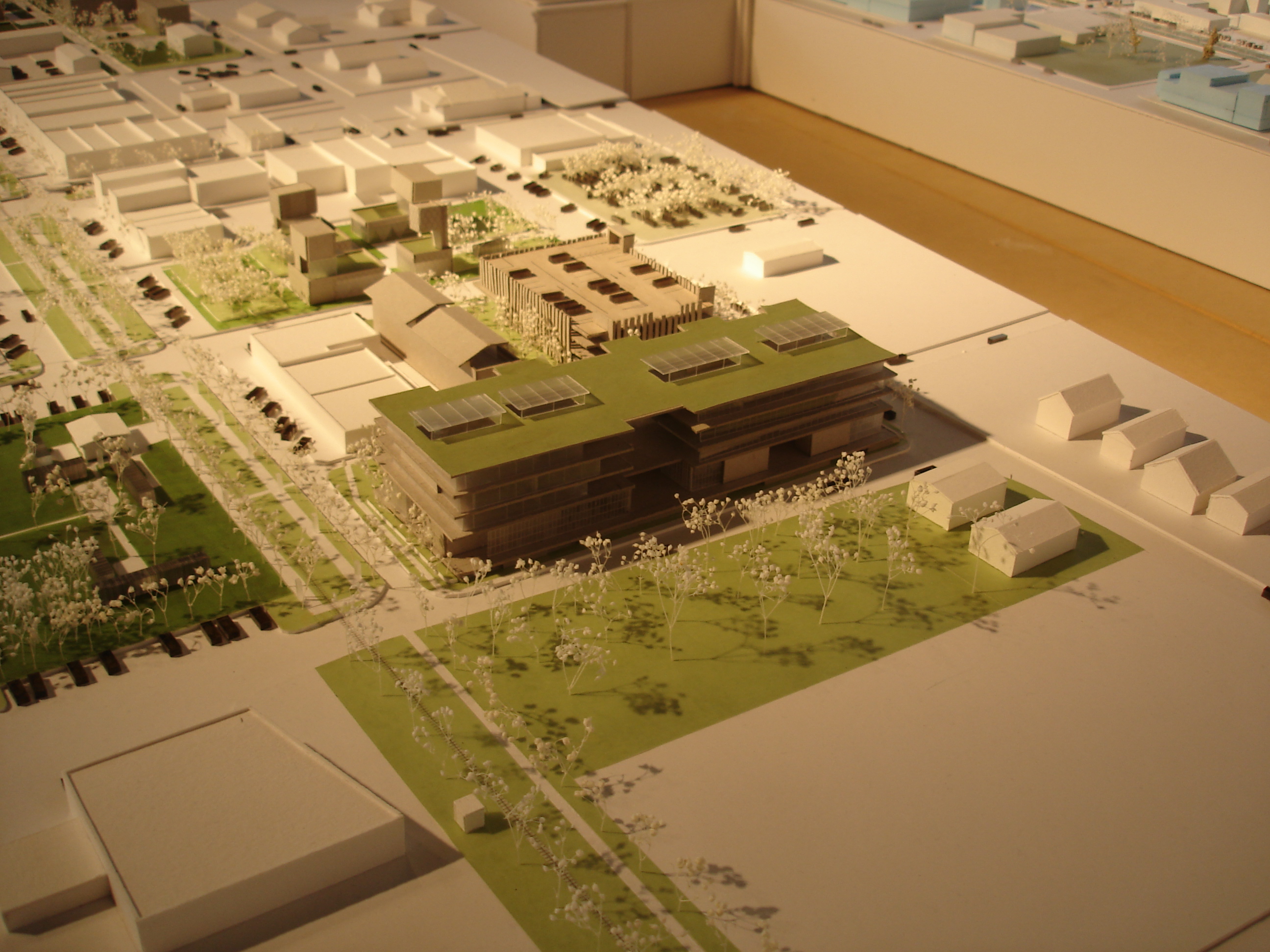
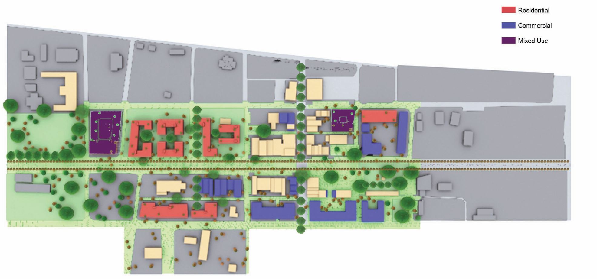
Each team is developing an analysis/ strategy for urban design and downtown redevelopment that includes urban sections, urban plans, physical scale models, and electronic models. The teams will focus on optimizing vacant land, identifying buildings for restoration/adaptive use, linking the two sides of the railroad track for improved pedestrian crossing, developing quality civic space, integrating parking (grade and garage), and locating key commercial anchors such as a hotel and retail establishments.
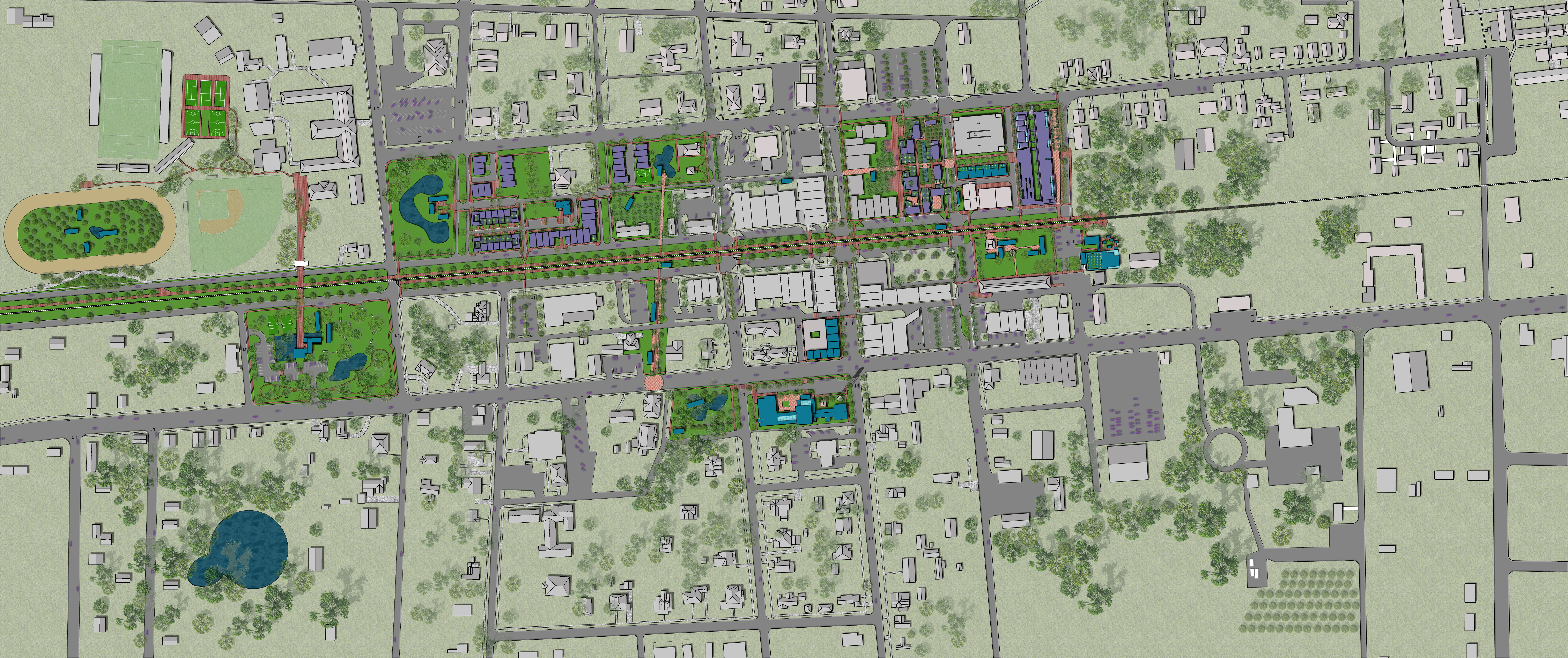
Group 1: PV Park
Jennifer Del Rio, Jourdona LaFate, Jairo Vives
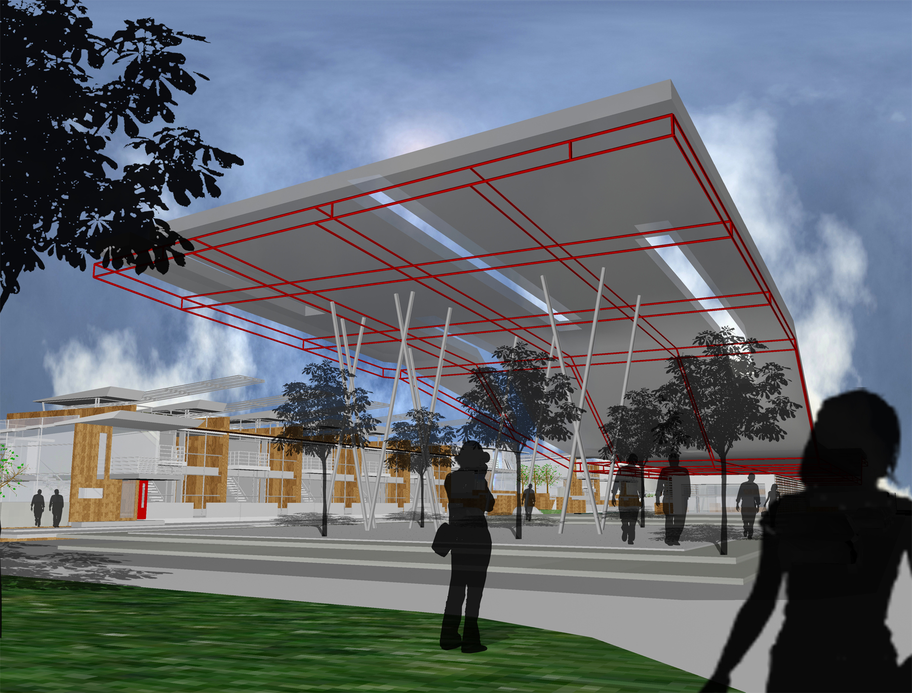
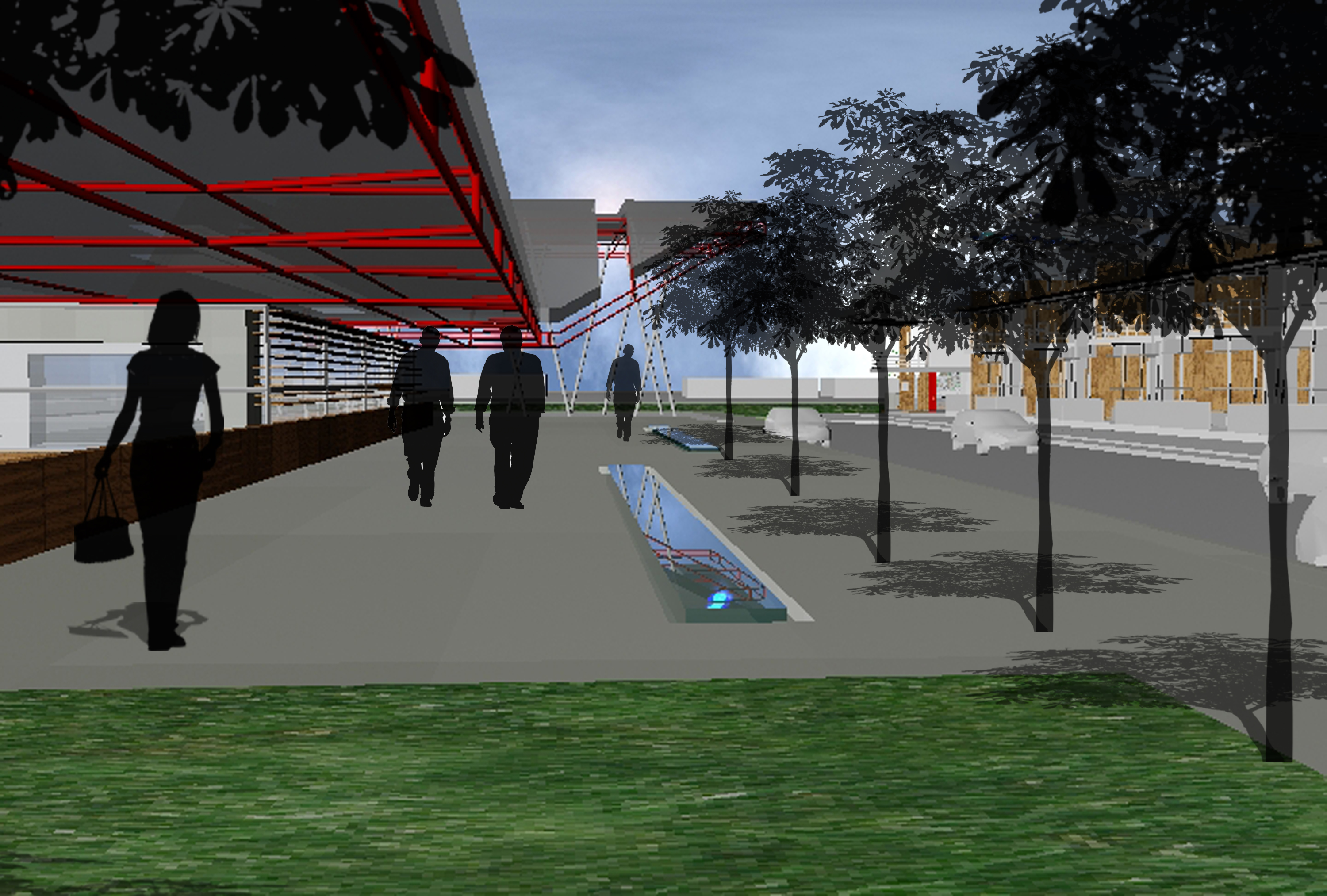
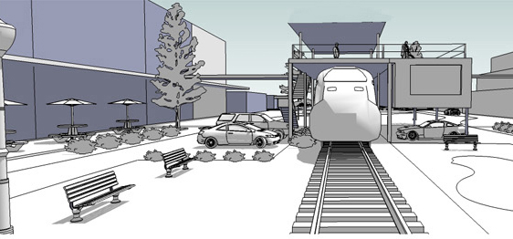
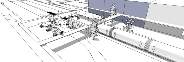
Drawing from the line of the railroad yet expanding the idea of a core infrastructure that supports a unique urban condition, PV Park incorporates a photovoltaic (sun electricity) power as generator for an urban park in the town.
Group 2: Pre-Urban Sutures
Patricio Ayala, Shaheen Gazvini, Orain Scarlett
This scheme emphasizes the lineage and heritage of the railway as a core element in downtown Chipley while deploying strategies to make connections (sutures) across the spatial gap that the track creates the downtown.
Group 3: The Parkway
Alex Chaille, Ron Devine, Jose Vieyra
Extrapolated from the Dutch Woonerf (pronounced “voonerf”) which translates to the residential yard, the Parkway scheme integrates automobiles, civic space, commercial entities, pedestrian movement, and bicycle movement into an overlapping spatial system.
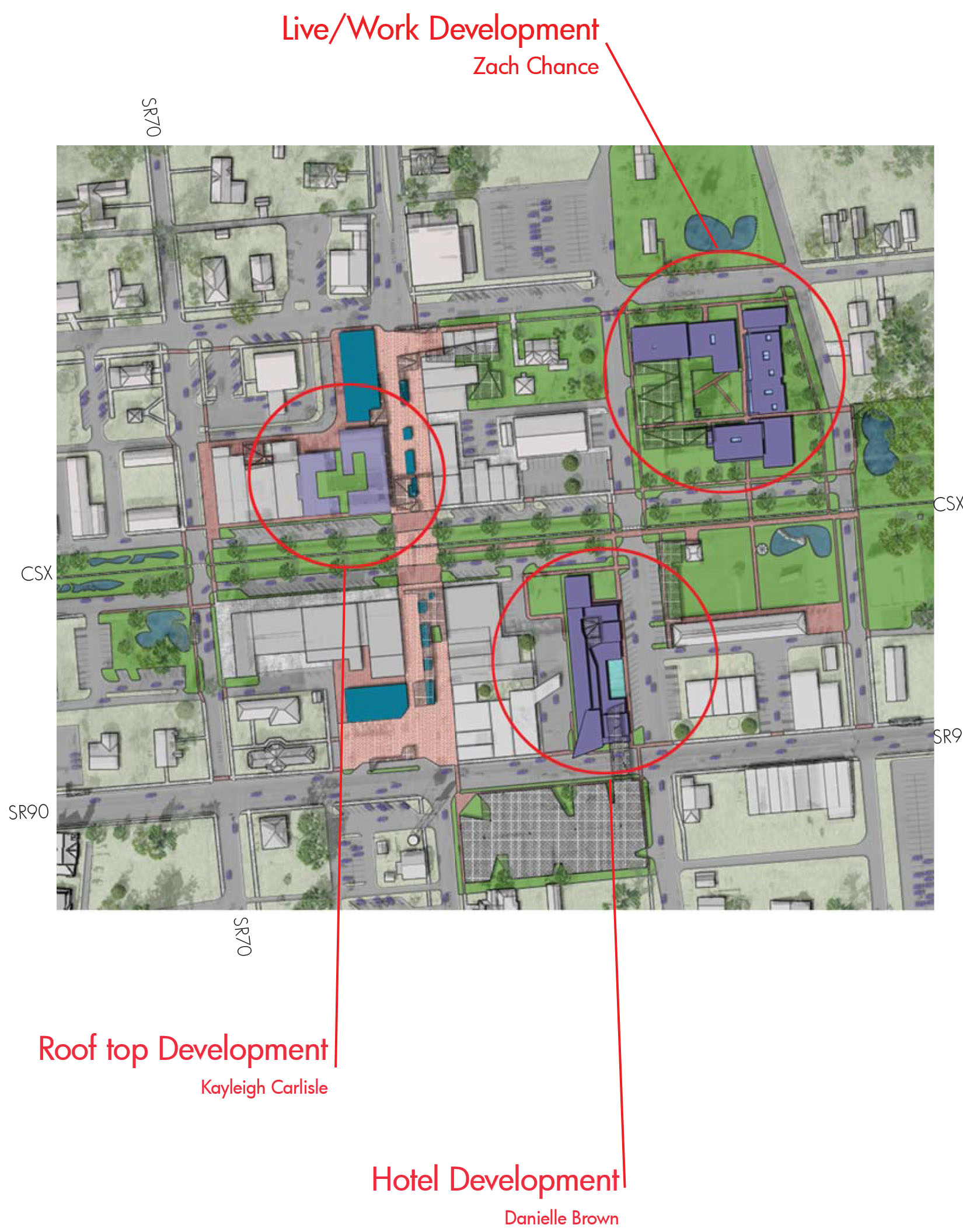
Group 4: Growing Small
Danielle Brown, Kayleigh Carlisle, Zach Chance
Redefining the downtown streets by combining pedestrian and transit priorities to concentrate commercial activity and residential growth, this plan seeks to create a pedestrian-dominated core.
Group 5: Urban Rooms
Christa Campbell, Ross Howayeck, Michal McVinney
Careful study of the relationship between public green space and residential density inspired the Urban Rooms concept.
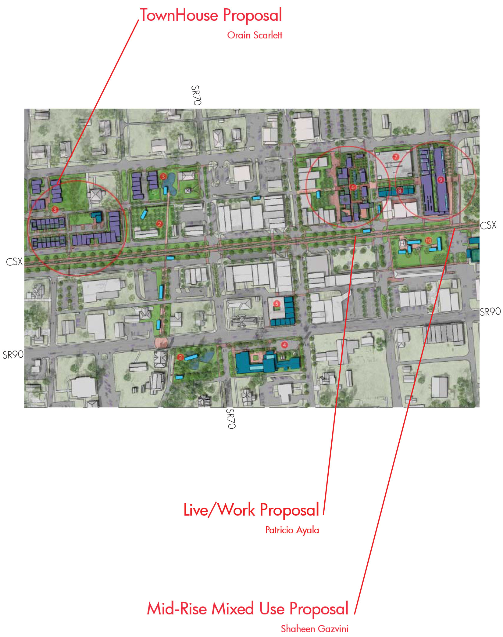
Site Proposals:
PV Park- Jennifer Del Rio, Jourdona LaFate, Jairo Vives
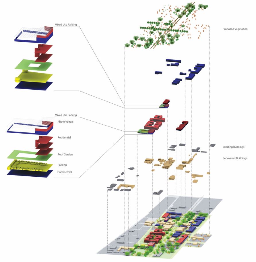
Drawing from the line of the railroad yet expanding the idea of a core infrastructure that supports a unique urban condition, PV Park incorporates a photovoltaic (sun electricity) power as a generator for an urban park in the town. This power generating system makes urban gestures to create civic space, enhance pedestrian circulation, provide needed shade and of course, generate electricity.
As an infrastructure, the system is completely expandable and able to accommodate both private and public investments. Green space is layered with the Photovoltaic elements as a system of PV canopy, tree canopy, hardscape, greenscape, and wetscape. Existing natural areas are connected to the core through a system of parallel linear parks, with adjacent row houses, low rise, and mid-rise housing.
The parks extend into the region through bicycle/pedestrian paths. A systematic phasing strategy will also be developed to take advantage of PV incentives from state and federal government agencies to facilitate the concept of Chipley as a unique PV town.
Suggested Strategies: Incorporate mixed-use residential buildings near downtown, Renew current strategies to accommodate new programs, Create a network of green alleys for pedestrian movement, and Implement sustainable systems to promote ecotourism.
Photovoltaic systems generate electricity from sunlight using solar panels.
Advantages
Reliable, well tested, very low maintenance. Do not release any harmful air or water pollution, deplete natural resources, or endanger human or animal health. Quiet and less visually obtrusive than other forms of renewable electricity generation. Because of their modularity, solar electric systems can be designed to meet any electrical requirements, large or small. In locations that do not already have a power supply, an off-grid solar electric system may be more cost-effective than running power lines.
Disadvantages
High initial cost. Ongoing research into the materials and production methods involved in solar panel manufacturing may lead to future decreases in price. Solar Power is a viable energy source. Solar panels can not produce electricity at night or during dense cloud coverage, so a residential solar electric system must either have batteries for storing electricity or a backup source (such as a connection to the grid).
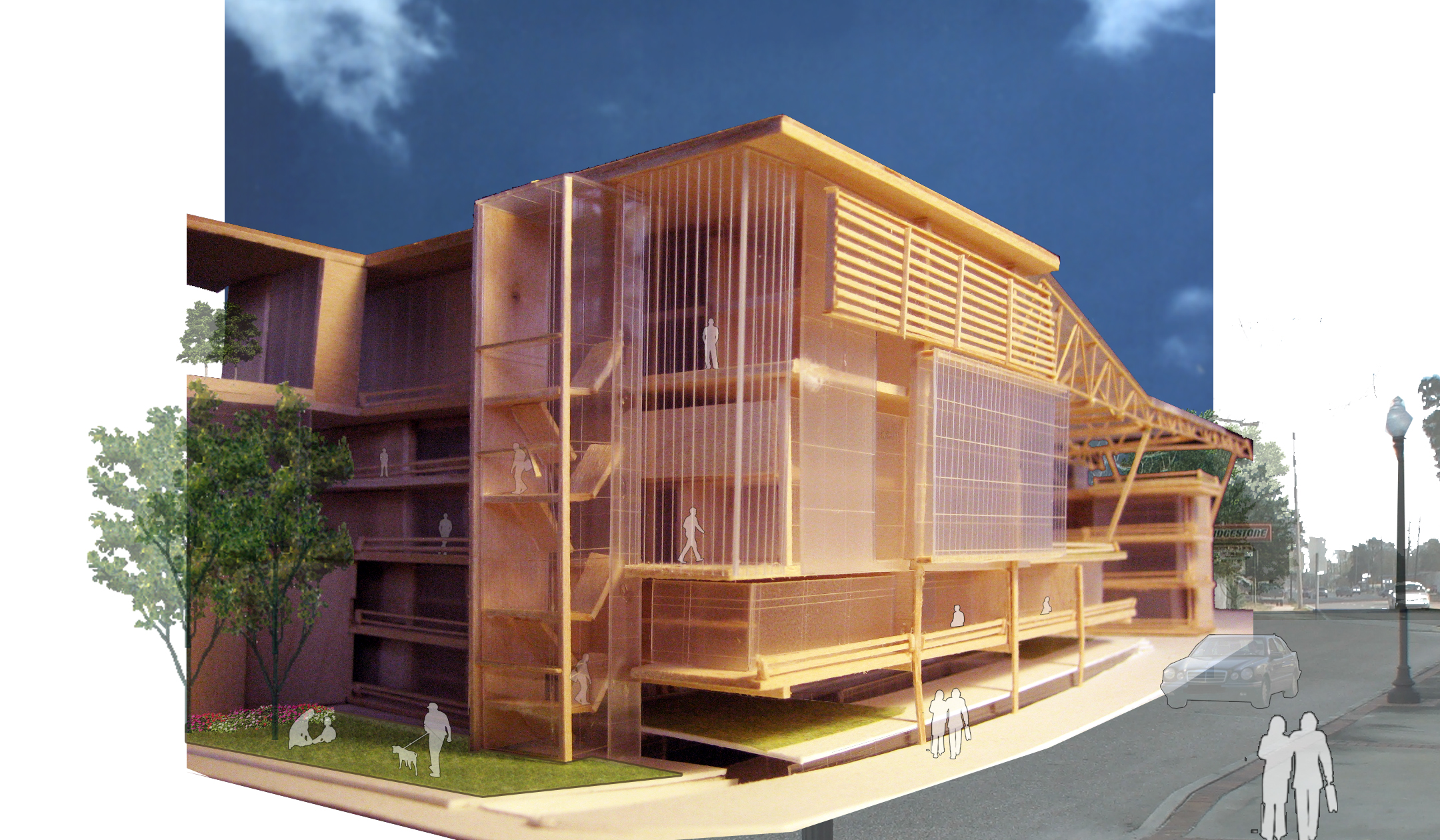
Drawing literally from the line of the railroad yet expanding the idea of a core infrastructure that supports a unique urban condition, PV Park incorporates a photovoltaic (sun electricity) power generator for an urban park in the town. This power generating system makes urban gestures to create civic space, enhance pedestrian circulation, provide needed shade and of course, generate electricity. As an infrastructure, the system is completely expandable and able to accommodate both private and public investments.
Green space is layered with the Photovoltaic elements as a system of PV canopy, tree canopy, hardscape, greenscape, and wetscape. Existing natural areas are connected to the core through a system of parallel linear parks, with adjacent row houses, low rise, and mid-rise housing. The parks extend into the region through bicycle/pedestrian paths. A systematic phasing strategy will also be developed to take advantage of PV incentives from state and federal government agencies to facilitate the concept of Chipley as a unique PV town.
Green Trail
Currently, there are no bicycle trails running through Washington county. Incorporating a trail along Railroad Ave would be beneficial by encouraging healthy living and promoting pedestrian-friendly living and a pedestrian-friendly city. Laying Biking and Walking Trails that connect to cities like Wausau and Vernon, which have nature parks, will establish Washington county within the greater network of Florida.
Solar Systems
The function of these solar energy systems is to convert sunlight to heat that can be used for space heating, space cooling, and domestic hot water. These systems are not an integral part of the building’s structure. Solar hot water, heating, and cooling systems are the best in terms of design and are the most economical when planned and incorporated into a new structure. The initial capital cost of these systems tends to be high.
Roof Pond Systems
This system can provide both heating and cooling. 6-12 inches of water are contained on a flat roof, usually stored in large plastic or fiberglass containers covered by glazing. During the cooling season, an insulated cover is removed at night to expose the water to cool night air. The water absorbs heat from below during the day and radiates it out at night. During the heating season, the insulated cover is removed during the day. The water absorbs heat from the sun and radiates it into the building below.
Geothermal Heat Pumps
Take advantage of the relatively constant temperature of the Earth a few feet below the surface and use it as a medium for heat exchange. Geothermal heat pumps can both heat and cool. They typically function by running fluid through pipes set in the ground.
Landscaping
Designed to reduce the heating and cooling load of a building can greatly reduce its energy needs. Vegetation can greatly reduce unwanted heat gain by keeping the sun from directly striking a building and preventing reflected light from entering. Trees, shrubs, and grass also provide cooling through evapotranspiration. Vegetation also affects wind velocity, and depending on location, can protect a building from cold winter winds, slow air leakage, and funnel cool summer breezes into the building.
Group 2: Pre-Urban Sutures- Patricio Ayala, Shaheen Gazvini, Orain Scarlett
Objective
The project investigates the progressive atrophy of urban conditions at various scales in downtown Chipley, Florida. In an effort to revitalize the idea of “pre-urban sutures” to stitch together the present cuts and gashes situated through the downtown, inevitably leading to the overall healing process of the city.
This scheme emphasizes the lineage and heritage of the railway as a core element in downtown Chipley while deploying strategies to make connections (sutures) across the spatial gap that the track creates the downtown. Sutures are strategies that stitch or connect the urban tissue to achieve a more connected pedestrian tissue.
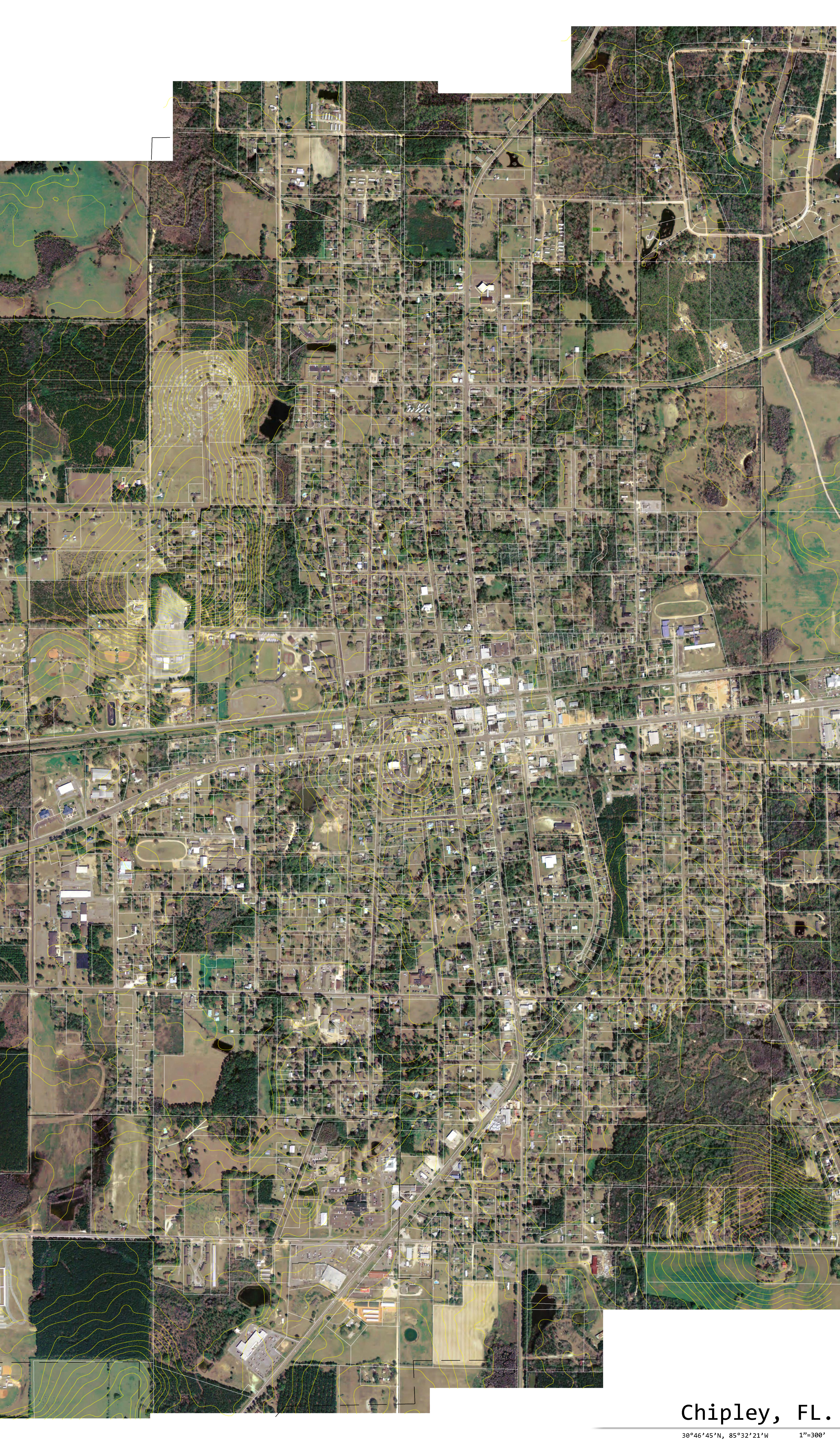
City of Chipley
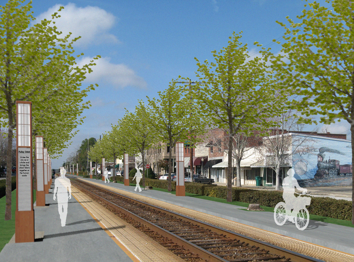
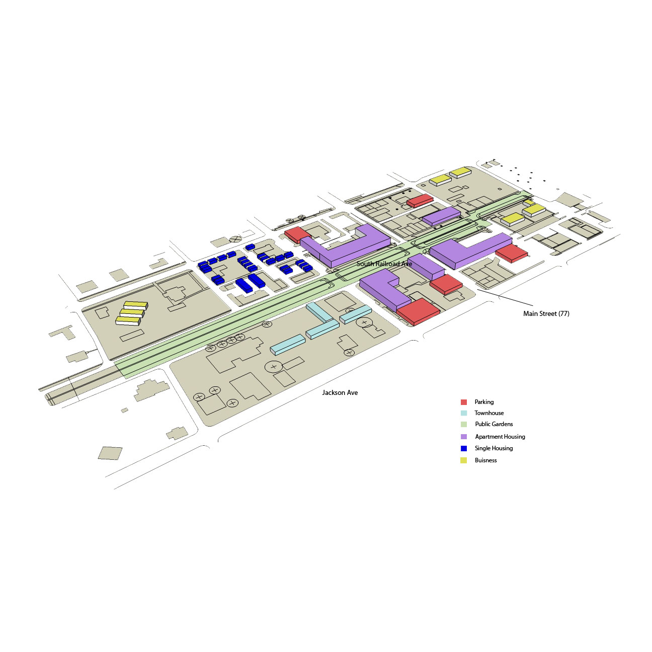
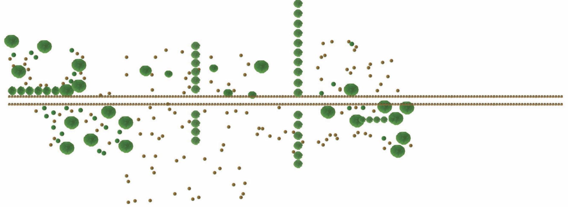
Chipley is located in Washington County, Florida. This tightly-knit community, which is home to only 3,682 residents – composing roughly only 17 percent of the population in this dry community – is proud of its slow-paced quality of life. The town was formed through the development of a railroad that connected Jacksonville to the west coast of the U.S., and by doing so, relentlessly sliced the downtown into two isolated entities.
Analyzing the city in its present condition, the severe gash/byproduct of the railroad disconnects the urban activities on the south side of downtown from the north. In addition, the commercial activities downtown has suffered immensely due to a lack of housing in the core. On a human scale, Chipley is experiencing a pre-Urban condition where people lack dialogue with the fabric of the city, aiding in the deterioration of downtown. The sidewalks are segmented and unappealing, and they lack the quintessential necessities that pedestrian-friendly pathways require. As a result, citizens are highly discouraged from walking a mere block. The nonexistent flow of people, in conjunction with the highly segmented pedestrian ways, creates a cyclical termination of newly established local businesses, ultimately impeding urban development.

City Program
The notion of suturing Chipley together by weaving green space across the railroad and linking commercial activities via pedestrian-friendly pathways will in turn create a coherent interaction between its people and architecture. Integrated with the various scales of urban green spaces (occupiable, passive, and stormwater spaces) are the pedestrian ways, and as a result, a friendlier atmosphere will be installed. Simultaneously, these pathways work on a larger scale to stitch together different zones in and around downtown, helping to mitigate the segregating effect of the railroad.
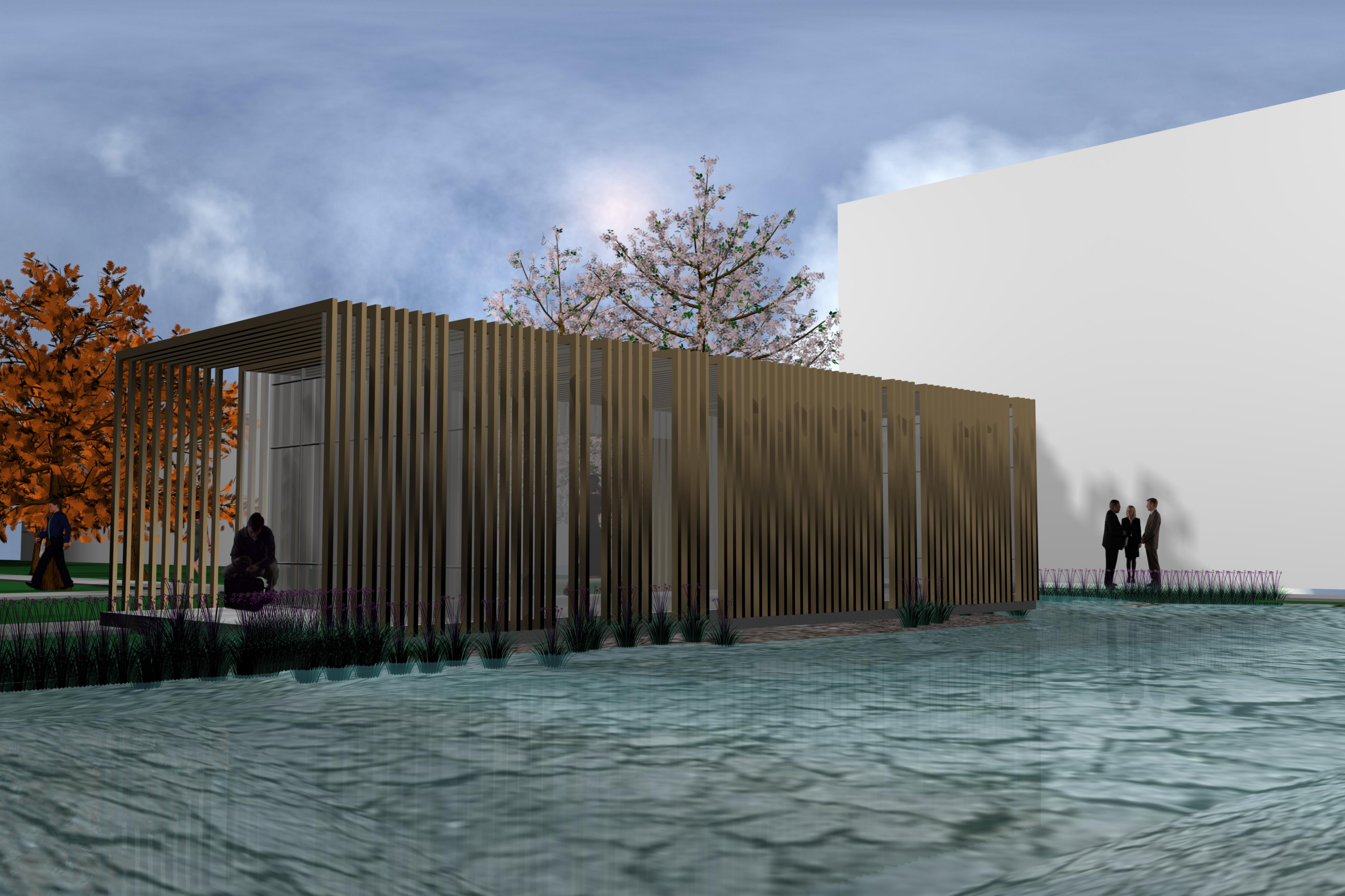
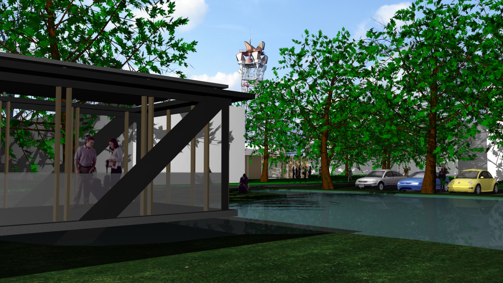
A third suture, sewn throughout the city, derives from the notion that Chipley was founded by the formation of the railroad. It would be devastating to neglect that aspect of the city’s history; therefore inscribed into the program is an itinerary of boxcar moments that originates from the module of a boxcar.

Carefully nestled throughout the town, these modified train cars are integrated into the network of pedestrian paths. Positioned in green space, they serve as restaurants, gathering spaces, and contemplation spaces; providing the urban open space with important basic human needs for healthy social interaction, restoration from stress and mental fatigue, and safety. There is strong evidence that experiences in natural settings within an urban environment produce restorative effects on mental fatigue associated with noise, crowding, and other environmental demands, and these revamped urban spaces with facilitating this. Most importantly, these spatial moments within the city’s context are a reflection of the city’s bleak history, reminding the citizens of their city’s past as they transcend into the future.
This scheme emphasizes the lineage and heritage of the railway as a core element in downtown Chipley while deploying strategies to make connections (sutures) across the spatial gap that the track creates the downtown. Sutures are strategies that stitch or connect the urban tissue to achieve a more connected pedestrian tissue.
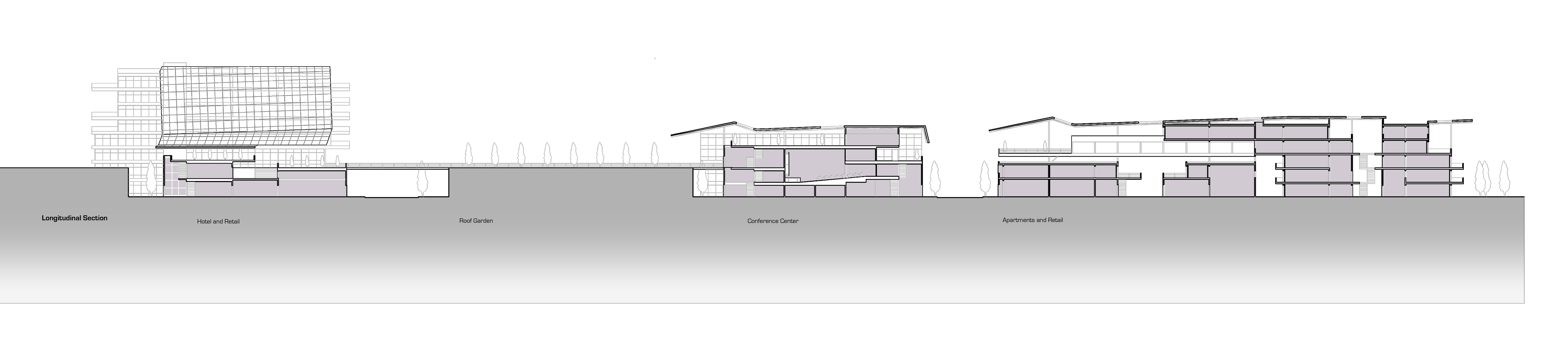
Traveler’s Itinerary
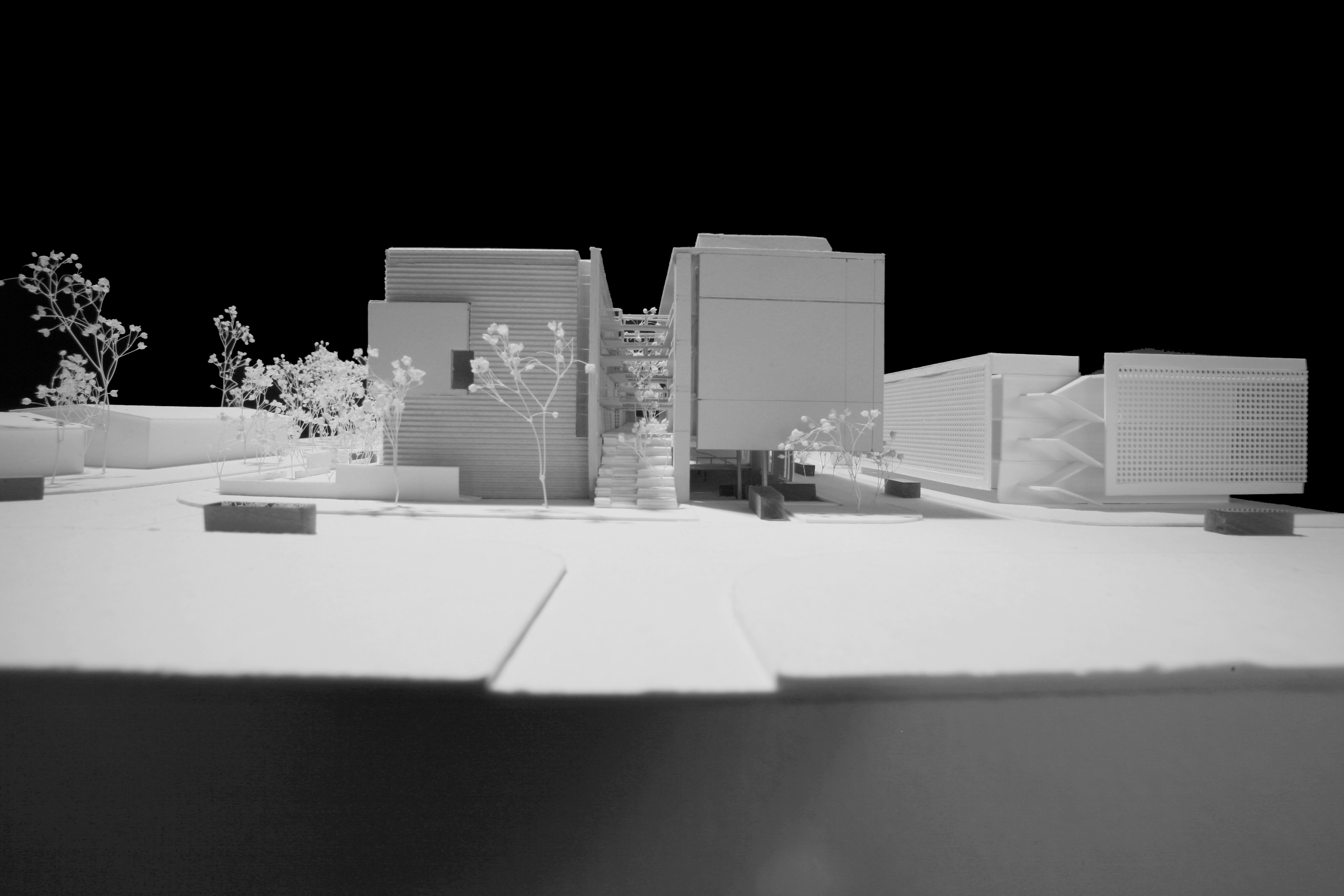
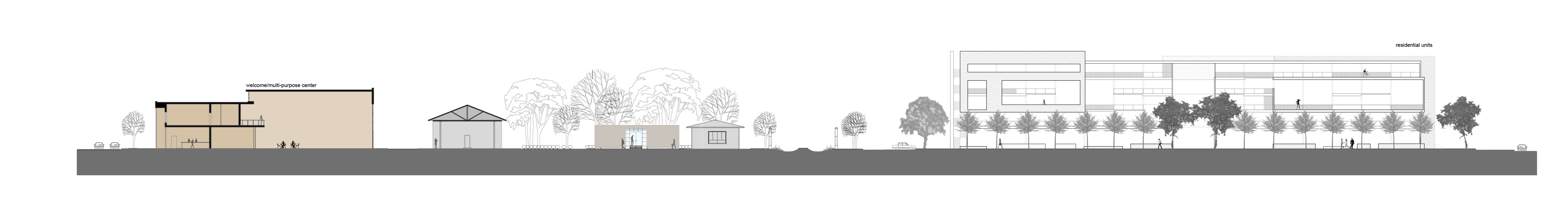
A proposal for a hotel situated along the intersection of the two busiest state roads running through town serves as a visible landmark that will draw a passerby’s attention. This hotel is located across the street from the city’s existing museum which will have a new design addition celebrating the heritage of Chipley’s history as a small train town. From here the traveler is connected to the rest of the downtown core through a series of interwoven boxcars. A physical path then leads one throughout, as a visible link stitches these places together. These cross-town sutures create a unique mapping in this small town. The functions of the boxcars vary, but each informs the occupant of Chipley’s past. The path directs the explorer to a restaurant composed of transformed boxcars nestled within a grove of pine trees adjacent to the town’s welcome center. The entry into the restaurant occurs at the original train ticket kiosk.
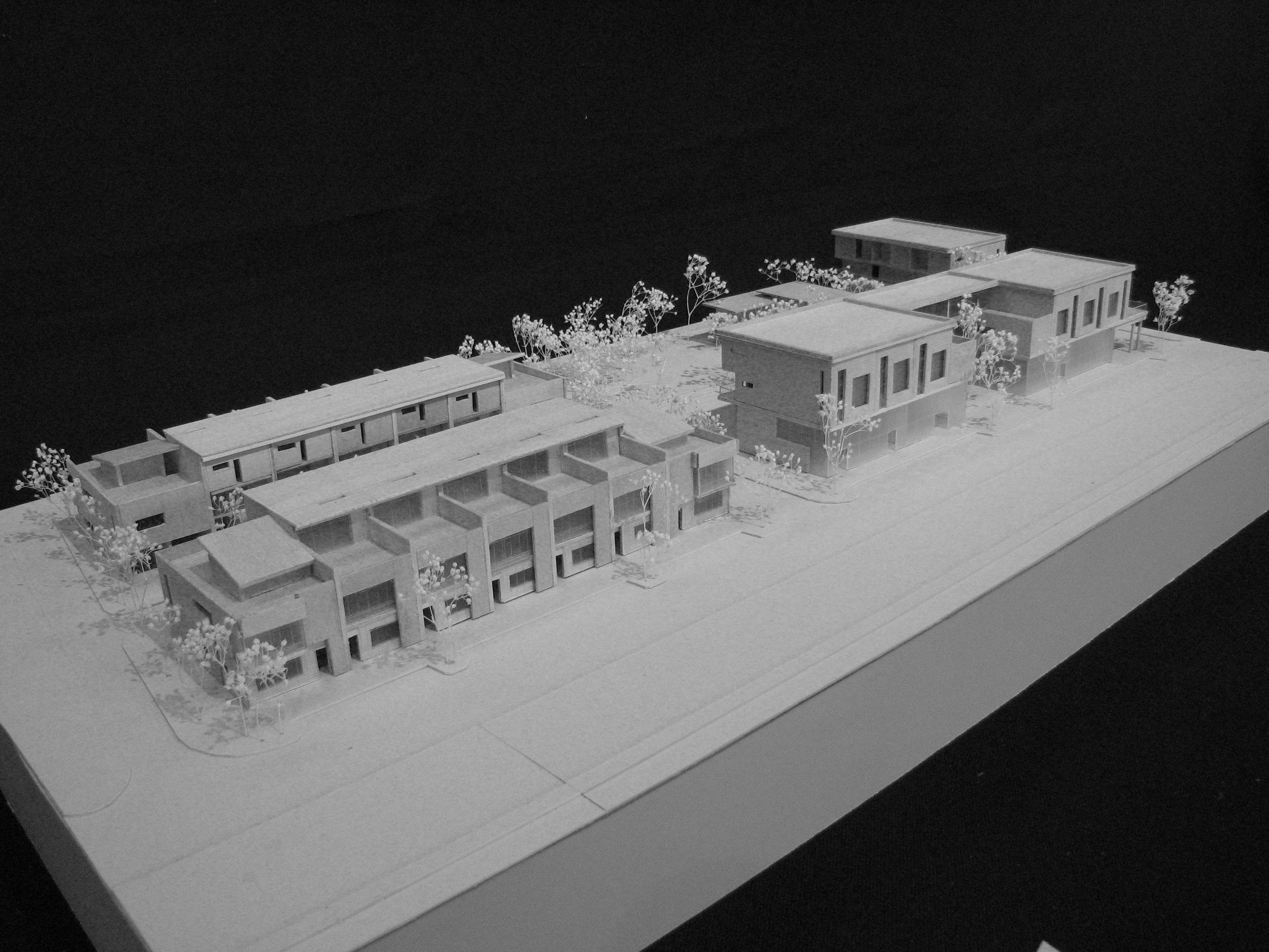
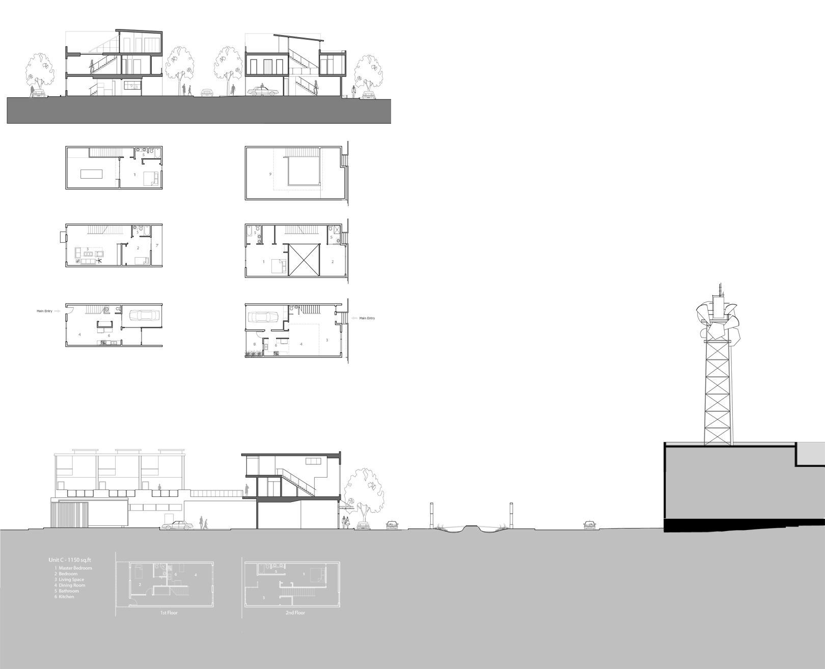
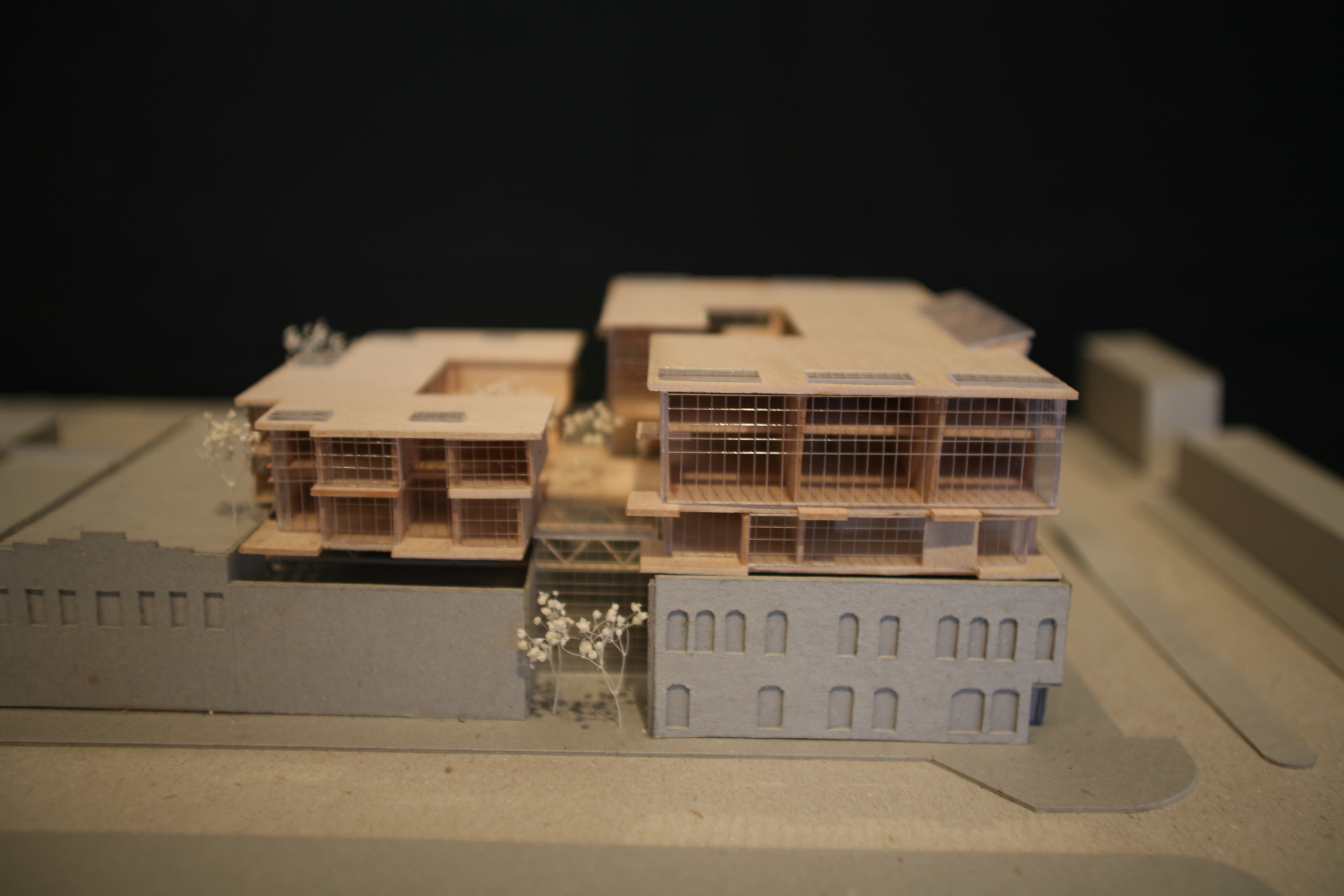
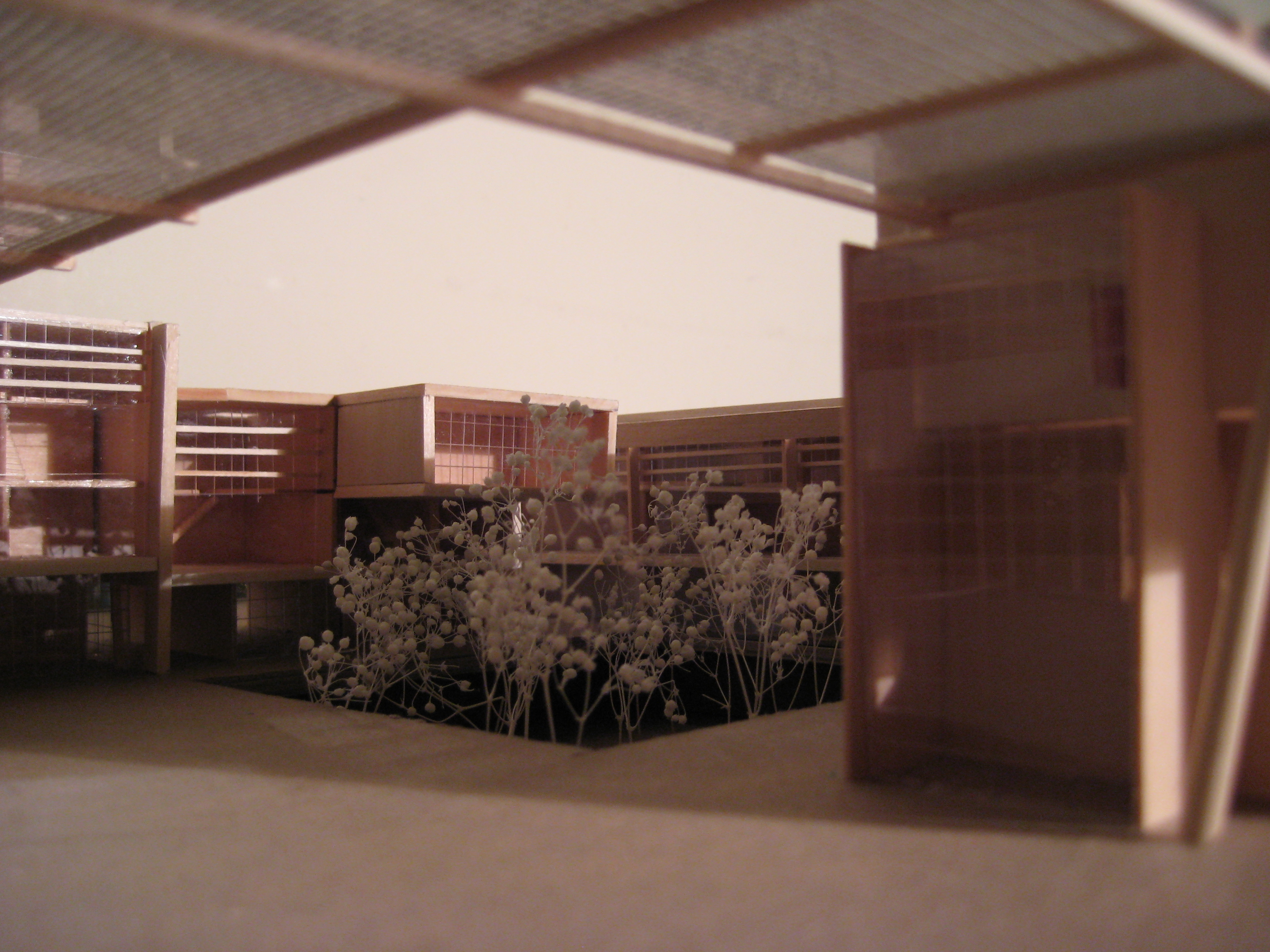
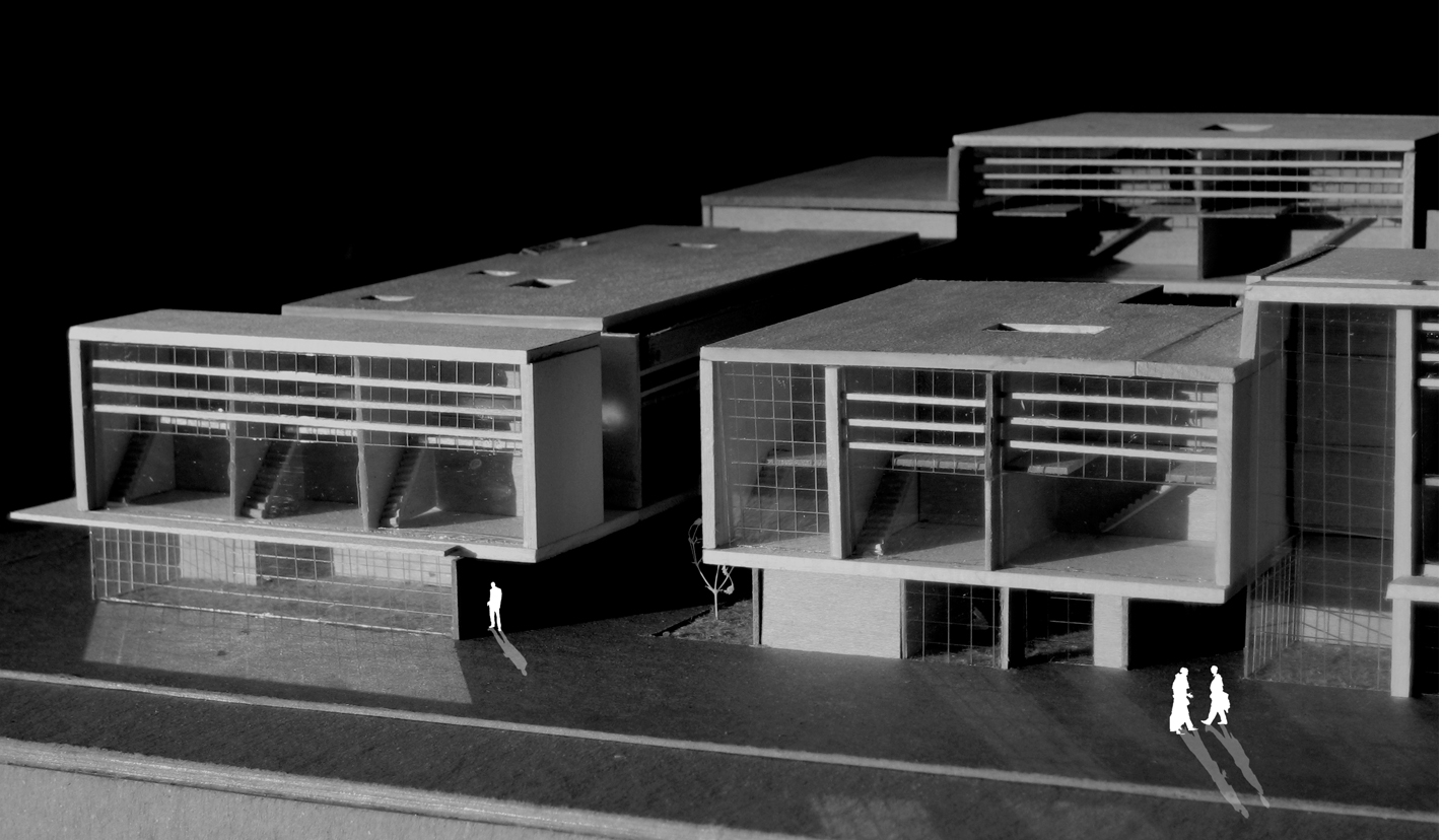
Proposed Housing
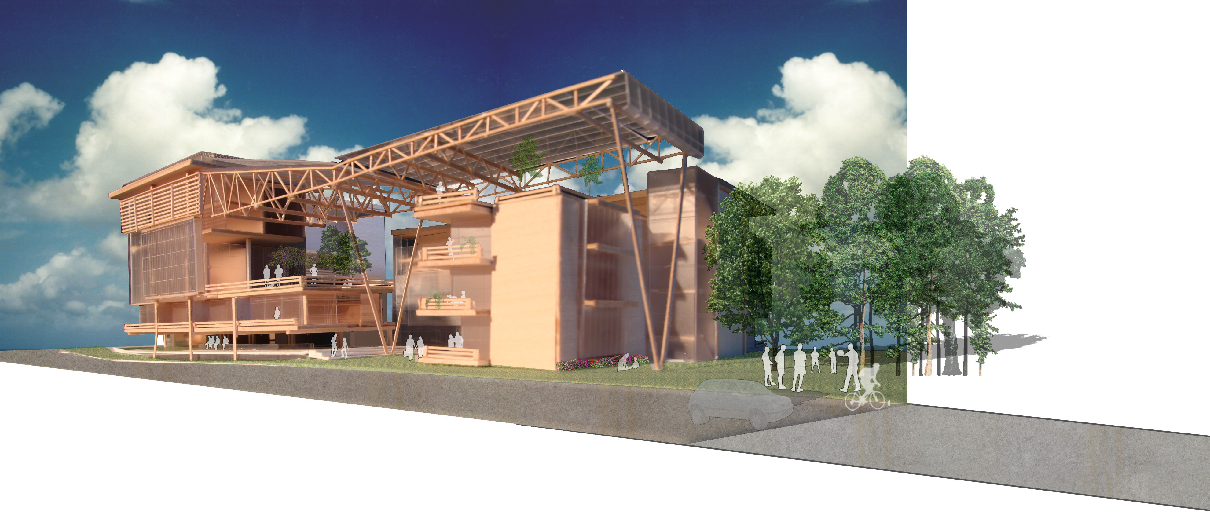
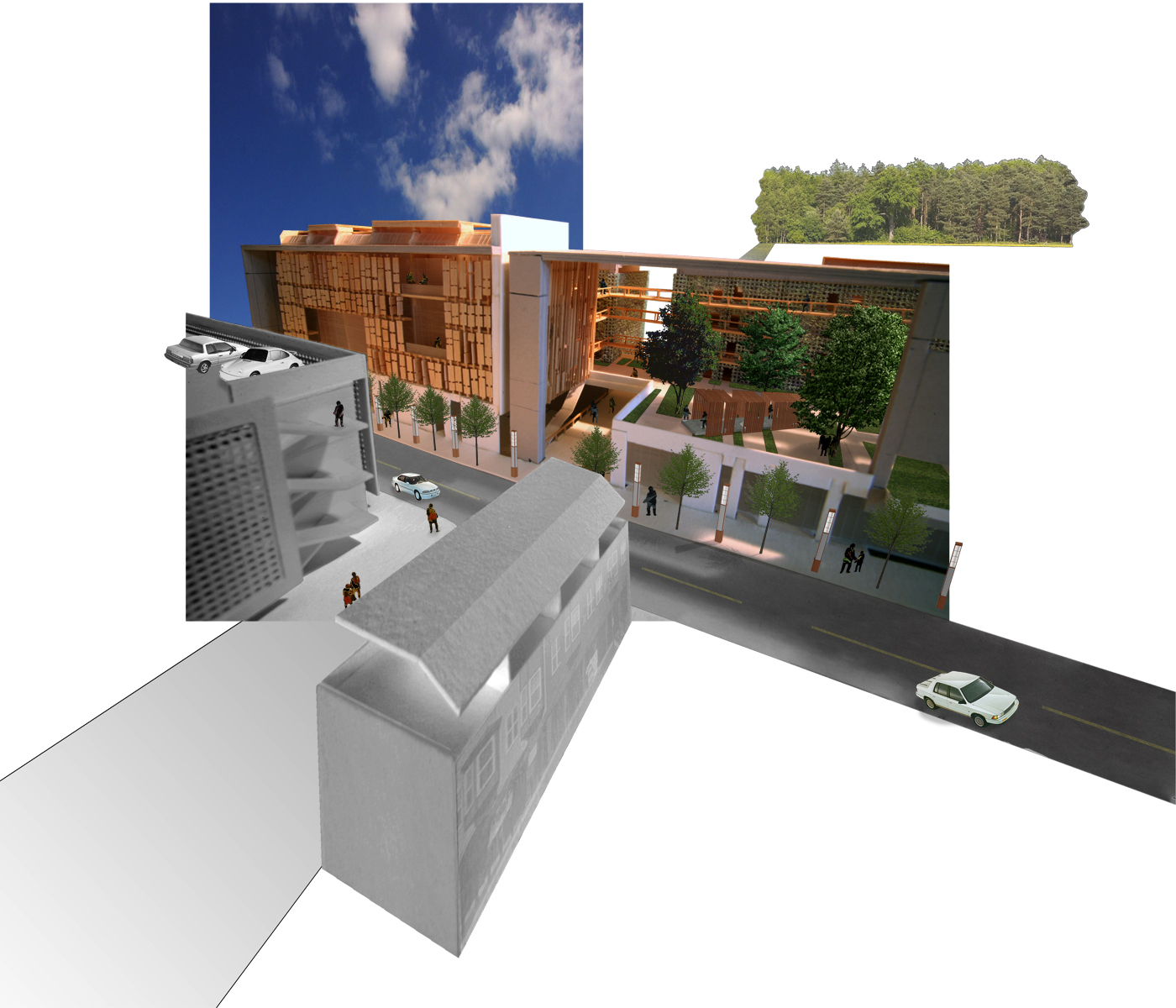
New housing is proposed for the eastern and western edges of the downtown core, with a low-rise row housing project on the western edge and a 6-story mid-rise apartment building on the east. The proposed apartment complex will have a density of 80 units per acre, far more than the surrounding single-family homes, and will allow for a flow of people to exist downtown. In addition, the buildings are also mixed-use facilities that will aid the economic deficit occurring in this area of Chipley.

Strategies include the location of important program elements on either side of the track with connective open spaces that link across in conjunction with streets as well as at pedestrian-only locations. These strategies provide the opportunity to make ‘short cuts’ and occupy exterior spaces that improve pedestrian connectivity. Furthermore, a railroad/cultural museum housed in ‘boxcars’ is located in the urban fabric along the railway that could provide a historic itinerary through the downtown — downtown as a museum.
The ‘boxcars’ would house cultural artifacts in addition to family-owned businesses such as small cafés, refreshment centers, restaurants, and gift shops. A central interpretive center or gallery would also provide historic information on the community and act as a visitor center. This network would provide a suggested path that stitches the urban fabric reinforcing the Pre Urban Sutures concept.
The project has investigated the notion of suturing the city of Chipley with several elements at various scales: urban green space stitch, pedestrian-friendly pathway switch, the itinerary of boxcar moments stitch, and visual stitch. The basic concept of suturing allows for the strengthening of the urban fabric. In order to tighten the sutures even further, stage two of the project must involve the incorporation of these “pre-urban” sutures into the design of the housing developments.
As this occurs it will fully alleviate the segregating effect of the railroad, and the city will carve out a niche for itself as it fully integrated these networks of stitches at the scale of the city, building, and human.
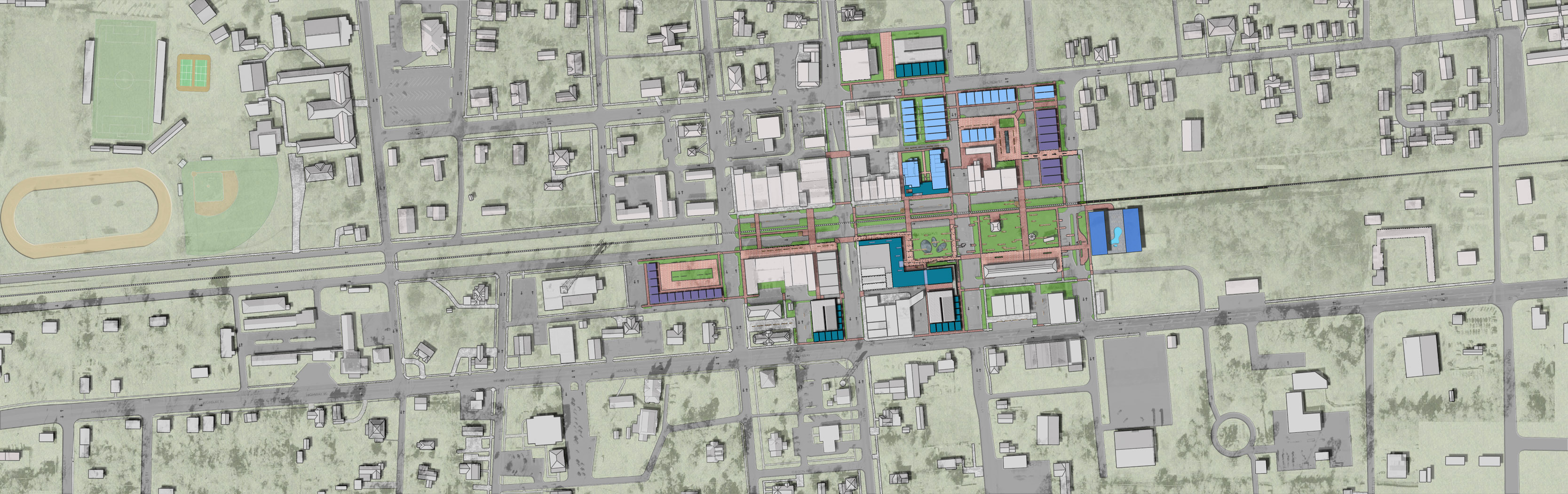
Group 3: The Parkway- Alex Chaille, Ron Devine, Jose Vieyra
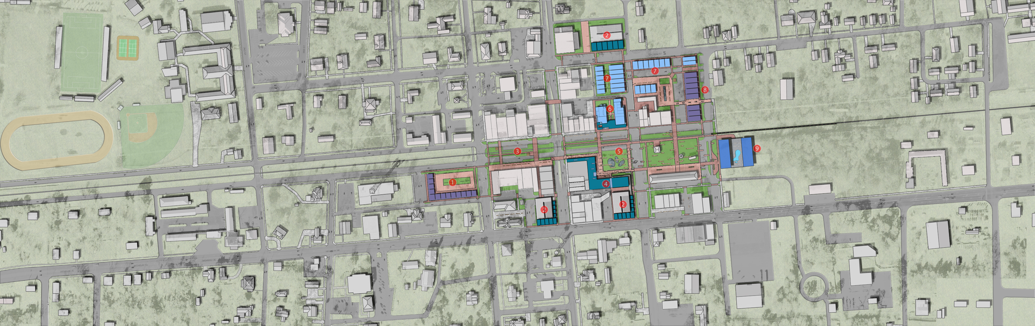
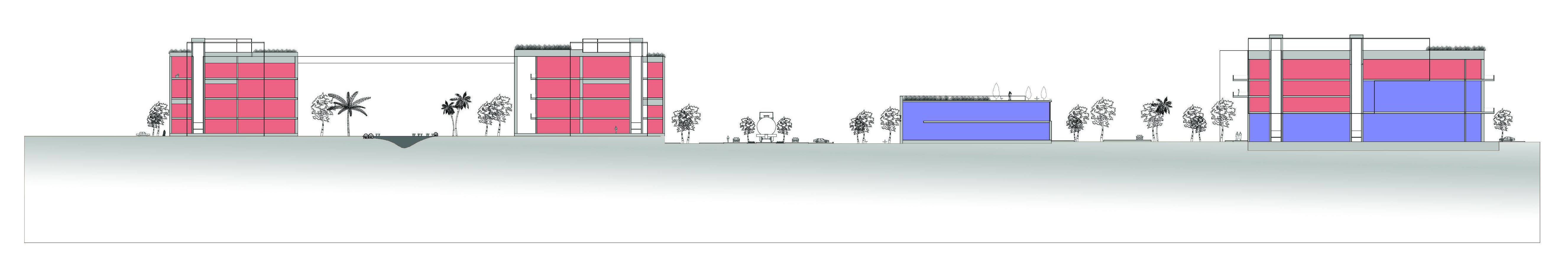
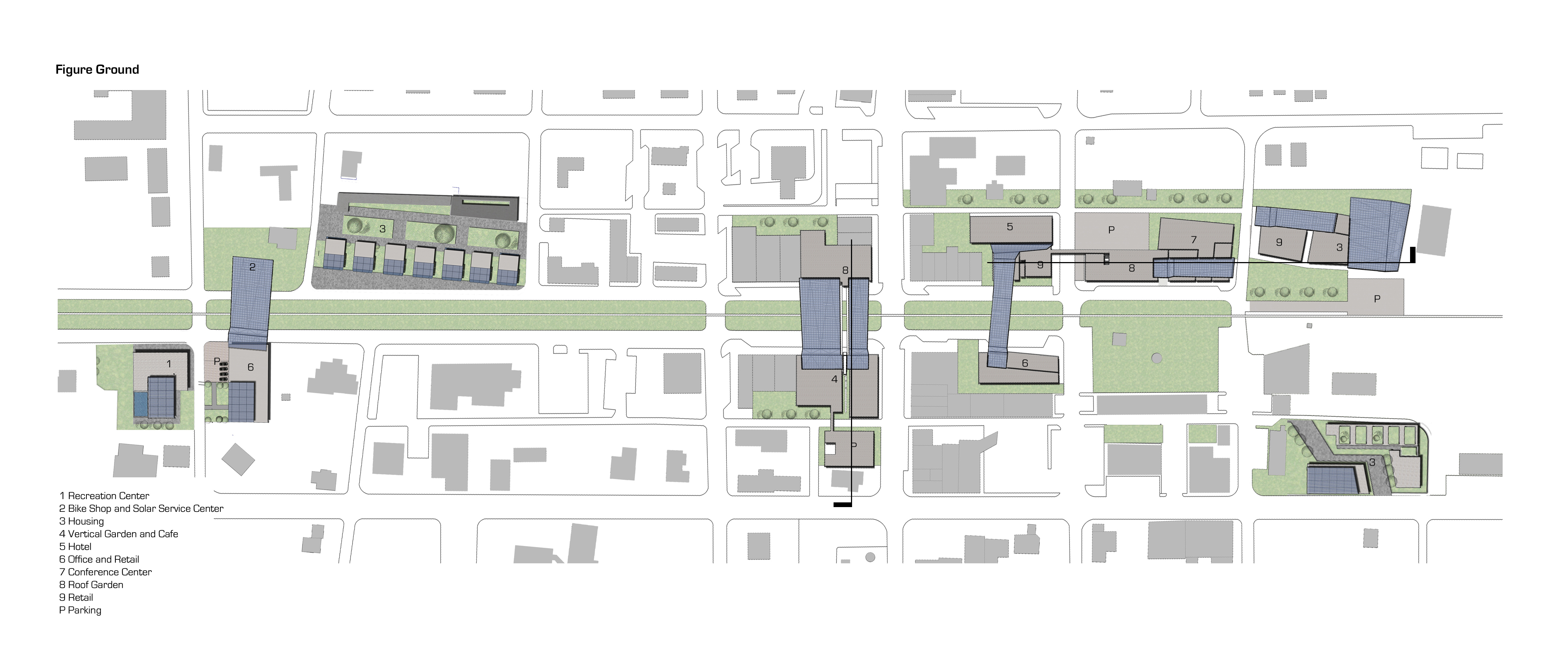
1) Row Housing 2) Parking Garage 3) Pavilion 4) Commercial Center 5) Civic Park
6) Office Building 7) Multiuse Housing 8) Commercial Center 9) Hotel
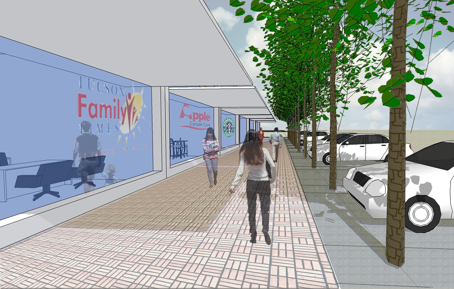
Extrapolated from the Dutch Woonerf (pronounced “voonerf”) which translates to the residential yard, the Parkway scheme integrates automobiles, civic space, commercial entities, pedestrian movement, and bicycle movement into an overlapping spatial system. Streets become navigable paths through a series of spaces with parking, shade trees, and ground vegetation incorporated to provide amenities and organized to provide traffic calming that optimizes the pedestrian experience.
One might characterize it as a pedestrian zone where cars are allowed to travel at speeds of 5 mph. This treatment is contained to the commercial core and with the existing urban grid network, there remains ample typical auto access to the area. SR 77 would be the exception to the low-speed rules and would operate as it does today. A hotel is strategically placed to extend the downtown past the current farmers market. Green space is suggested as overflow parking for civic events that remain parked during normal periods. Additional commercial and residential development is recommended with garage parking at noted locations. The overlapping of civic spaces extends into the alley system to provide additional exterior space that cafés and restaurants can flow into extending the commercial viability of the ‘kitchen’ beyond the floor area of the leased space.
Chipley’s downtown economy is becoming stagnant. Without a new plan, Chipley will be threatened with failure. Wal-Mart has seemingly beaten out all the competition and left the town reaching out for innovative solutions.
The addition of new residential typologies into the core will bulk up density. Increasing the number of consumers in the area helps provide a dependable basis for small shops. Businesses, such as restaurants, will be able to draw on these new residents and hopefully recycle the profits back into downtown.
In order to get these residents to move in the atmosphere must be changed. The current facilities are functional yet leave much to be desired. By evolving into a pedestrian’s first neighborhood the shopping areas and storefronts will become a desirable places even for those who aren’t shopping.
The Parkway is designed to integrate the area between N. and S. Railroad Ave. with the surrounding interior courtyards. The courtyards were created to give shoppers and residents a more personal space in order to retreat from the parkway. The courtyards are heavily shaded and provide numerous areas to sit with your company and remain undisturbed.

The Parkway has a biking/jogging path that lines the railroad. There are numerous pavilions along the path that provide shade and seating. These pavilions also act as a passageway to the opposing side of the parkway.
The Street system was a balance of efficient circulation, optimizing parking, pedestrian safety, and spiral fluidity. A hotel was added on the outskirts of the core. The hotel marks a turning point for Chipley as people are coming to stay now.
It is fair to say that roads are the view of a city. They are the ones that pump and flow life through day and night, rain or shine. A faulty road system is similar to a clotted vein or artery. It is with this intention that it is significant to manipulate Chipley’s road system to revitalize the historical downtown. Within our analysis, we took into consideration both a long and short-term view. The first considers Chipley in the early stages:
The main road system that currently exists is improved. It is made more pedestrian-friendly and eases traffic flow via the reconsideration of parking spaces. Parking would be divided into four quadrants which coincide with the idea of four multifunctional cores. This system would serve Chipley in the beginning while the revitalization process undergoes. But looking more into the long run, Chipley’s current main artery would not suffice. It is then why the road system has to be divided into two arteries that run around the cores instead of through them.

These new sets of arteries would still be linked to the original parking quads but would free up even more pedestrian active space. An additional parking garage might even be necessary due to population expansion. The current Chipley parking is scattered which makes the sense of flow a bit unpleasant. The green space proposed will also accept this open space and foot traffic will increase. It is this foot traffic that helps move a city. Manhattan for example. It is easier to walk into a store if you are one foot than if you were in an automobile. The current road system in Chipley in a way divides the city’s potential by half. By bringing in the idea of core it is necessary not to have such a divisor.
The four quads and perspective parking are to make the lack of a car within the historical downtown simple. They are to be planned to make walking trips short. It is also to help clear up room for more green space by deleting in front store parking (currently existing in abundance). Studies have shown that pedestrians are more comfortable walking outdoors when cars are either absent or further away. The long-term proposal takes both notes into consideration. Chipley is essentially a small town so the idea of the car to get from one store to the next is unnecessary. Bicycle flow is probably more ideal, so biking ideas should be taken into consideration.
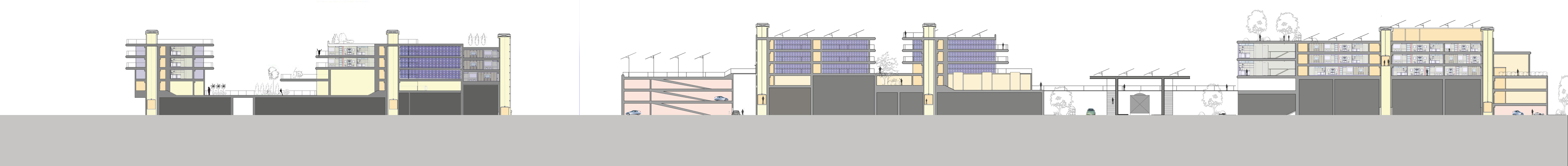
Group 4: Growing Small- Danielle Brown, Kayleigh Carlisle, Zach Chance
Redefining the downtown streets by combining pedestrian and transit priorities to concentrate commercial activity and residential growth, this plan seeks to create a pedestrian-dominated core. Growing Small explores transforming SR 77 into two, one-way, two-lane roads (southbound to the west – northbound to the east) creating a core pedestrian-oriented district in between.
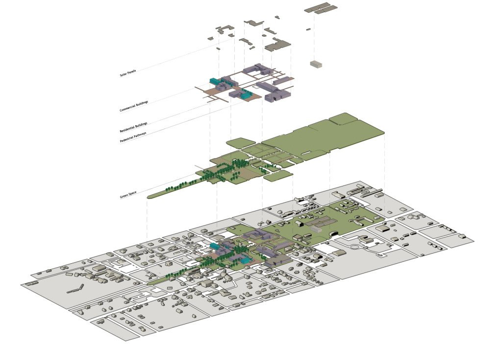
Meta technologies (high, medium, and low) are utilized as sustainability components that are leveraged from concentrating and mixing uses such as Photovoltaic power generation and shading, vegetative facades (shading), stormwater gardens, and a municipal chilled water loop for cooling (eliminating the need for condensing units at or on buildings).
Growing small attempts to optimize the pedestrian core by rerouting SR70 as a one-way pair on the east (northbound) and west (southbound) edges of the urban core. Two blocks of the former SR 70 are now dedicated as a pedestrian mall with limited vehicular access for service and deliveries as needed. This becomes the new location for art festivals and related cultural and commercial events while produce remains at the farmers market thus allowing simultaneous events that activate the entire downtown.
The projects developed within this scenario take advantage of connectivity to the railway as linear green space while reconciling adjacency to the pedestrian mall and auto-dominated streets. Varied programs including hotel, apartment, and mixed-use try to optimize the opportunities generated by relocating SR 70.

Road and Pedestrian Usage- The downtown area is currently an asphalt river of heavy traffic. To bring the scale back down, all roads in the immediate downtown would be redone in brick pavers. TO further entice the public to come back downtown HWY 77 would be rerouted one block east and the current route would be close to bus traffic only.
Pedestrian crosswalks would be installed on every corner to provide safe and comfortable crossing areas. Also, a crosswalk across the railroad track would be placed on both sides of HWY 77 to further enhance the area to the public.

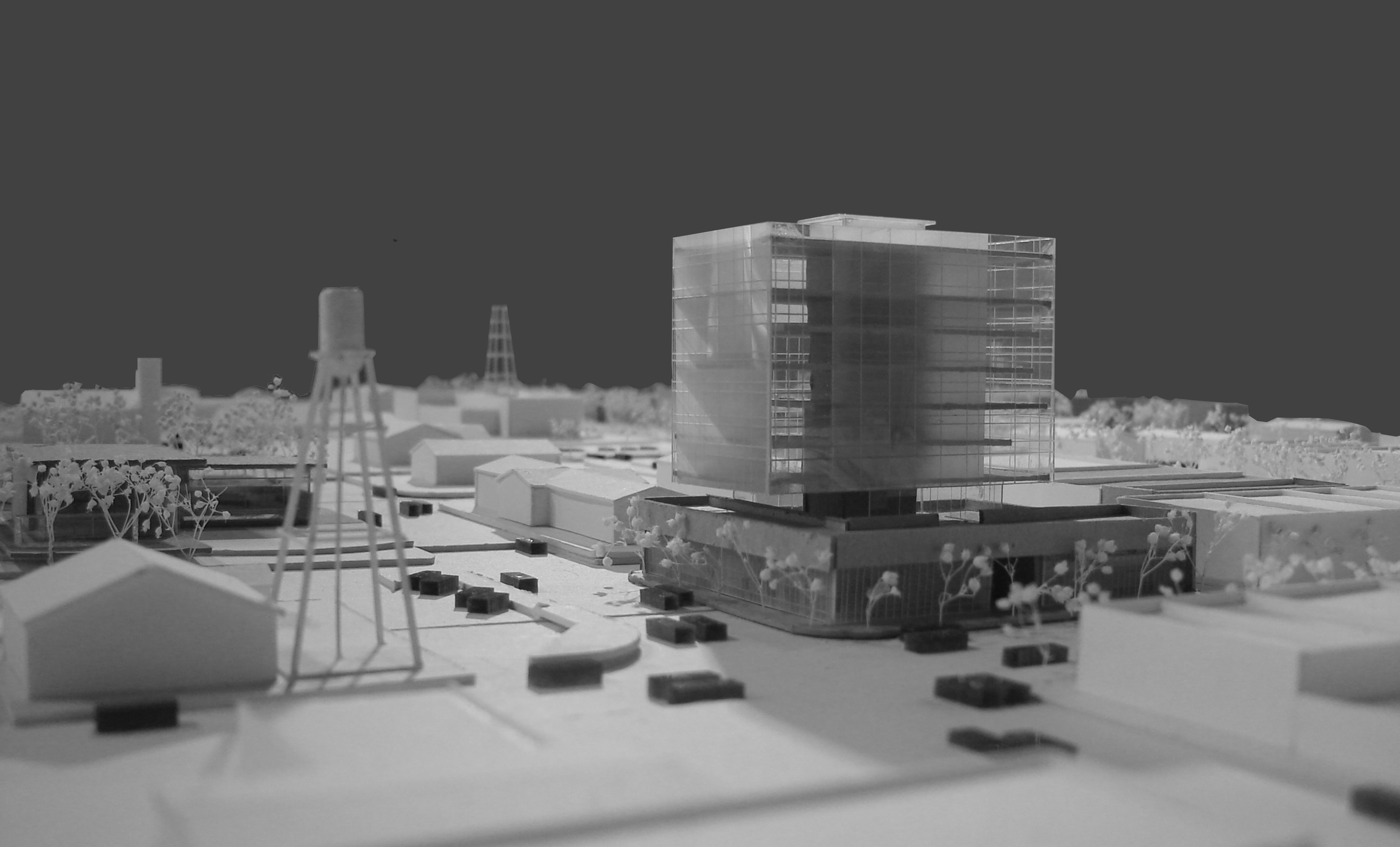
Proposed Buildings- Chipley could serve as a sleepover spot for travelers to the new Bay County International Airport and an alternative place to leave their car in our proposed mixed-use parking garage instead of the airport which usually charges higher fees. With the incorporation of a downtown hotel to serve these new guests, the tourism market would expand with the possibility of commercial retail to once again return downtown.
Two new restaurants at different scales, a deli-style eatery, and a full-scale dining establishment, are to be placed in the downtown area. The deli-style eatery is to be located on the vacant lot currently used for parking across from the proposed hotel.
While the other larger restaurant will be placed on top of the existing buildings for vistas of the trains and new green space. Courtyard housing is projected to be located downtown on a currently sparse lot that would further connect the residential space to the downtown area. With this notion, the market for apartment-style housing returning downtown would force owners to upgrade their infrastructure to meet the demand for housing in existing urban buildings.
Local and Regional Transportation- A local public transportation bus route is proposed for the residents of Chipley. The route would have stops in the residential areas, downtown, the new hotel, Piggly Wiggly, and at Wal-Mart.

These stops would decrease the burden for residents without cars and entice residents to come downtown due to the specially located bus stops near commerce and restaurants in the revived area. A regional route is also proposed to further encourage travel to Chipley. The shuttle route would travel from the parking garage/hotel area to the new airport, Panama City business district, and the beach. Eventually, the regional route ideally would become a light rail system when the demand is right.

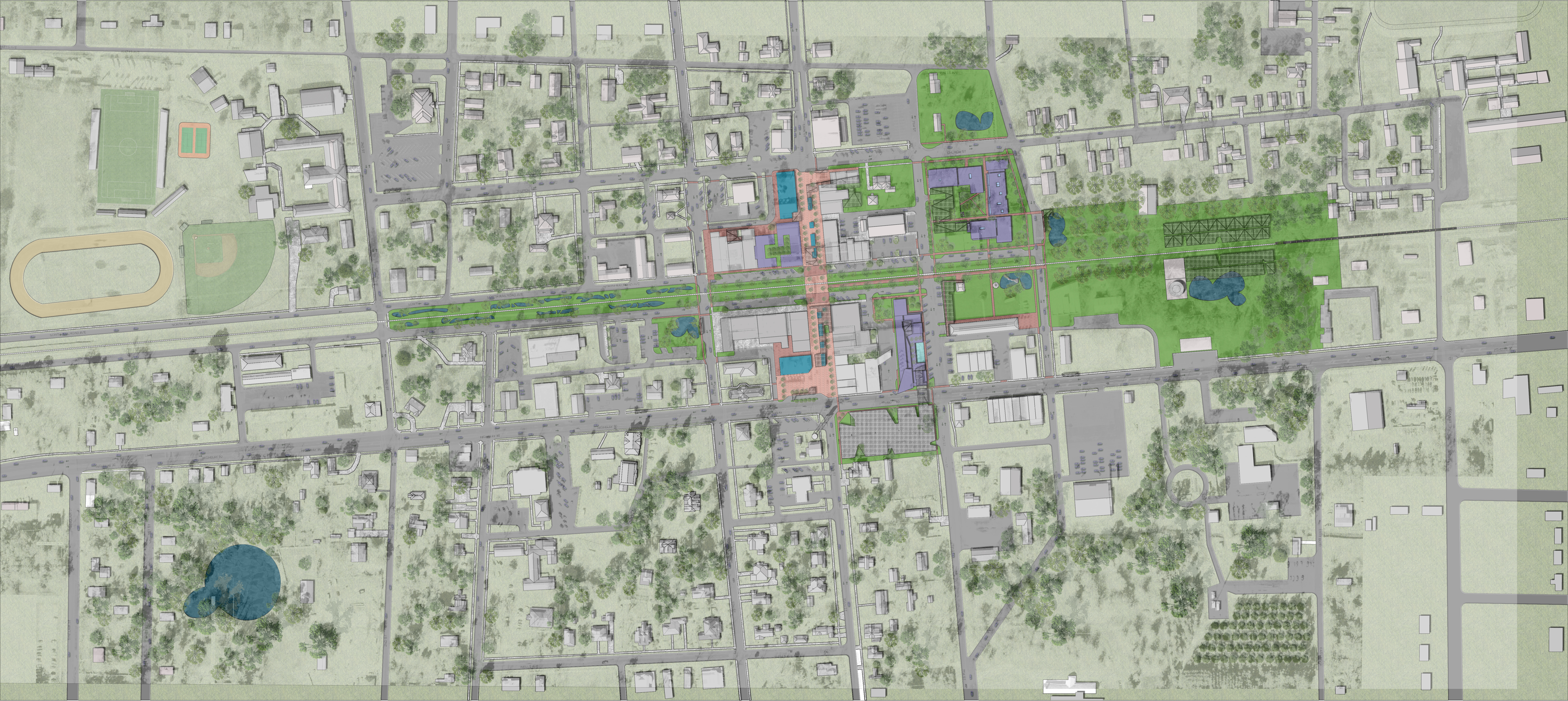
Group 5: Urban Rooms- Christa Campbell, Ross Howayeck, Michal McVinney
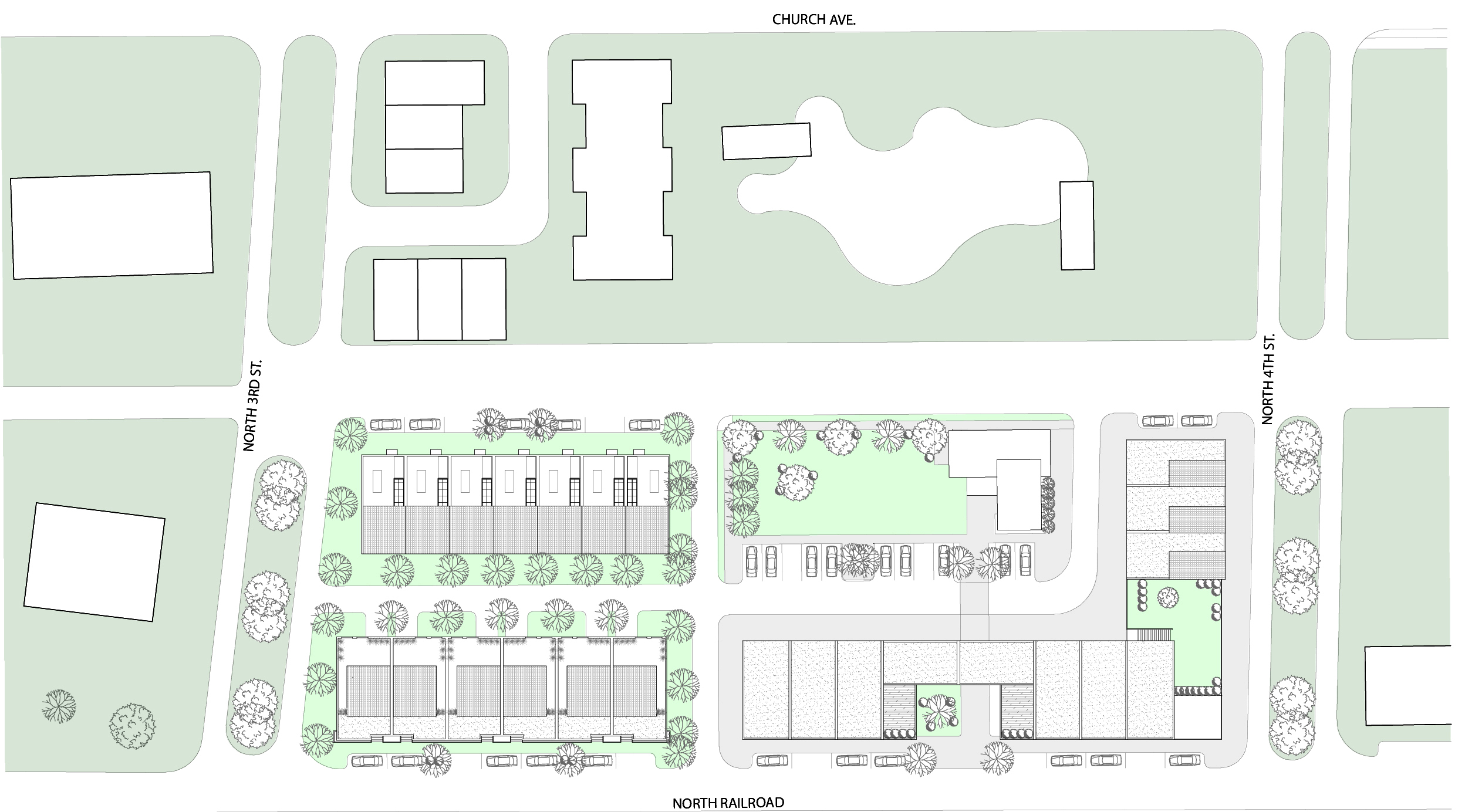
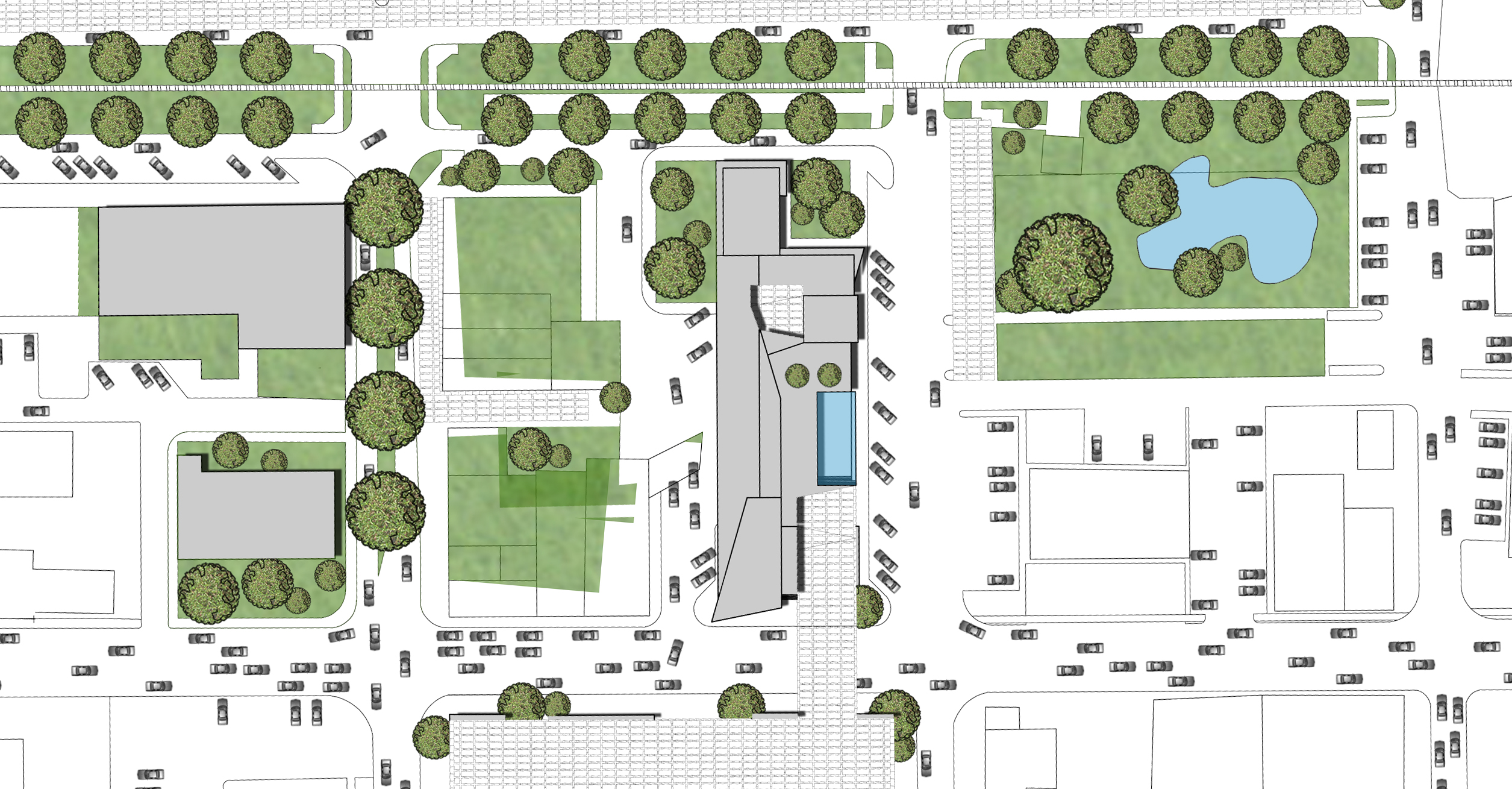
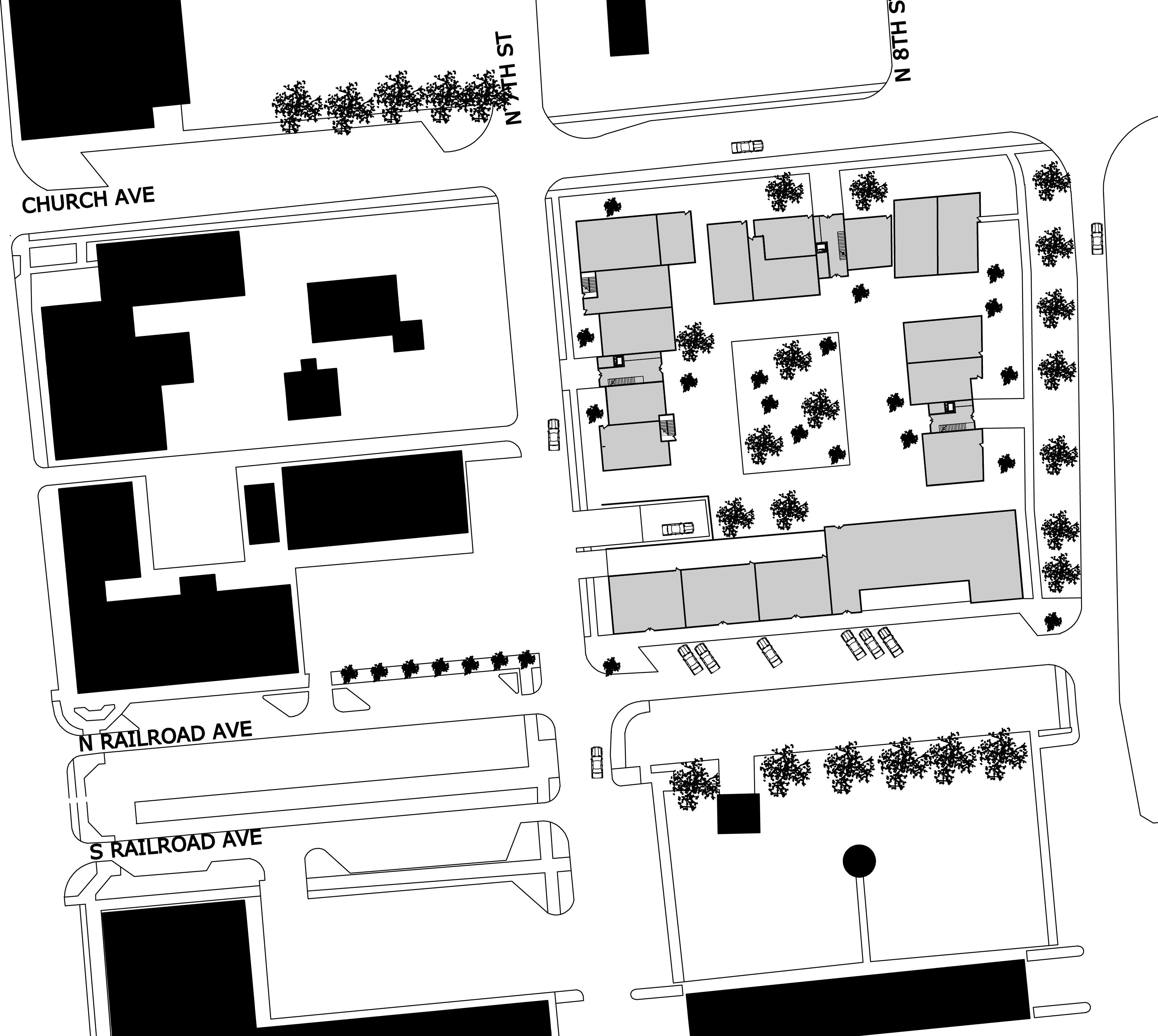
1) Railroad Park 2) Row Housing 3) Mixed Use Mid Rise Housing 4) Parking Garage
5) Mixed Use 6) Commercial Center 7) Civic Park 8) Parking Garage 9) Pedestrian Path
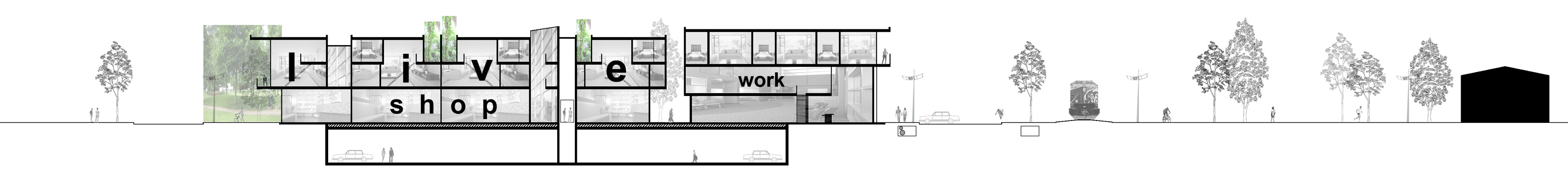
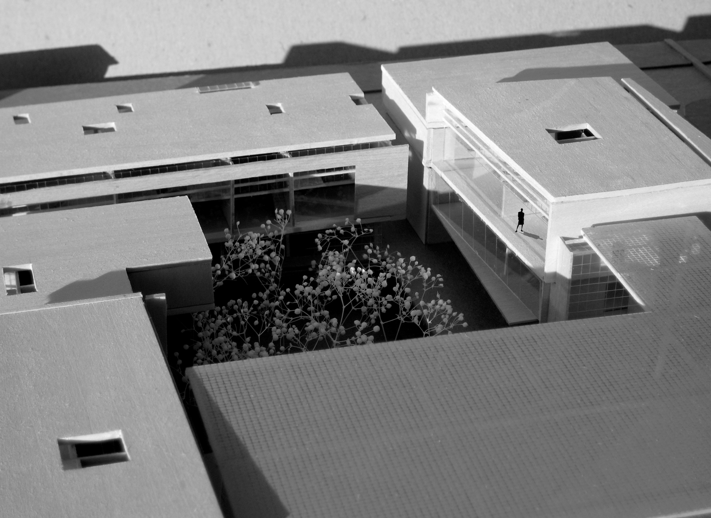
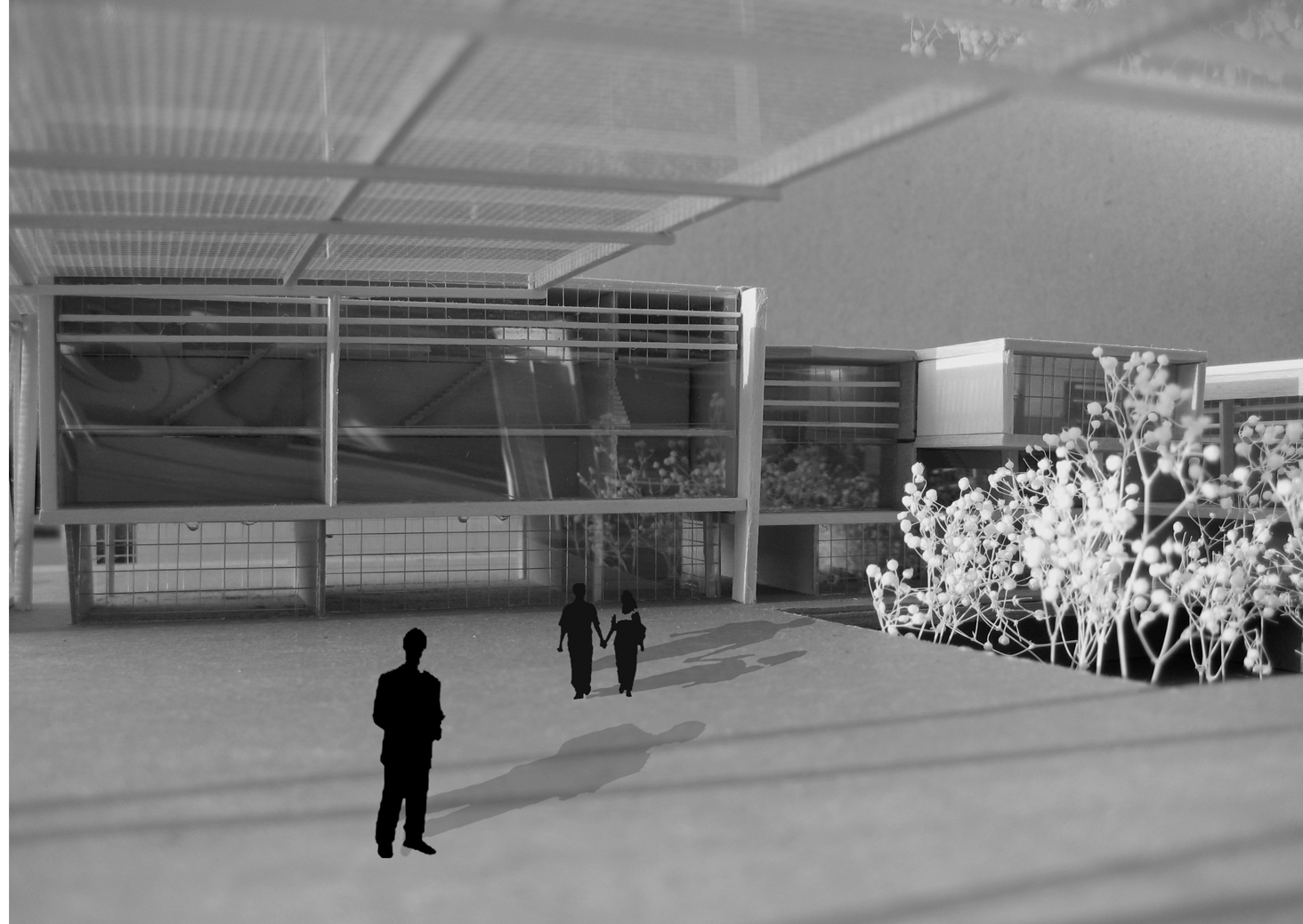
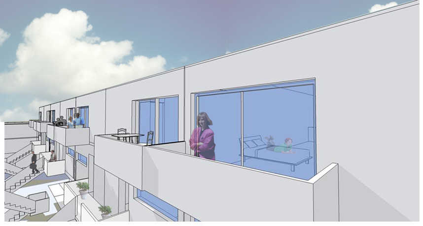
Careful study of the relationship between public green space and residential density inspired the Urban Rooms concept. Shared, high-quality exterior space can allow concentrated populations to thrive through mixed-use, live/ work opportunities that support routinized pedestrian lifestyles (no ‘need’ for an automobile).
Private outdoor spaces are reduced but maintained in favor of community-oriented Urban Rooms operating at civic scales and semi-private as needed. This conceptual approach also advances market diversity so housing units or varied price points, amenities, and sizes are gathered around an ‘Urban Room’ to provide full-life opportunities for living in the town core. This approach will attempt to enhance existing underutilized spaces through occupation, view, and connectivity.
The word “synapse” comes from “synaptein”, from the Greek “syn-” (together) and “haptein”(to clasp). Synapses are specialized junctions through which the cells of the nervous system signal to each other and to non-neuronal cells such as those in muscles or glands. Chemical synapses allow the neurons of the central nervous system to form interconnected neural circuits. They are thus crucial to the biological computations that underlie perception and thought.
Through the regeneration of this crucial part of the brain, a large amount of improvement in functions can be seen. By re-connecting the infrastructure of the city core of Chipley a canvas for renaissance is laid. Stimulation through connection allows for growth in activity and development.