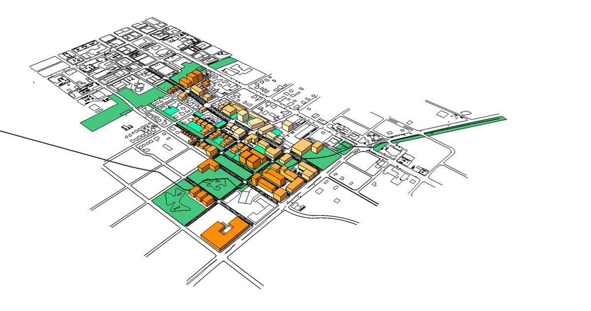
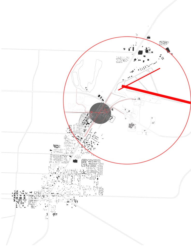
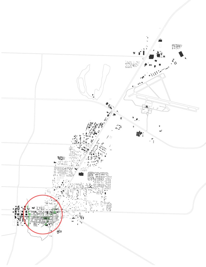
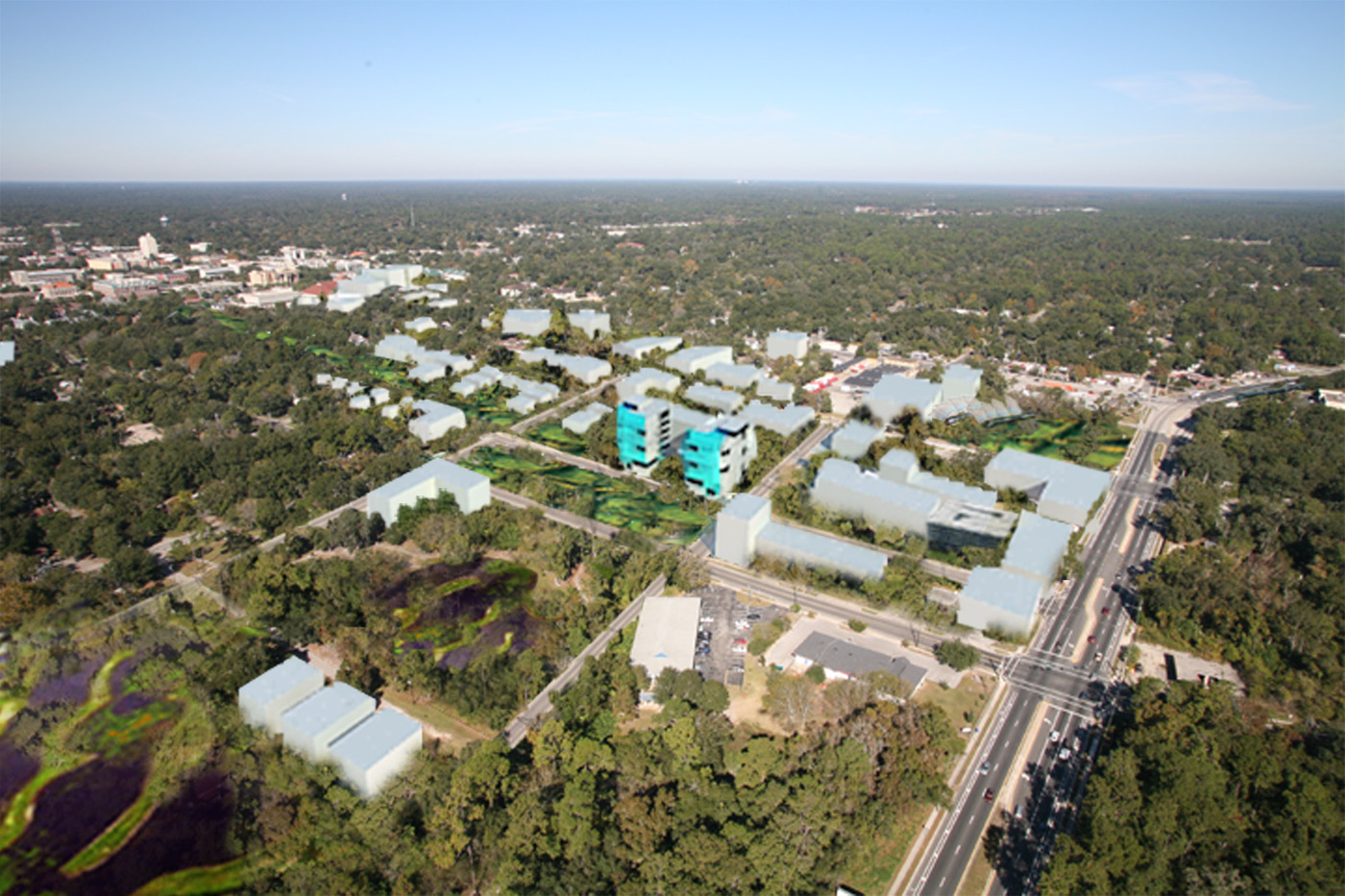
As an important gateway to Gainesville and the University of Florida, the Waldo Road corridor and environs evokes the first ‘Gainesville’ experience to travelers arriving by air or by automobile from the northeast. The corridor presents opportunities for sustainable development through its linear form, the opportunity for the nodal concentration of activities, proximity to the downtown core, abundant vacant land, infill potential, and a number of existing uses such as civic, agricultural, institutional, municipal, commercial, mixed-use and residential.
Introduction
For decades, the transportation infrastructure of Gainesville, such as Interstate Highway 75 and state roads, has alternated between following and leading the growth west of the city. This has fueled development such as the Oaks Mall, North Central Florida Regional Medical Center, and Butler Plaza, and has been a great economic boom providing many new jobs, entrepreneurial opportunities, commerce, and a variety of retail, dining, and service choices to the community. It has been argued that the east side of Gainesville has languished during the same period, seeing little private and limited public investment.
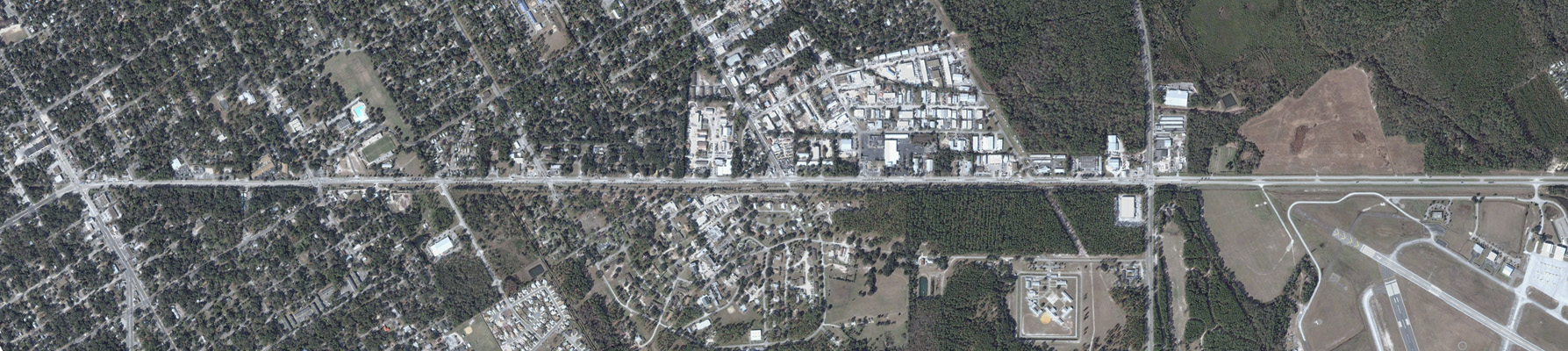
The public investment that has been deployed has focused on services for low-income citizens, work camps, and the jail, rather than on improving urban infrastructure that could promote private investment. Ironically, the development to the west has become somewhat of a victim of its own success. As of 2008, new development west of Gainesville has been limited by transportation capacity, both through regulations and through perceptions, as existing commerce is negatively affected by traffic congestion on the arterial roads that serve as access to the commercial establishments. In other words, many consumers avoid shopping along Archer Road and at the Oaks Mall when possible, in order to avoid the traffic.
If the best local examples of commercially vital transportation infrastructure are Newberry Road and Archer Road, we have room for improvement. Given the limits on development along arterial transportation corridors in west Gainesville, the extent (distance) of westward development from the downtown core, and the need for sustainable growth in Gainesville, the case can be made that the timing, market demand, transit viability, utility capacity, the expectation for quality development and availability of vacant land are conjoining along the Waldo Road corridor. East Gainesville is the most viable location for new development and redevelopment.
The project team uncovered only two significant obstacles to substantial new development in the corridor: environmental sensitivity and market perceptions. First, the geological structure is low lying and rich in nonpermeable clays, resulting in generally poor absorption of water during storm events. Accommodating this circumstance requires drainage mitigation and stormwater management strategies generally not required in sandy well-drained soils. This will add development costs that are unique to this area. And, where poorly drained lands have evolved into ‘wetlands’ ecologies, the developable area of land is limited and/or requires mitigation strategies that can be time-consuming and expensive.
Secondly, there appears to be stigmatization attached to east Gainesville based on the lack of disposable income and other statistical parameters typically used to evaluate the potential for development in this area. Market studies of potential service-oriented businesses have not shown them to be viable. Perhaps the success of the pioneering Super Wal-Mart will begin to assuage this perception. Multiple studies, master planning reports, transportation analysis, community workshops, and citizens’ initiatives have been focused on the area of east Gainesville.
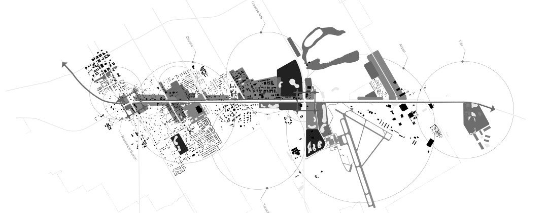
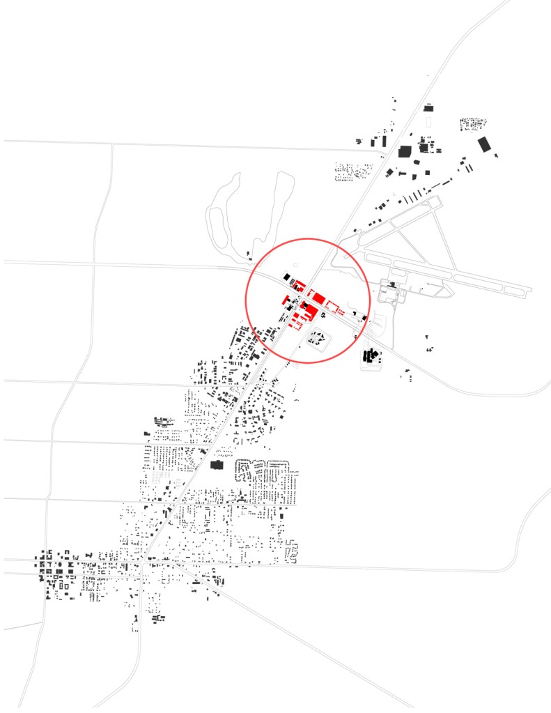
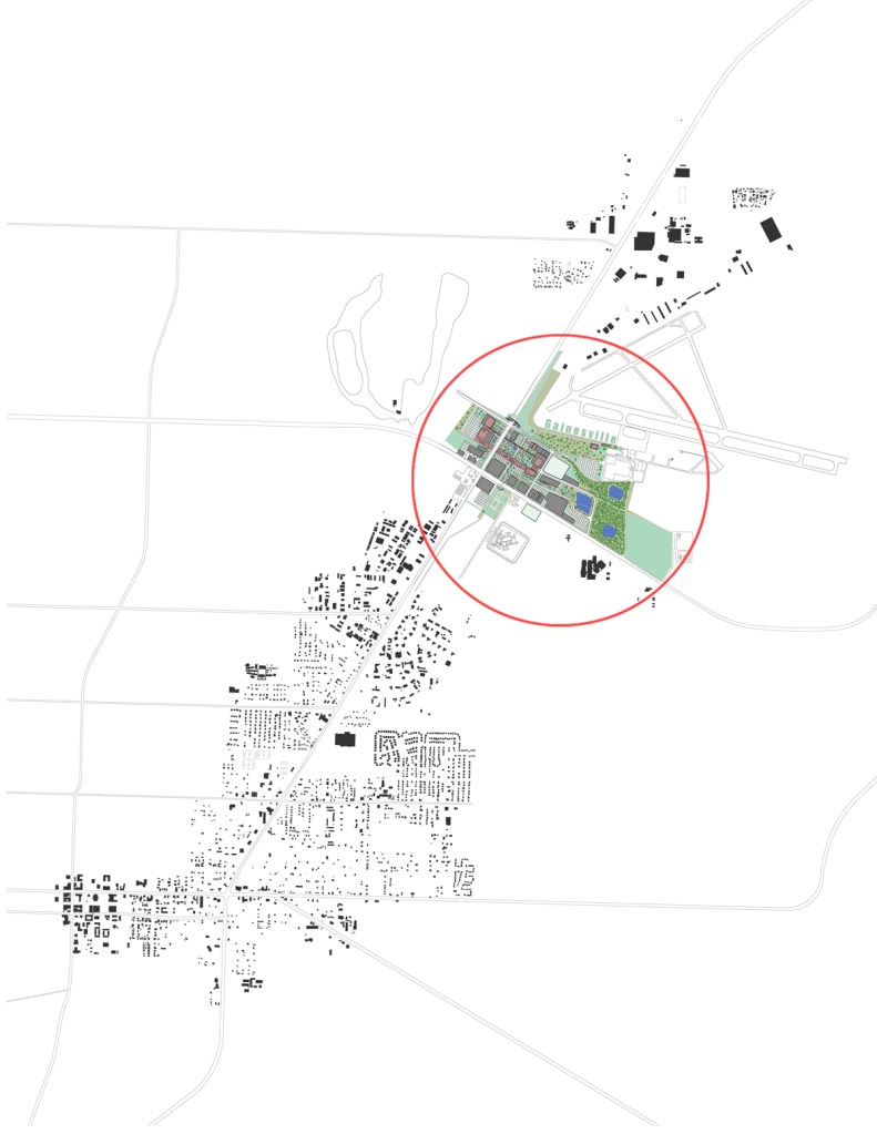
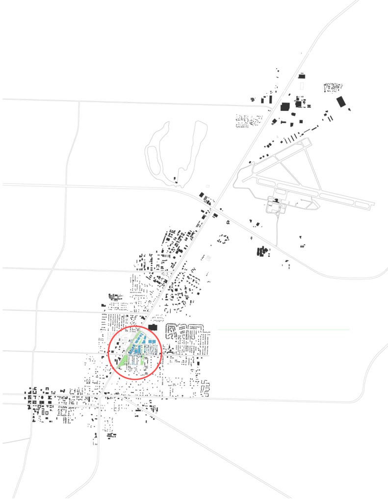
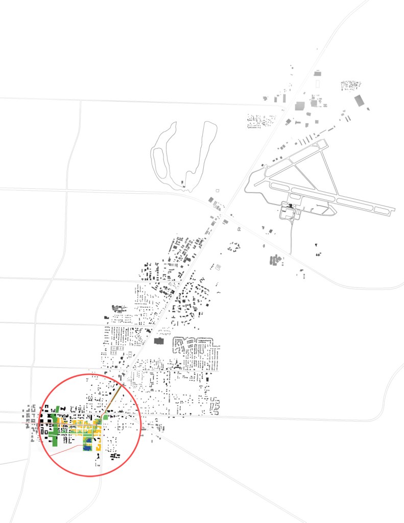
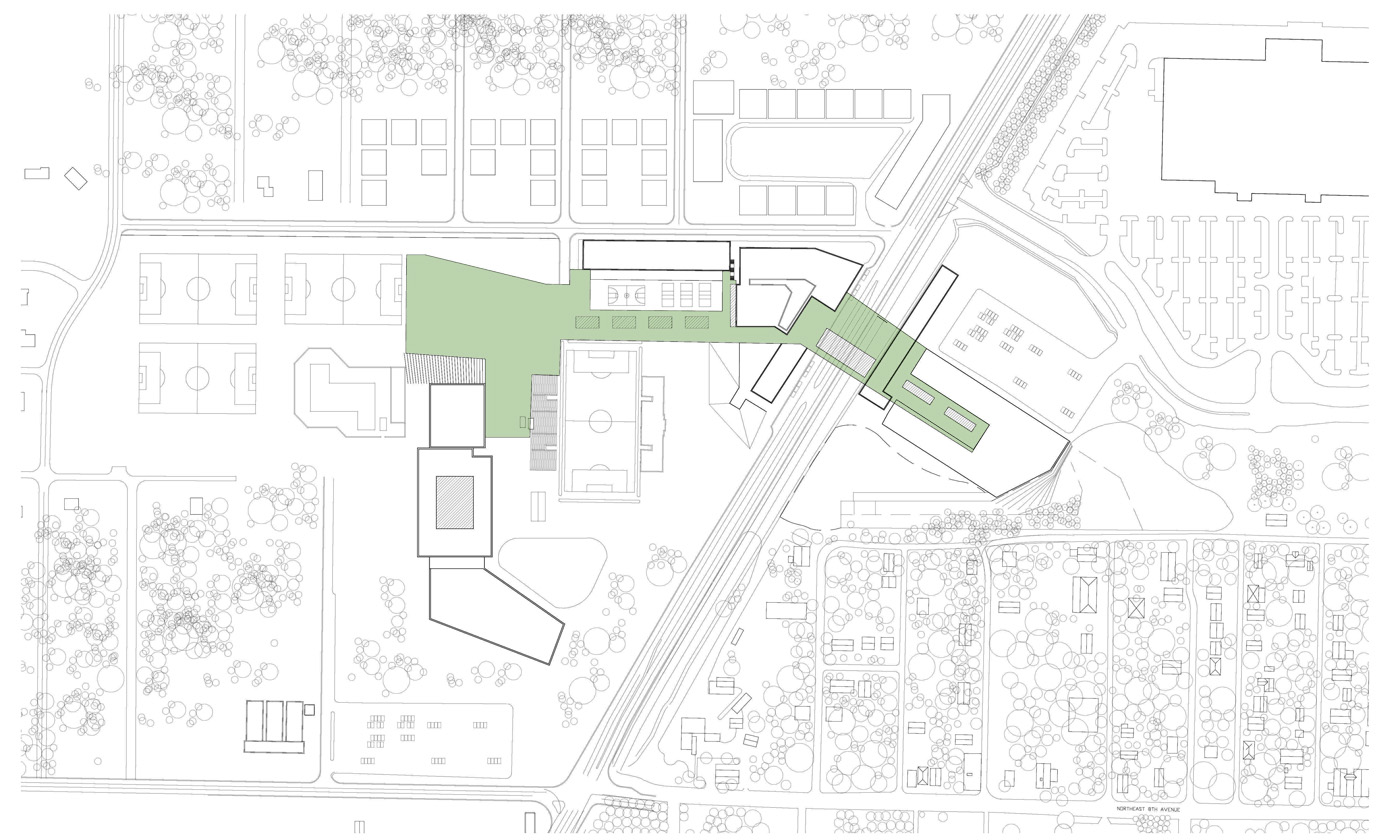
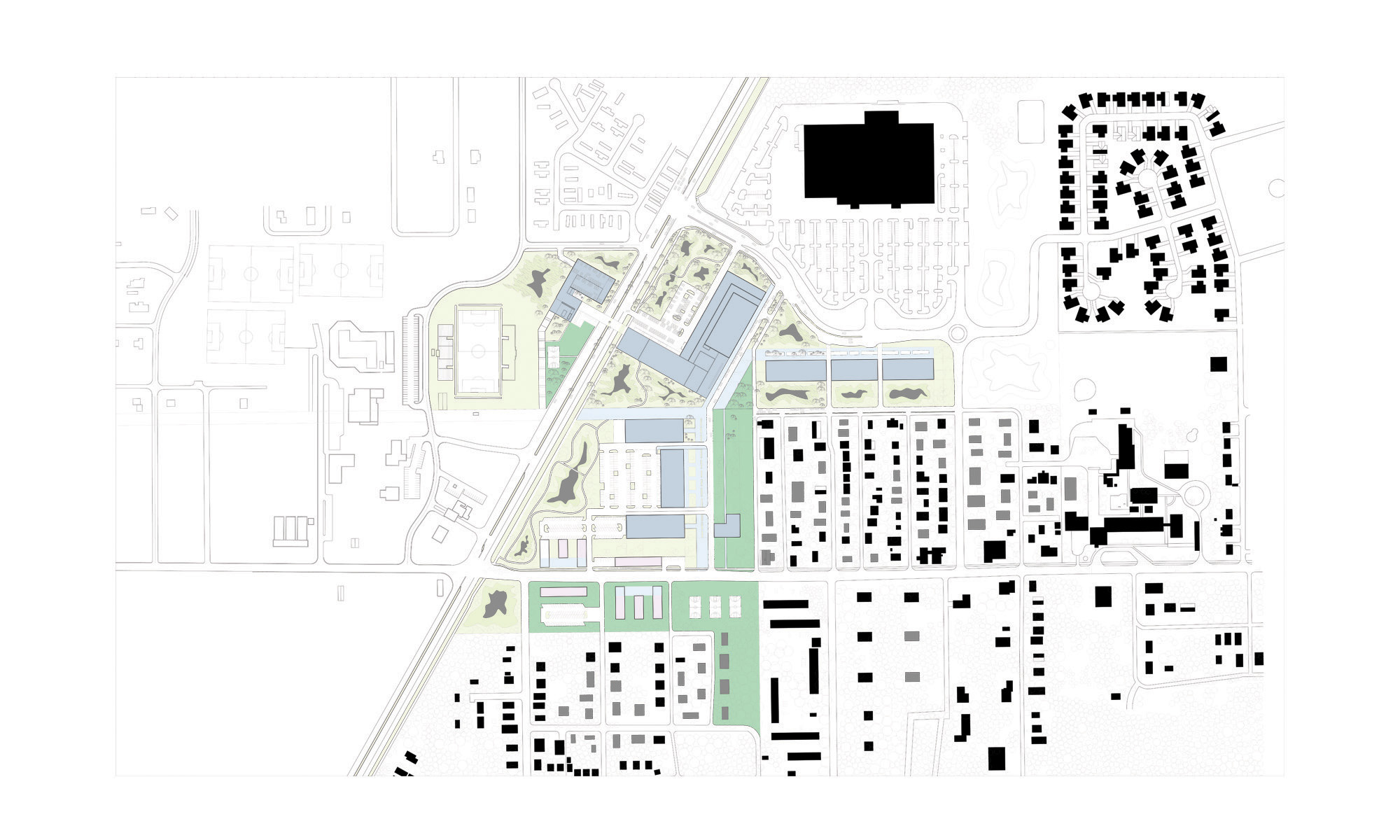
Airport District
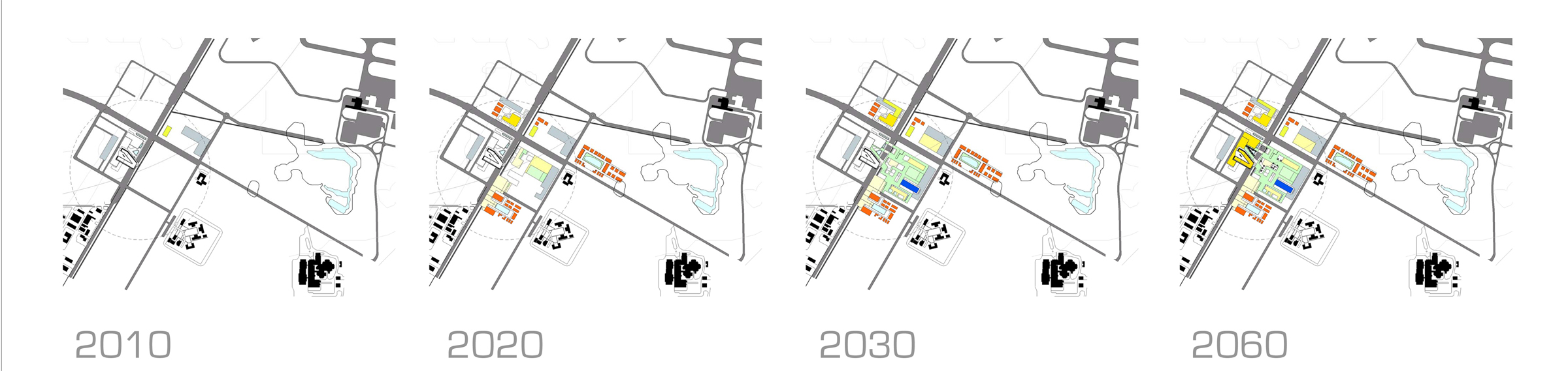
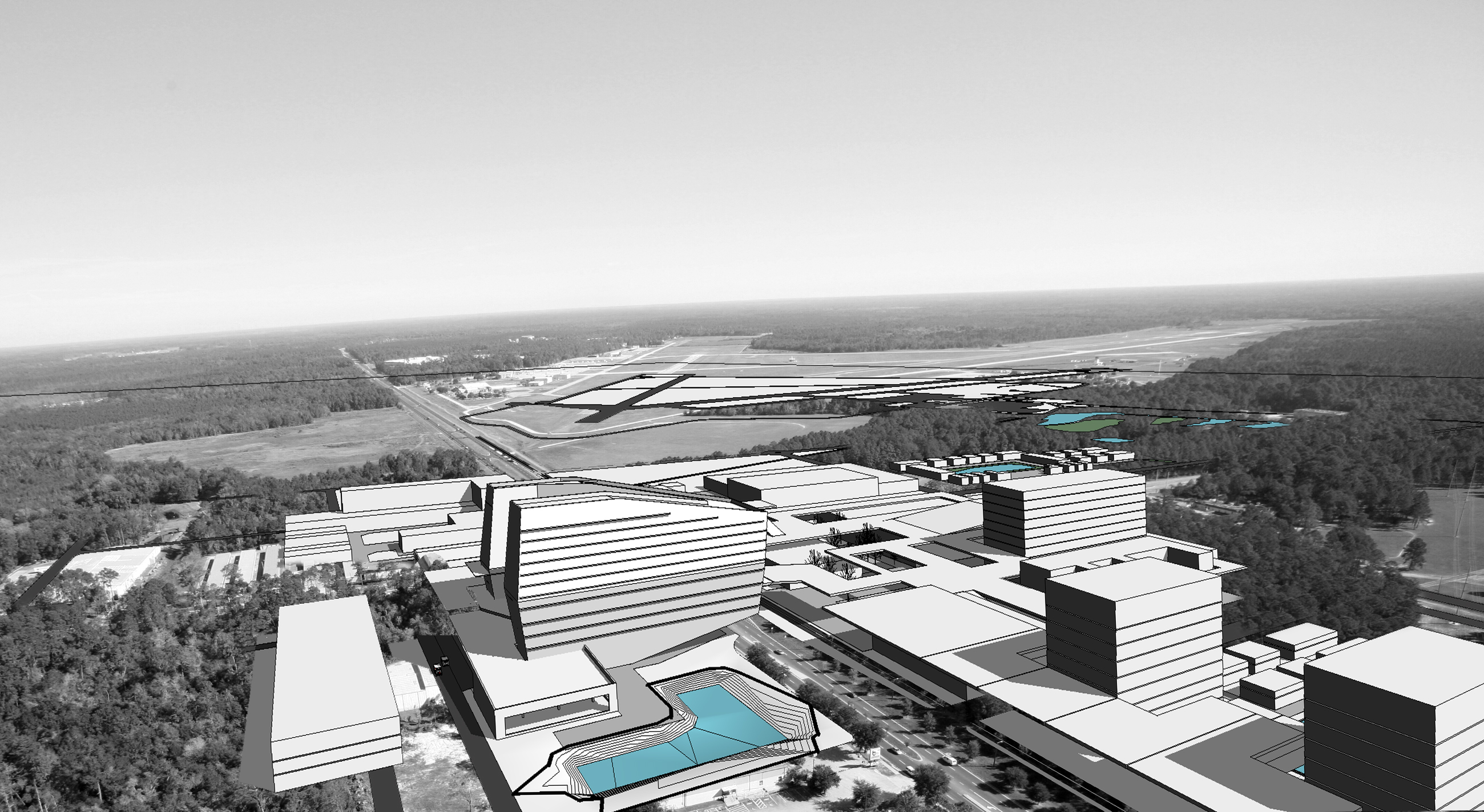
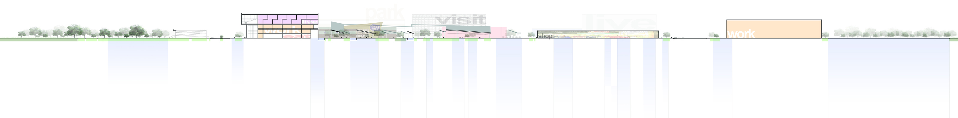
Airport district proposals studied two different program alternatives for the corner of NE 39th Avenue and Waldo Road. Occupied Thresholds and In-Transit propose a center of medical facilities south of NE 39th Avenue as the core program for other associated development that might include ‘big-box’ retail such as a Target store. The proposals show what the long-range build-out might be (30 to 50 years) to provide high-quality community health care services as the population grows. Near-term development would focus on small-scale urgent care facilities and outpatient private health care that might also have affiliation with Tacachale. Later, this might develop into full-service medical facilities with an emergency room and hospital. There is good transportation connectivity to I-75 as well as areas north and east of Gainesville.
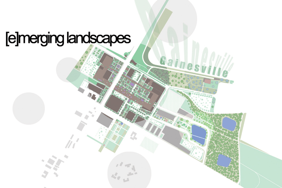
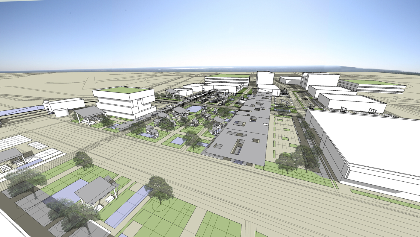
A commerce park, [e]merging landscapes is proposed on the former Fairgrounds site that includes ‘big-box’ retail, grocery, office, entertainment, and parking structures that would support the airport. The proposal takes advantage of the gateway morphology of the existing site and extends it into the site development. A dominant feature of this proposal is that the entire site is considered a stormwater filtration network to aid in cleansing the runoff that eventually terminates into Newnan’s Lake.
Occupied Thresholds
Michael Compton
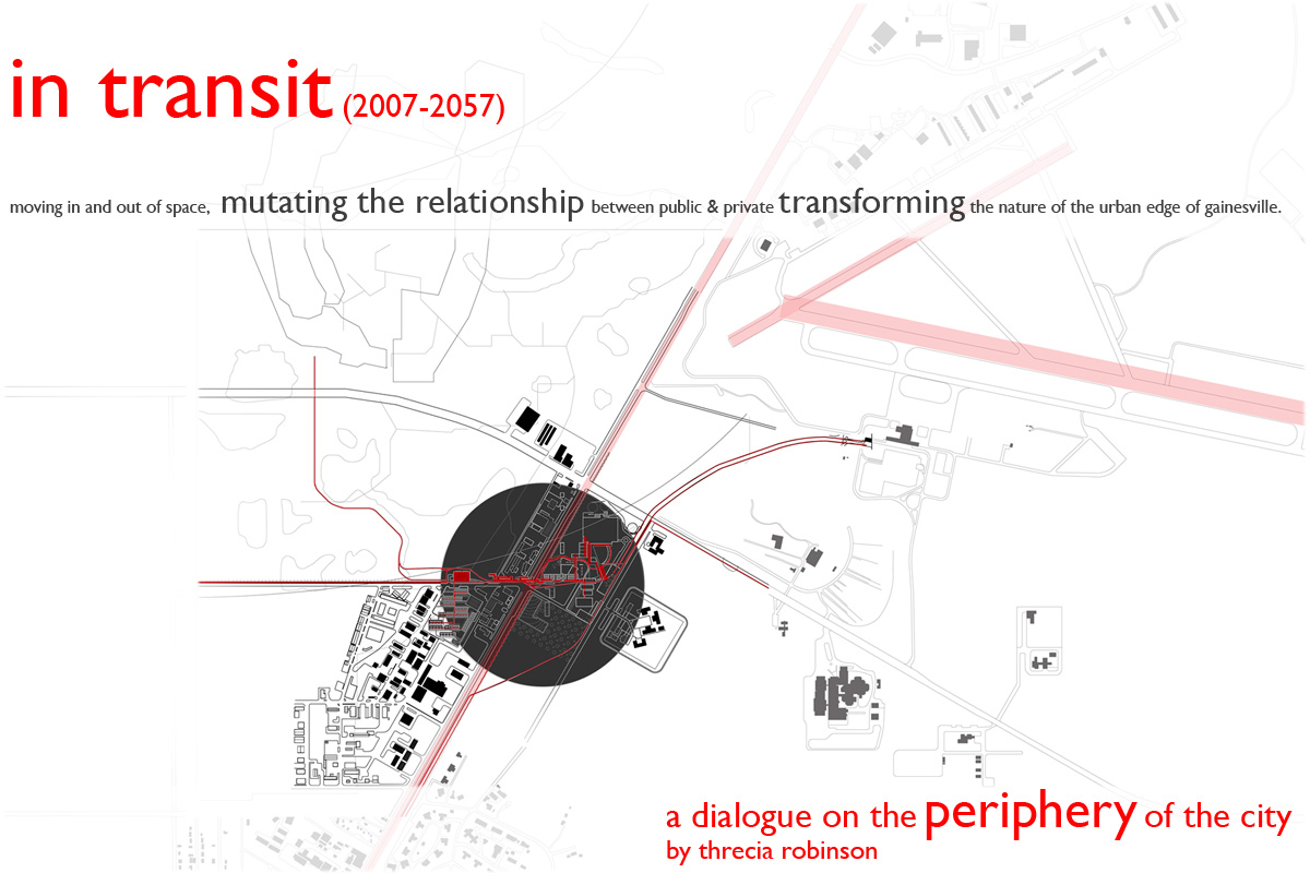
In Transit
Threcia Robinson
[E]merging Landscapes
Matthew Rossi
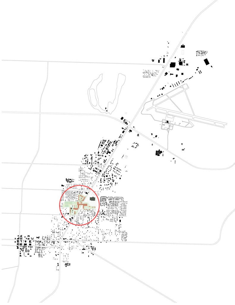
Citizens’ District
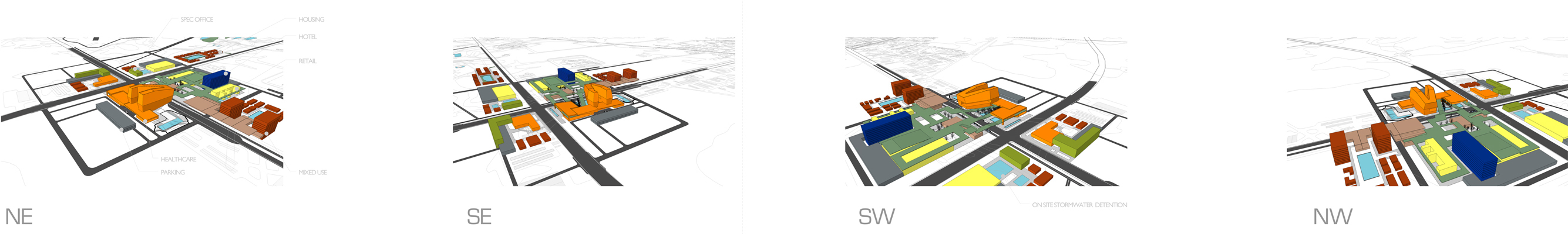
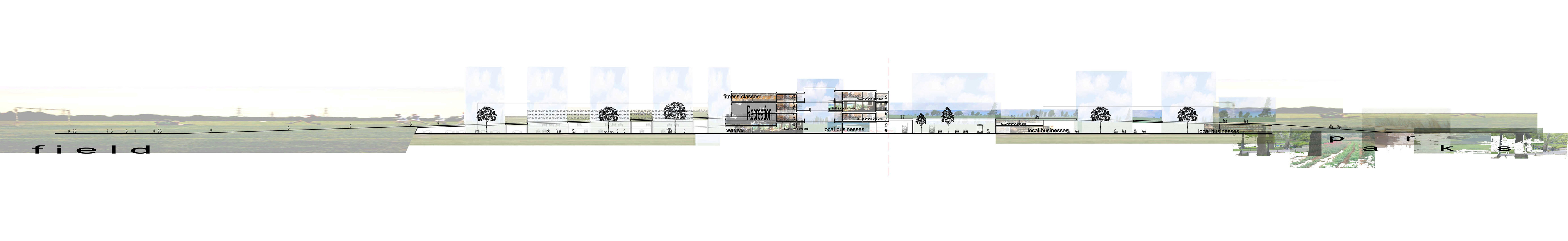
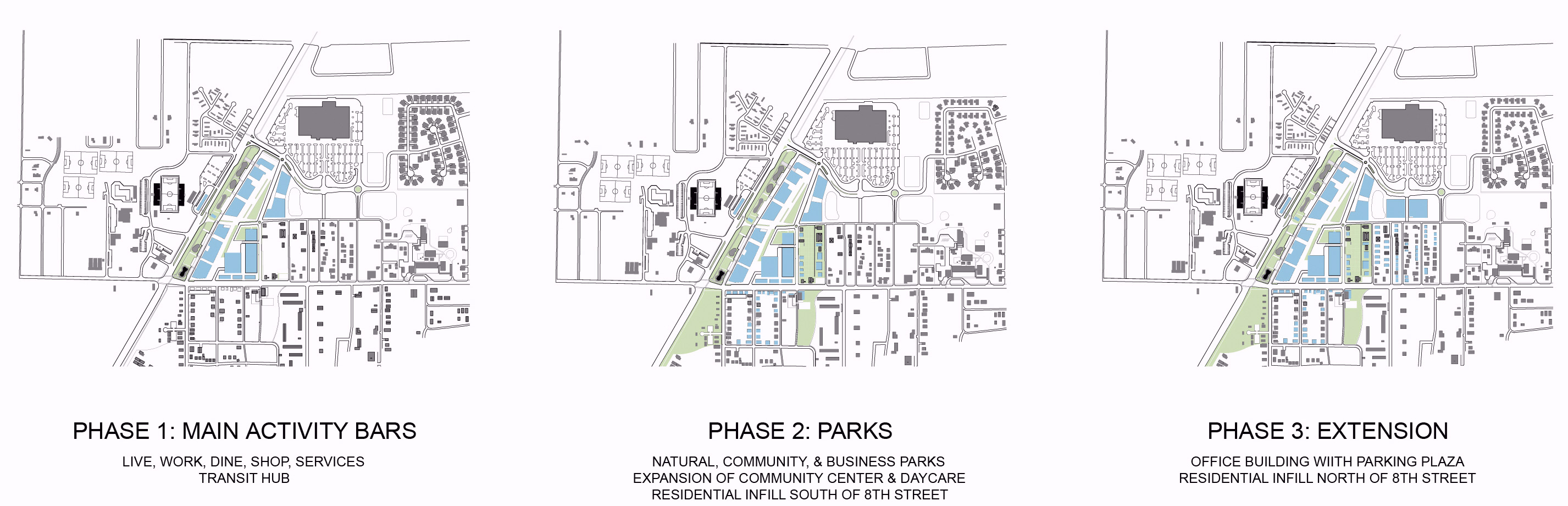
Housing is the crucial urban program element for this district. More residences are needed to support commercial development in a pedestrian-oriented ‘activity center’ model as suggested by Plan East Gainesville. Medium and high-density housing is needed to support commerce and to provide housing to a range of demographic groups. Program elements at Citizens’ Field should be expanded to include more community education opportunities.
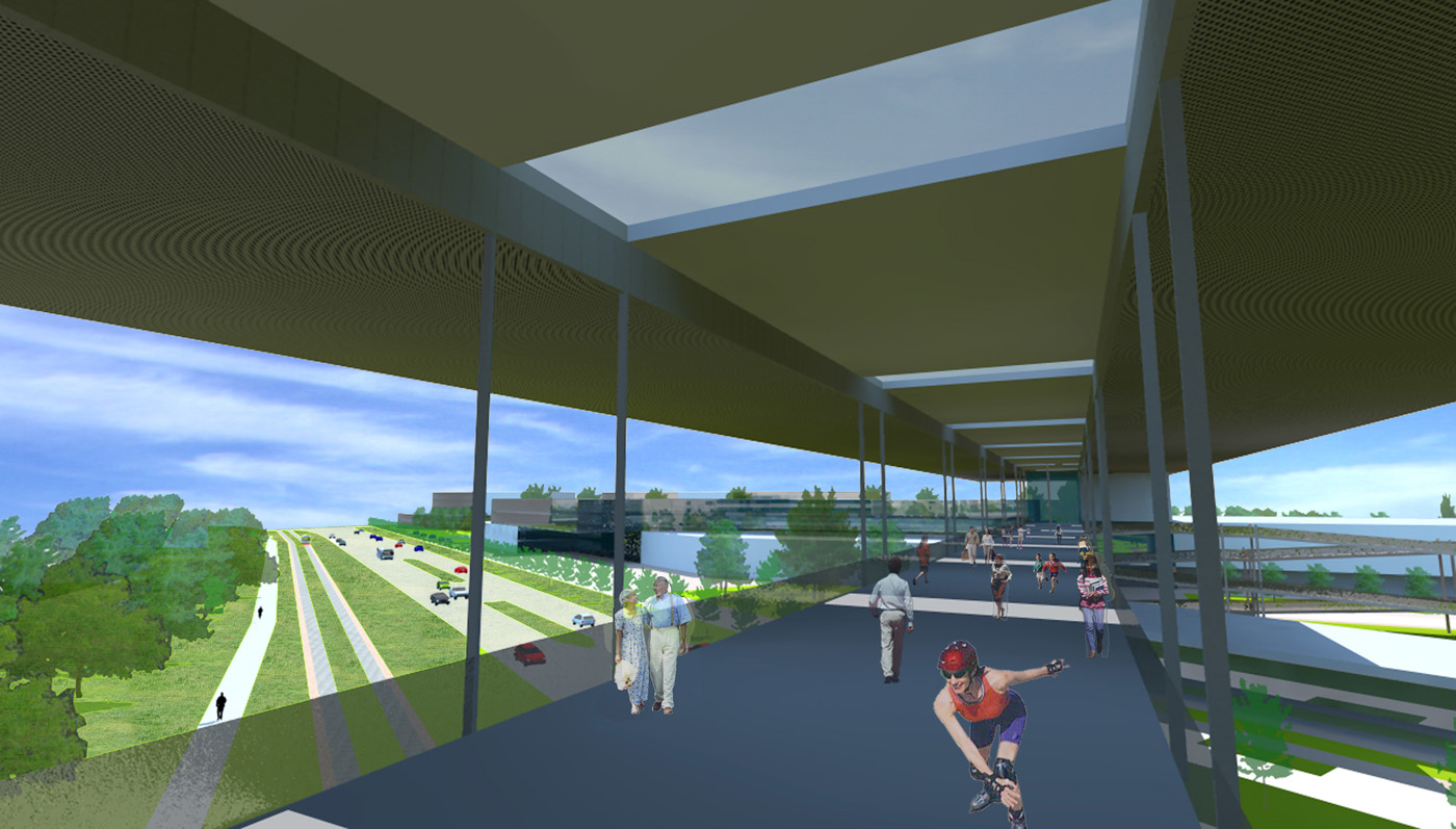
Linking the east and west sides of Waldo Road is a fundamental issue that must also be addressed. Project proposals investigate this linkage through grade-level intersection design and adjacent planning, in concert with elevated overpass connections that utilize commerce and public space components to integrate the overpass into a robust pedestrian activity center. The Community Fields and Four Ecologies Park proposals utilize enhanced educational program elements in addition to speculative commercial space as program components that would support an overpass as part of a civic Citizens’ District gallery. Collective Hinge optimizes the transit (today bus, tomorrow rail) stop as the pedestrian lynch-pin, linking a public plaza, commerce, commuter/consumer parking structures, and large retail with proposed new housing and existing single-family home fabric. Uniting the Community explores a strategy of wrapping a significant parking infrastructure with commercial and medium-density housing to achieve a transitional fabric that connects across Waldo Road at both grade and overpass locations.
All of the proposals attempt to respond to the impact that the Wal-Mart development has made north of NE 8th Avenue. Precedent studies have focused on NE 8th Avenue as the potential focus of any new ‘urban’ development. The work presented here suggests a more complicated strategy is needed to address the greenway between NE 8th Avenue and Wal-Mart and proposes types of housing that can act as both a buffer to and supporter of new commercial development that will wrap around and protect the existing residential neighborhood.

Community Fields
Phuong Kim Lam
Four Ecologies Park
Justin R. M. R. Taylor
Collective Hinge
April-Ann Creech
Uniting the Community
Renee Webley
Greenfield
Tiffany Barlow
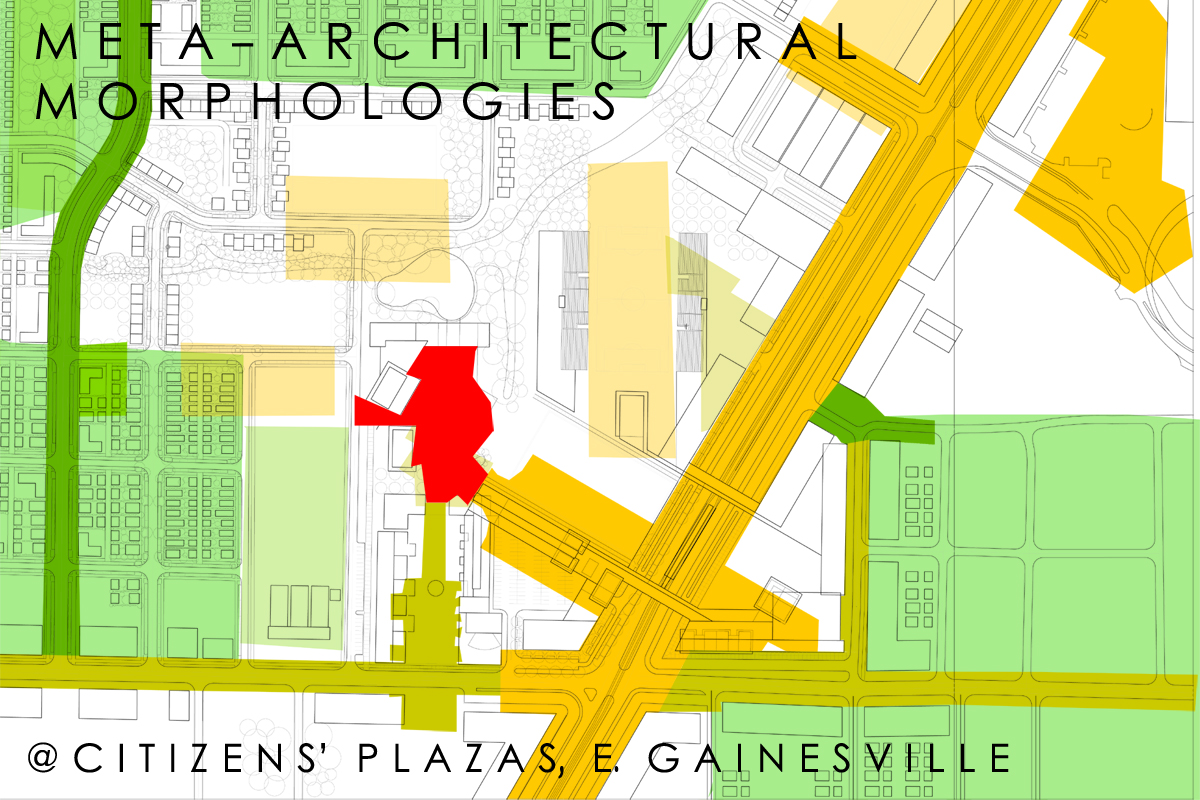
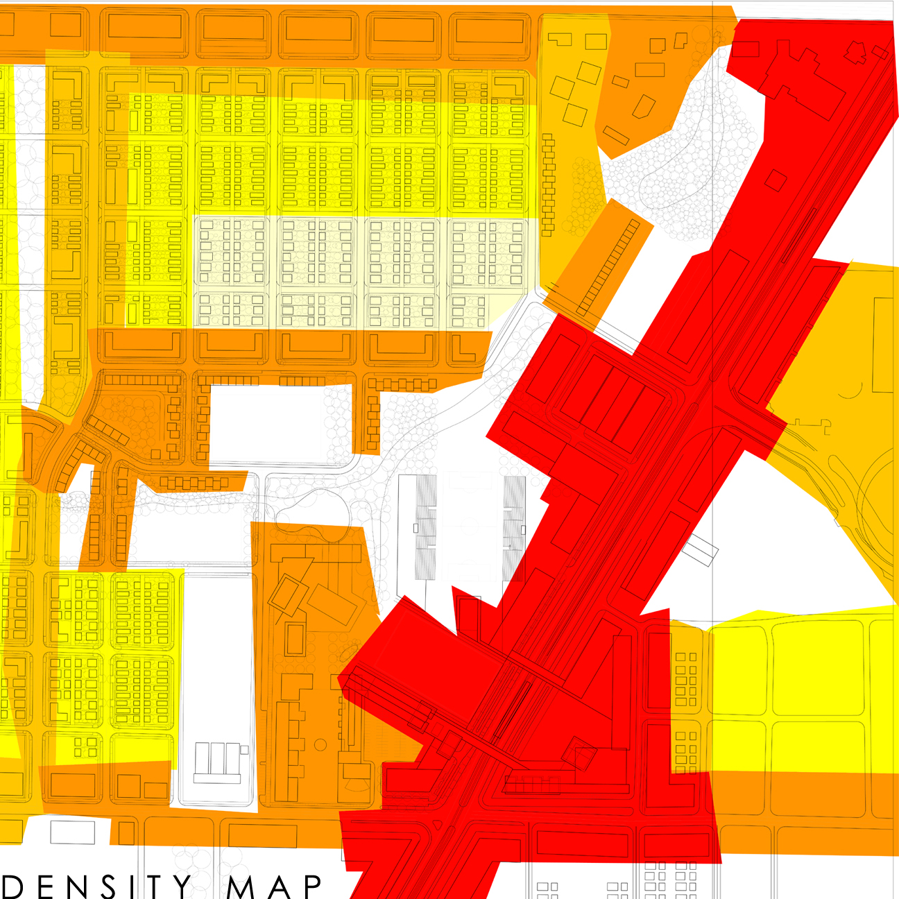
Meta-Architectural Morphologies
Adam Bettcher
Rosewood Branch District
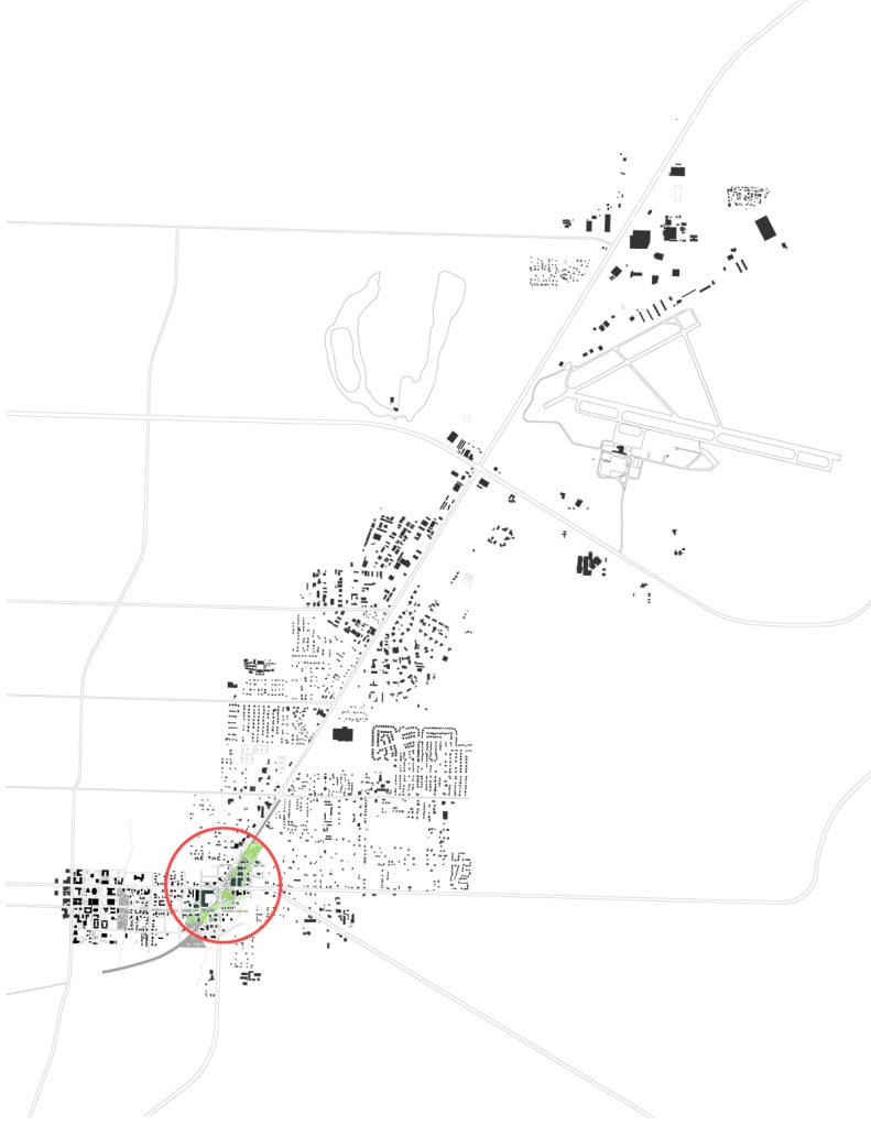
The projects proposed for the Rosewood Branch district are adapted to the combination of the rail-trail diverting from Waldo Road, the cemetery, riparian conditions, and the need to effectively cross pedestrians, cyclists, and transit at University Avenue. In walking distance to the downtown, development at SE 2nd Avenue and Waldo Road could have a major positive impact on both the east side and downtown commerce. Housing is the core program element needed in addition to supporting commerce such as grocery and service businesses including restaurants, dry cleaners, and preschool.
Urban ecology sensitivity is critically important as the local hydrology (creeks and branches) feeds into Paynes Prairie; many existing homes have historic quality, and SE 2nd Avenue retains its original boulevard structure. Proposals focus on reestablishing the creeks as important civic elements, supporting transit along SE 2nd Avenue, and integrating sustainable (green) architecture to enhance the Rosewood Branch District’s existing neighborhood fabric. This is accomplished by focusing on housing density along Waldo Road and stepping down as development moves toward the downtown. Medium-density housing is used as a buffer between established neighborhoods and new development along Waldo Road.
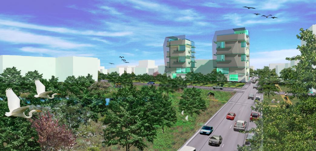
SE 2nd Avenue is an important urban thread that, if developed appropriately, can extend the prosperity of the downtown into east Gainesville. As a combined auto, cycle, and transit corridor, it would gather both fine-grained commercial and quality medium-density residential development interspersed with historic structures. High-density residential units in mixed-use structures are appropriate at Waldo Road as the high elevation of units provides a buffer from the street. Mid-rise mixed-use development at Waldo Road will also provide support for parks that will manage stormwater and enhance the quality of the district.
Bridging the Gap
Gareth Morgan
Green Braid
Robin Schindler
Alternative Neighborhood Design
Amber Wangle
Greening the Corridor
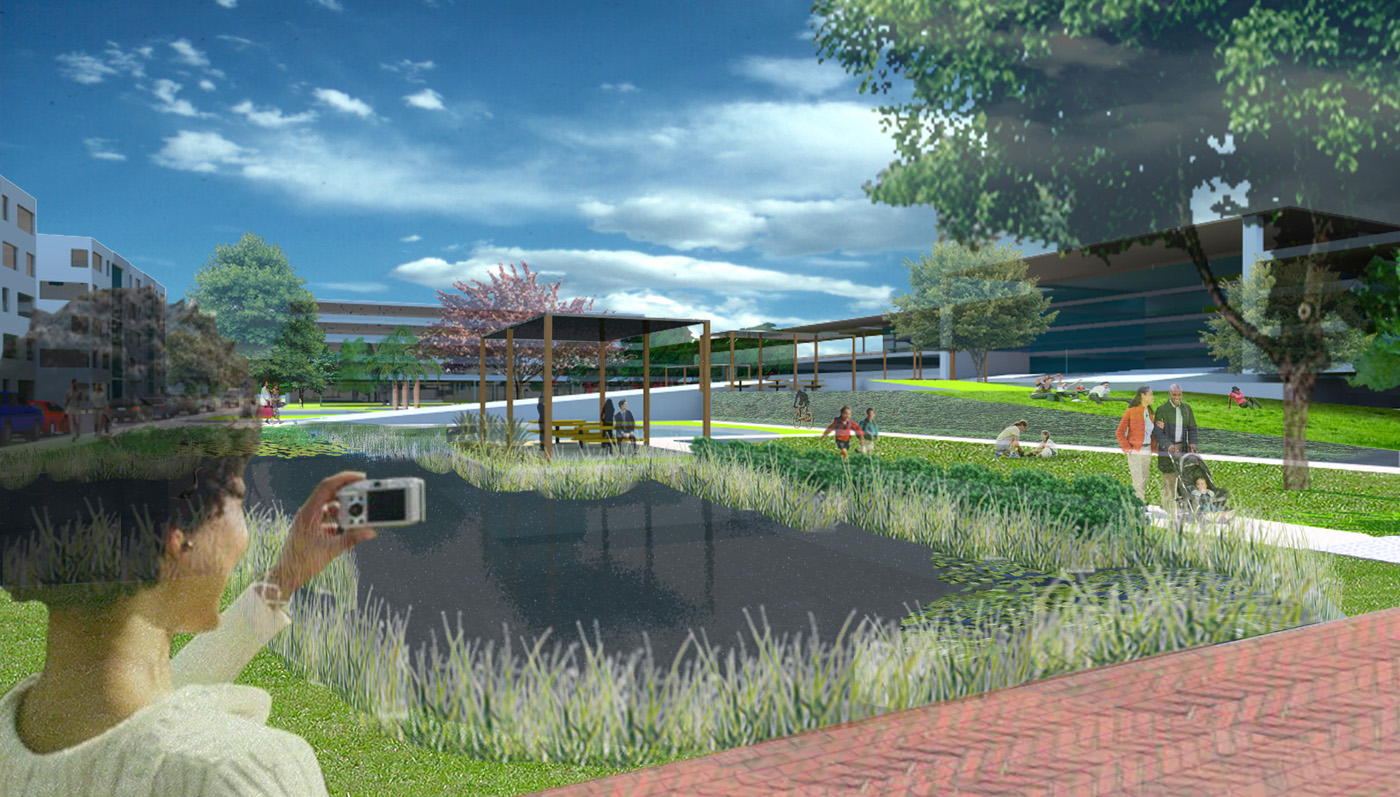
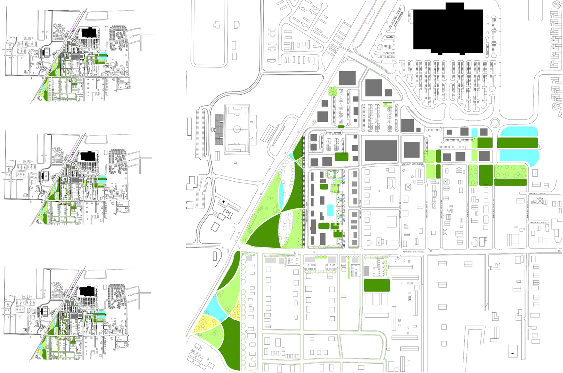
Dedicate open space compatible with residential density and use through revitalizing existing parks, creating new pocket parks, establishing playgrounds, and developing form-based guidelines for green parking. Design streetscape to provide shade and encourage walkable or pedestrian-friendly streets, as well as stormwater infrastructure as an integrated civic amenity within public open space and community greens.
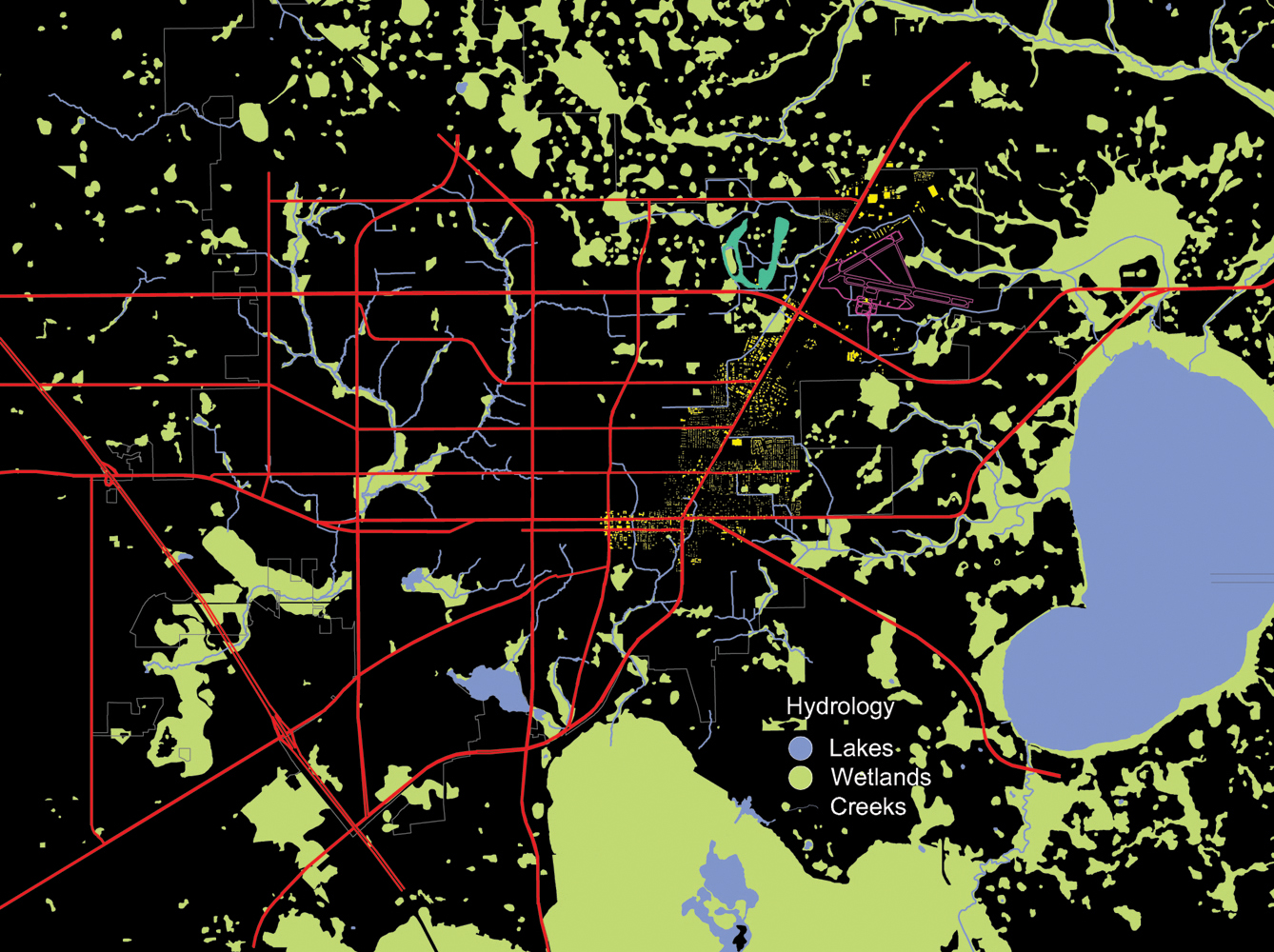
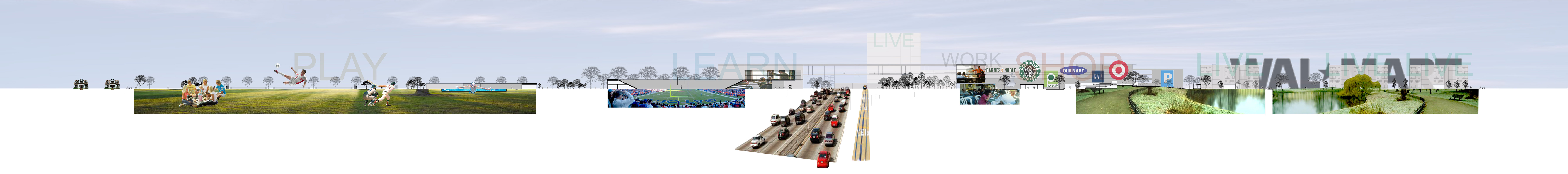
Many existing features suggest the Waldo Road corridor is the ‘green’ gateway to Gainesville — an asset that could be enhanced, emphasized, and expounded. Entering from the north on Waldo Road, one emerges from the pine forest into the expanse of grassland occupied by the Gainesville Regional Airport. Just prior to arriving at NE 39th Avenue the gateway is compressed by the pine forest — transitioning visitors into the linear park/greenway that crosses over into the downtown area at the intersection of University Avenue and Waldo Road. This gateway system has three distinct conditions: the grassland to forest compression north of NE 39th Avenue; the linear park running along Waldo Road (former railroad track); and the cemetery and park just south of University Avenue.
Airport gateway strategies include development that enhances the natural compression of the grassland/forest condition and emphasizes a landscape of stormwater cultivation — taking advantage of the already disturbed wetland at the existing fairgrounds and the need for cleansing of run-off. Greenway strategies include the incorporation of municipal stormwater gardens at key locations to improve habitat diversity and to provide alternatives to on-site stormwater management (promoting development). When possible, the greenway should extend into adjacent neighborhood fabric to provide connected parks and perhaps medium-scale stormwater elements.
Project Proposals
Occupied Thresholds – Michael Compton
The project proposes a medical park as the primary economic driver for development on the corner of NE 39th Avenue and Waldo Road. Big-box retail and other similar scaled development would occupy adjoining corners of the arterial square intersection. In this proposal, hospital-scale medical facilities occur in the southeast, taking advantage of the proximity to the Tacachale site and perhaps a labor pool from the correctional facilities nearby.
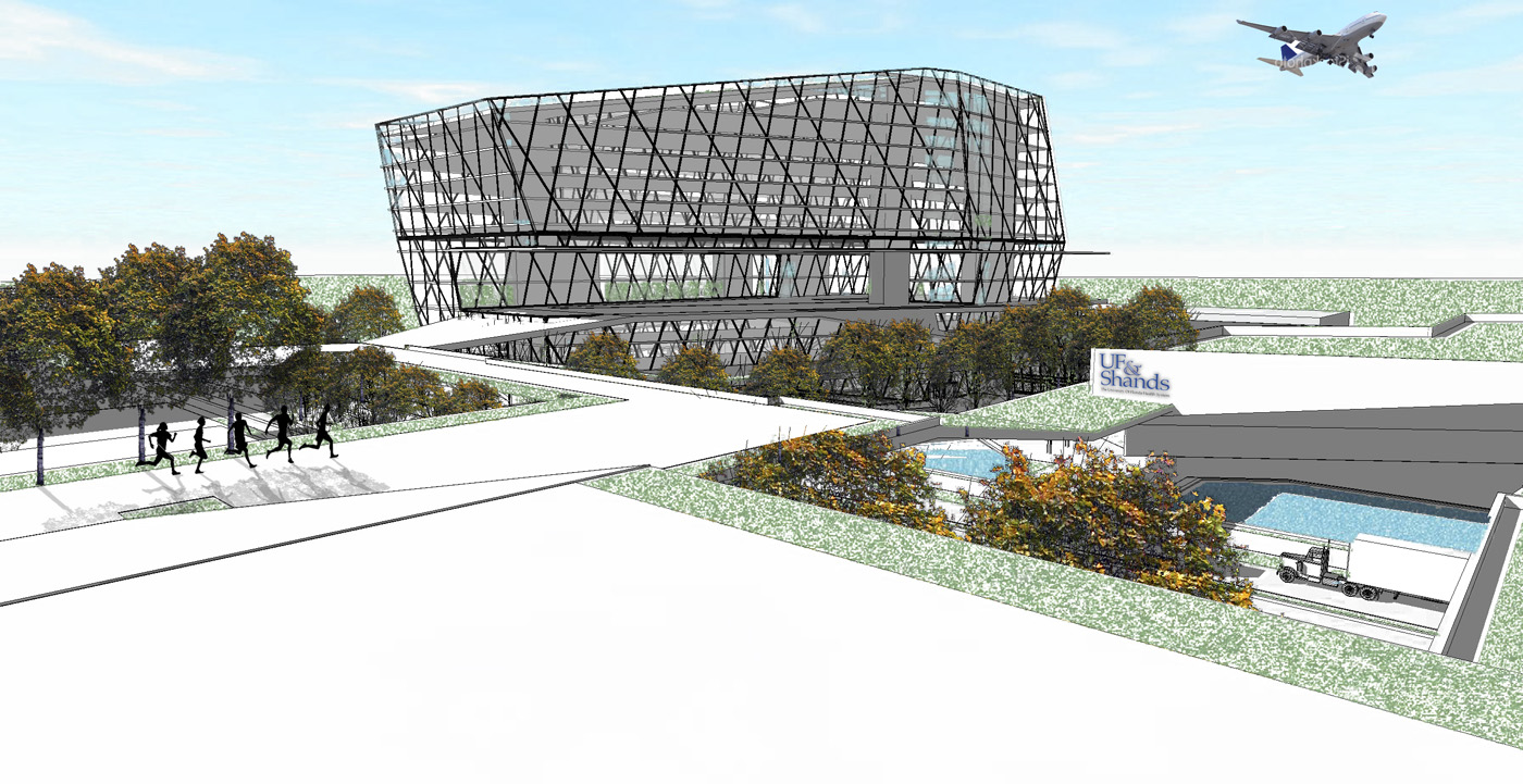
This proposal sets up an organization that will allow medical facilities to emerge through the promotion of smaller clinics and urgent care centers, or alternatively be catalyzed through the construction of a large-scale medical building. The project is based on a network of elevated walks and gardens that connect commerce, office, and medical program elements, providing an integrated mixed-use destination. This includes hotel facilities, restaurants, and a grocery.
High-density housing is not proposed for sites directly adjacent to the corner. Nearby locations, such as the Ironwood golf course (north and south sides), offer prime opportunities for a variety of housing types that would support and be supported by this type of development. Lastly, this concentration of development would support the airport, as medical- and research-oriented events could occur with easy in and out air access. No ground transportation is needed.
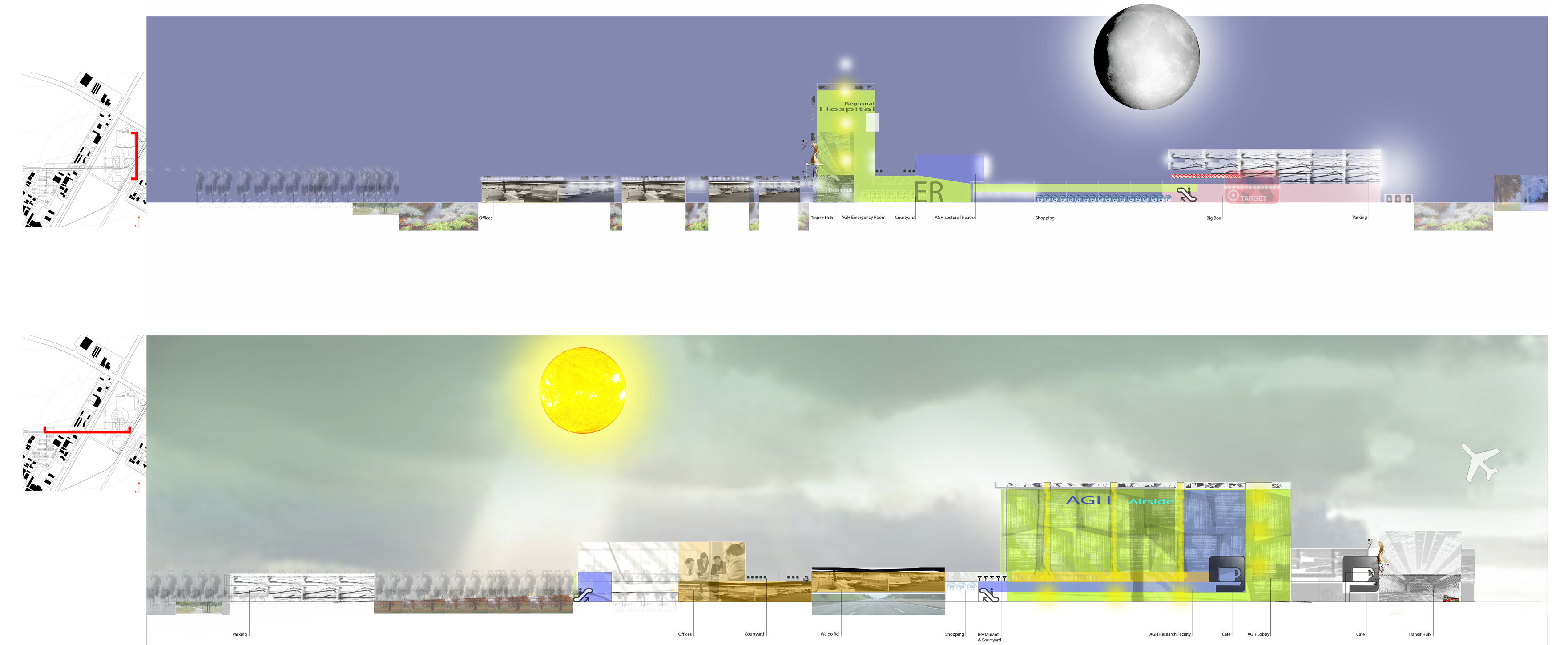
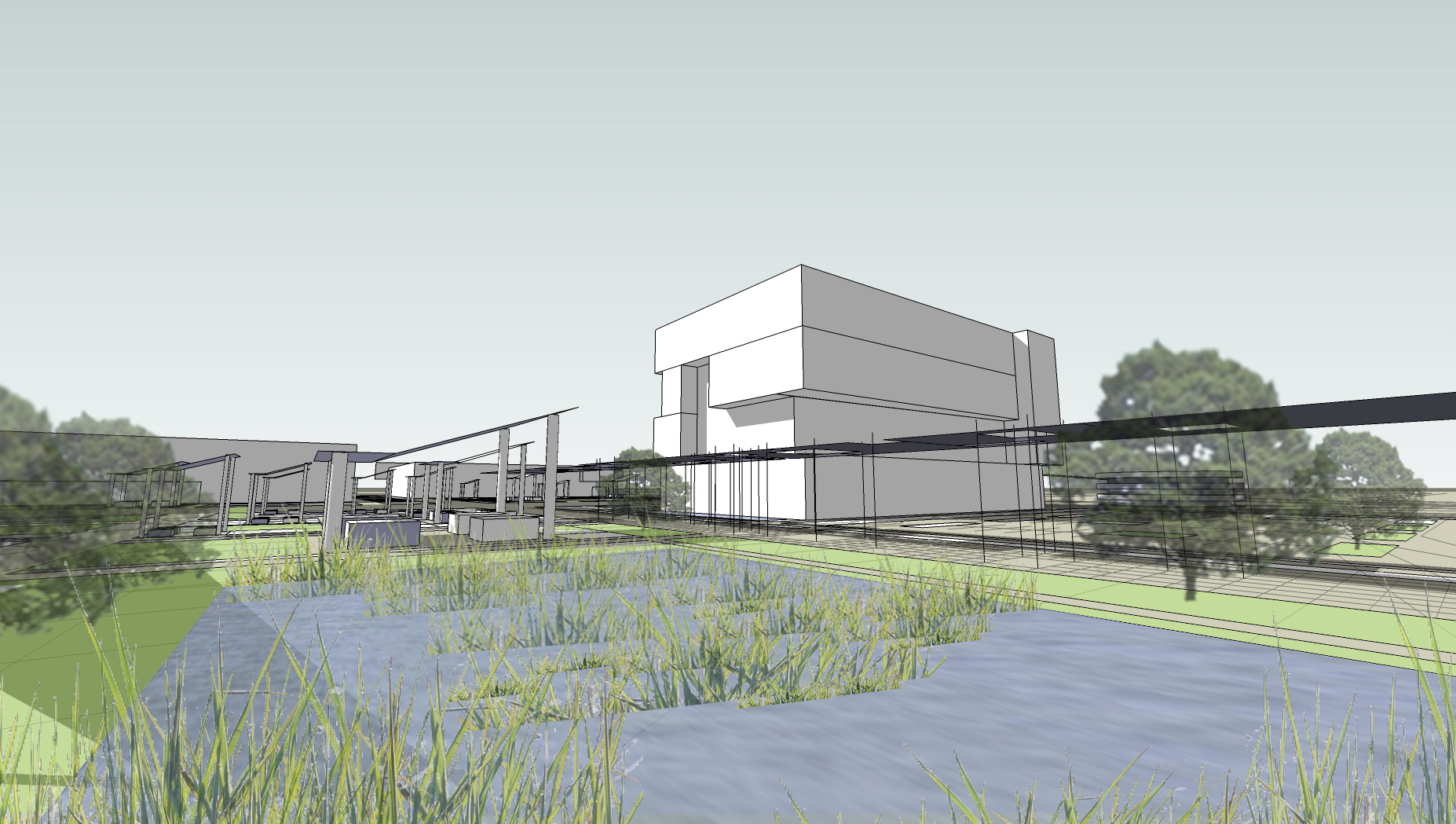
In Transit – Threcia Robinson
In Transit proposes the collaboration of a big-box store, such as Target, with a medical center development group to optimize the use of the southwest corner of NE 39th Avenue and Waldo Road. The project suggests selling the corner for private development (Target), with the 18-hour hospital connected through conditioned space along with patio and garden spaces in between. Additionally, an elevated ‘street’ would connect the hospital complex across Waldo Road to associated medical facilities such as physician offices, laboratories, pharmacies, and insurance providers. Housing is also suggested a bit farther to the west.
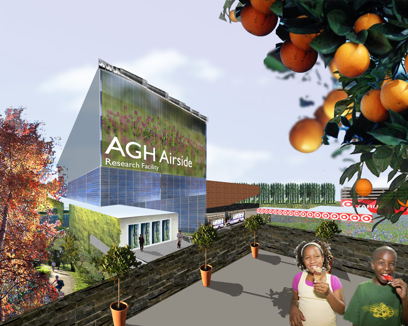
This vision relies on the redevelopment of the corner currently occupied by the UF library book depository which might be better located farther up Waldo Road near the new fairgrounds in the proposed warehouse/ industrial park. However, development could be initiated through smaller-scale initiatives on the west side of Waldo Road that would eventually support the larger projects on the east side. The land to the south (on the east side) is currently owned by the State of Florida (Tacachale as administrator) which could be transferred or translated to accommodate the proposal.
The scheme incorporates transportation connectivity to provide efficient emergency access in addition to transit and cycle modes. The overpass provides a positive transit connector for commuters and, in this case, is incorporated into speculative buildings that could house the needed offices and laboratories. Parking is provided as a combination of on-street, surface, and garage.
Emerging Landscapes – Matthew Rossi
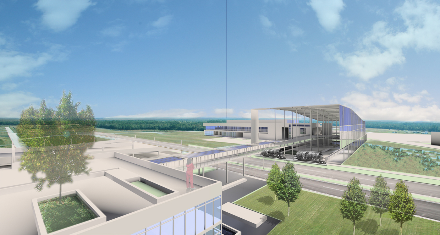
Transforming the former Alachua County Fairgrounds site, this proposal includes ‘big-box’ retail, grocery, office, hotel, entertainment, and parking structures that would support the airport directly as well as regional growth to the north and east of Gainesville. The project takes advantage of the gateway morphology of the existing grassland/woods relationship and extends that into development organization to suggest a gateway destination. A dominant feature of this proposal is the stormwater filtration network including roofs, gardens, bioswales, and wetlands to aid in cleansing the runoff that eventually terminates into Newnan’s Lake.

Commercial programs are organized around a central open space that includes commerce pavilions, small parking areas, parking streets, wetland habitats, and photovoltaic shading structures. The proposal is suggestive of model sustainable development in terms of the ground (cleansing runoff and capturing water) and sky (solar harvesting and providing shade). Building programs and associated parking would be initiated as markets suggest. The central ‘garden’ is uniquely positioned to celebrate the gateway concept as cars pass by on Waldo Road and planes land and take off from the airport.
Transit and a pedestrian overpass are incorporated to facilitate non-automobile commerce. The development proposes grocery and big-box retail on the northwest corner of the intersection to optimize connectivity with future residential development associated with the Ironwood golf course.
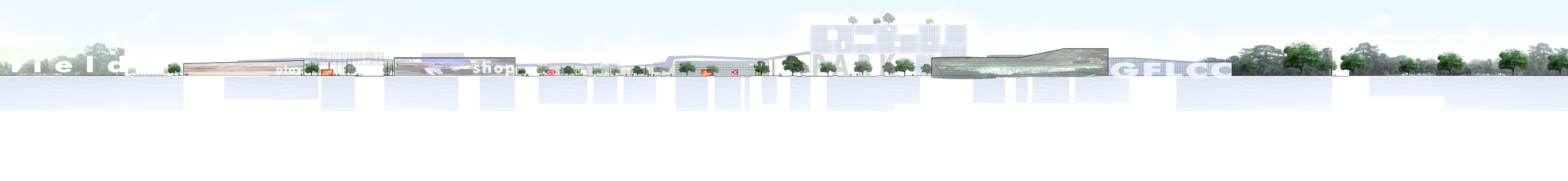
Community Fields – Phuong Kim Lam
An elevated lawn becomes the linkage between education, community recreation, and commercial development at NE 12th Avenue and Waldo Road. Formerly a nondescript intersection, it was reconstructed for the new Wal-Mart and subsequently offers new potential for a commerce corner and extension of civic activities across Waldo Road.
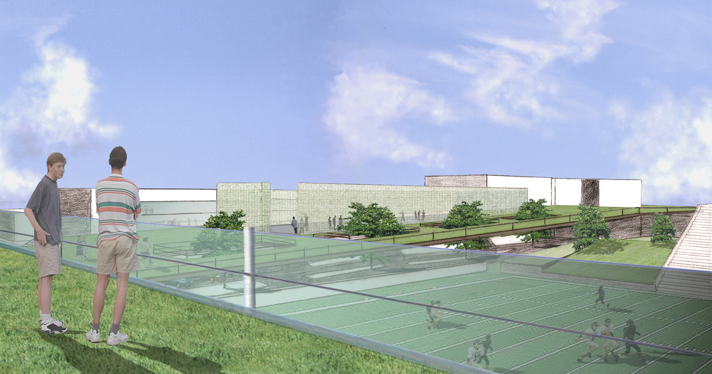
The elevated lawn connects the existing stadium with a newly proposed magnet high school that would occupy new construction and would support existing buildings. On the north side of the lawn, mixed-use buildings would provide commerce and housing with parking tucked below the lawn. The lawn extends across Waldo Road, connecting to higher-intensity commercial (more typical of strip mall program elements) with offices above and dedicated parking at grade. The elevated lawn acts as a courtyard to the shopping and extends out into the neighborhood as a park along the northern edge of the existing residential fabric.
Transit, pedestrian, and cycle modes are highly supported in addition to supporting the transition between auto and transit. Parking infrastructure is highly leveraged, as this recreationally-oriented activity center is occupied by different groups during weekdays, evenings, and weekends. New medium-density housing would be located on the north side of NE 12th Avenue, initially at the existing trailer park and then into the neighborhood over time. This is shown with semi-private courts that transition the large park scale to the smaller housing enclaves. This provides a good balance of amenity and affordability.
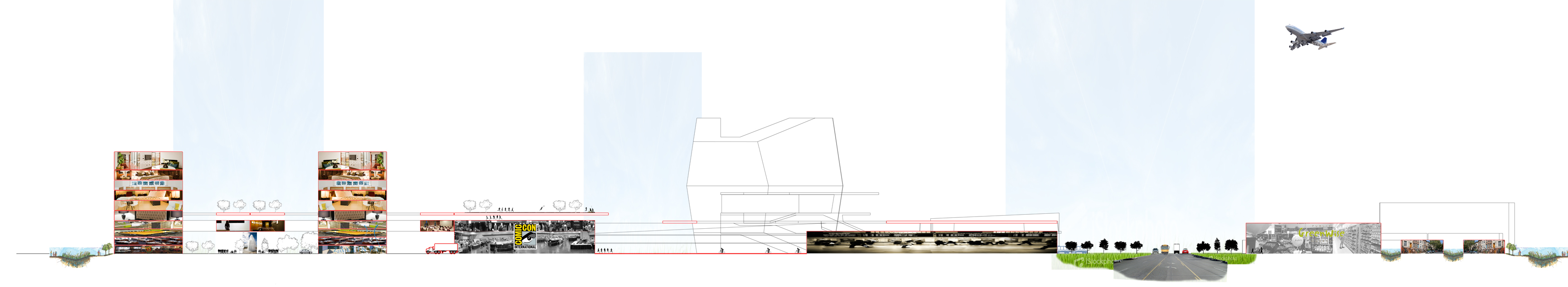
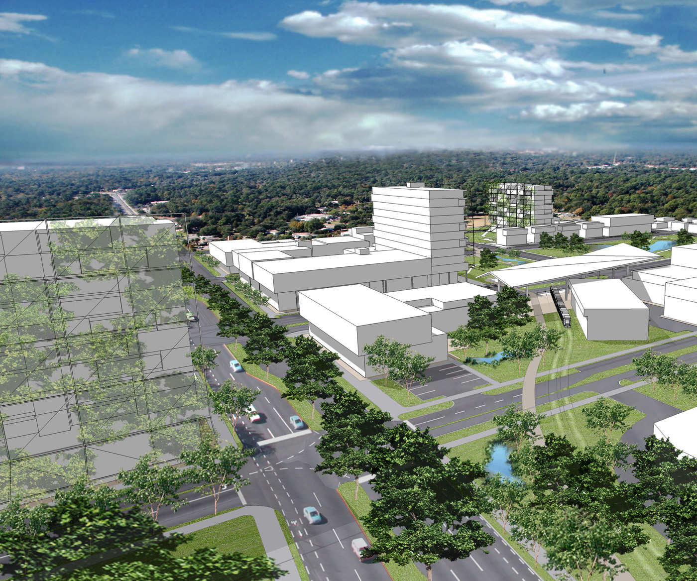
Four Ecologies Park – Justin R. M. R. Taylor
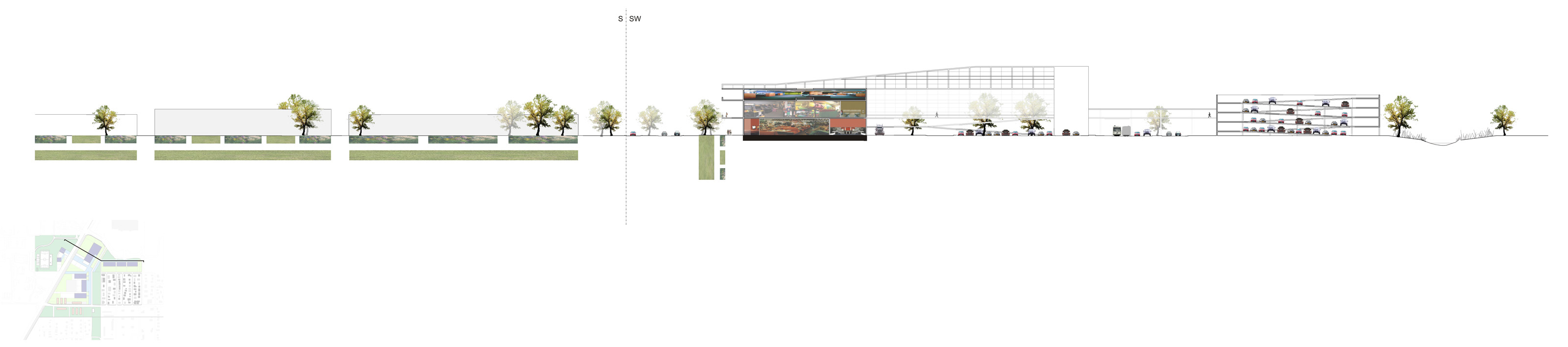
This ambitious scheme engages an elevated pedestrian street as the spatial, municipal, and commercial link between two distinctly different campus typologies — education and commerce.
The east side of Waldo Road is proposed as a commerce campus. Linked regionally by a transit hub, the organization expands the development, suggested by Wal-Mart (auto-oriented), with the distinct difference of incorporating stormwater infrastructure as the central element.
Retail and office buildings along the central ‘quad’ or green space provide a buffer between the residential fabric and the Wal-Mart parking lot. The green space also includes amenities for residents such as playgrounds. Commercial entities would include preschool, fast food, restaurants, dry cleaners, and movie rentals to support further residential development in the neighborhood — vacant lots still exist.
An education and recreation campus is proposed on the west side of Waldo Road, gathering around the existing stadium at Citizens’ Field. This includes community college spaces, continuing education, and conference facilities that might also include magnet high school facilities. Some appropriate commercial development is incorporated within the educational focus campus. Speculative office and incubation space are included as a transition from education to entrepreneurship.
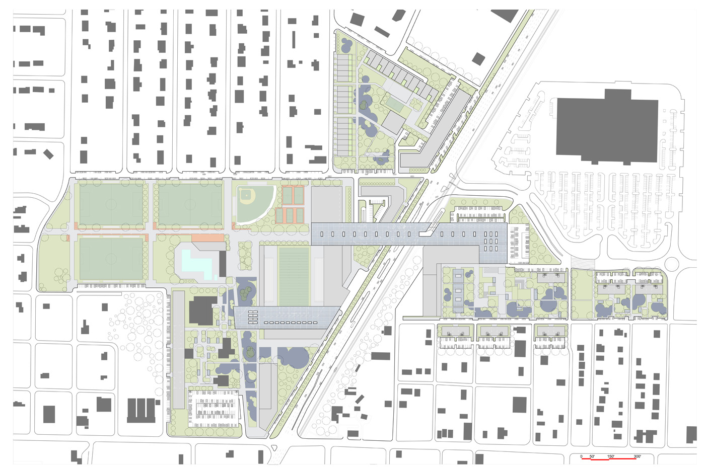
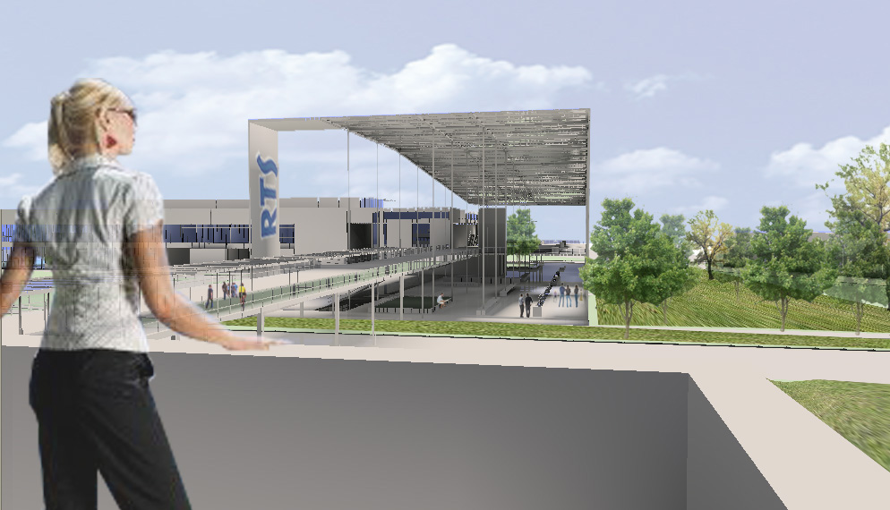
Sustainable features include rainwater harvesting and a substantial amount of photovoltaic panels (regional utility-scale) that could be a substantial demonstration project for the State of Florida (Sunshine State), while also providing much-needed shade to extend the viable use of exterior spaces. This is the type of gateway element — PV canopy to support transit and pedestrian urbanism — that characterizes the communities commitment to both sensible growth and the environment.
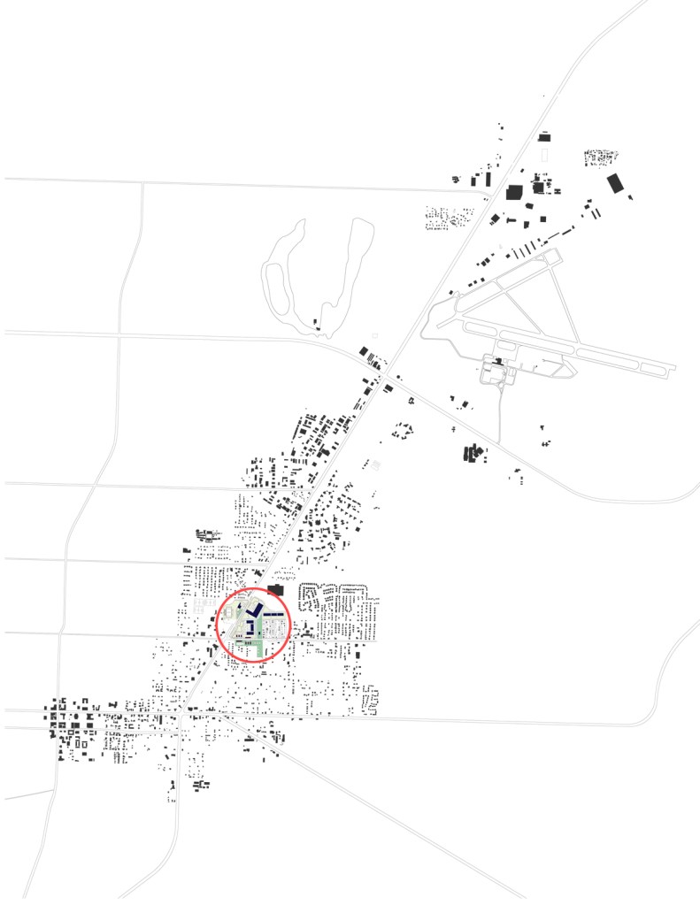
Collective Hinge – April-Ann Creech
This proposal strategically ‘turns the corner’ by wrapping program elements from NE 8th Avenue as an activity center northward, along the Waldo Road greenway, and then back east to capture frontage with Wal-Mart. The ‘hinge’ of this wrapping strategy is a civic transit stop that utilizes a pedestrian overpass to link both sides of Waldo Road and program elements including commercial businesses, offices, and a commuter/stadium parking structure at Citizen’s Field. The proposal integrates infrastructure, commerce, and civic space activated by pedestrians at a uniquely urban scale.
A commuter transfer hub is located adjacent to the Citizens’ Field Stadium that includes some commerce to serve commuters and visitors of the stadium. This parking, along with the stadium itself, is connected via a pedestrian overpass to the ‘hinge’ linking commerce, transit, and public space. Recreational program elements are introduced near NE 8th Avenue to serve existing new residents.

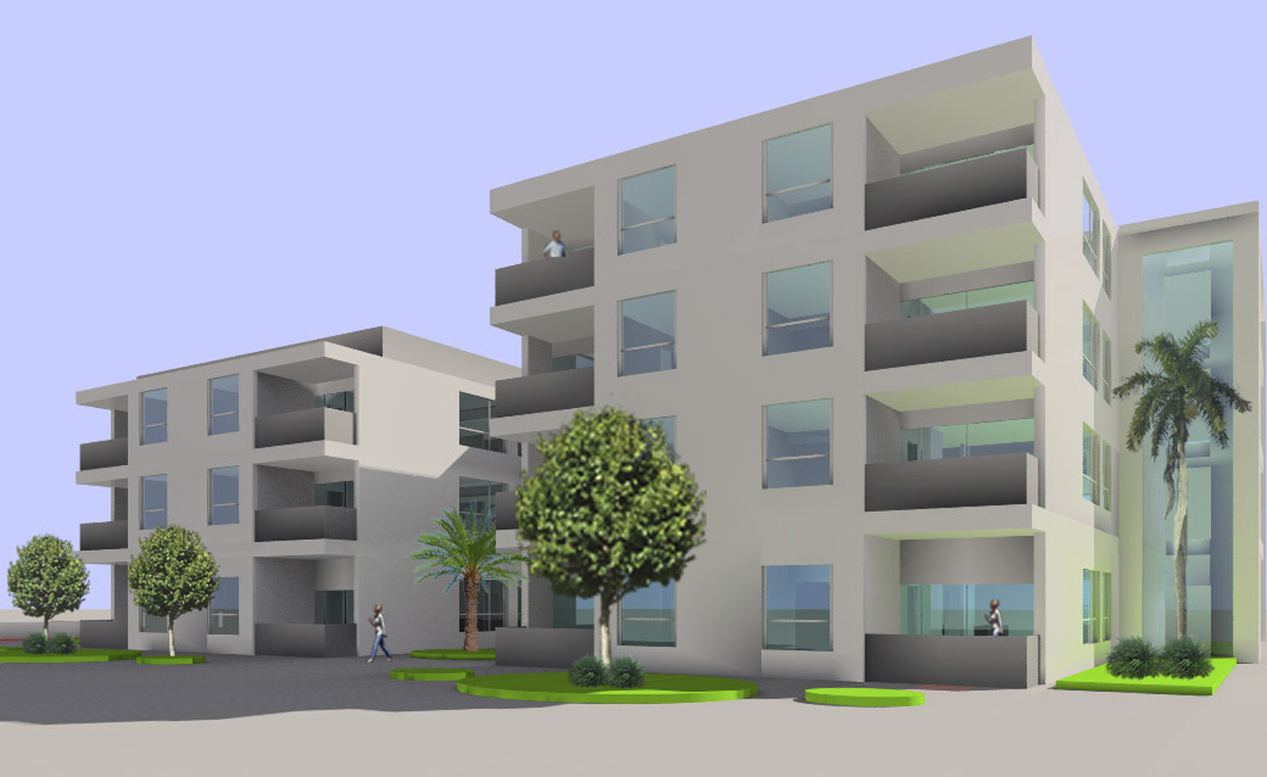
New housing is proposed as an infill development within the existing parcel structure. Strategies that provide duplex housing, dual house, and garage apartment living would be introduced to increase density. At locations near the green spaces, apartment and condominium mid-rise housing are recommended that may or may not be mixed-use.
Uniting the Community – Renee Webley
This proposal wraps civic green space, and commercial and mixed-use functions around a core of parking and service spaces to create ‘frontage’ along NE 8th Avenue, Waldo Road, and the commerce area developing around Wal-Mart. A new connection to Waldo Road is proposed that will promote a grid street network to diffuse potential traffic congestion points such as the Waldo Road and 8th Avenue intersection.
The greenway is maintained as a stormwater and linear park with commercial frontage pulled back to allow a commerce street with on-street parking — additional parking is sequestered behind commerce buildings. Additional parking is provided across Waldo Road near the stadium with an overpass that also serves as a transit stop.
New housing is integrated into the existing urban fabric as infill single- and multi-family units compatible with the existing housing. Green space is deployed as pocket parks in residual space; as a greenfield to support high- and medium-density housing; and as a boulevard to enhance NE 8th Avenue pedestrian commerce. This also provides multiple opportunities for stormwater gardens and associated infrastructure.
Unique bungalow-type apartments were developed to provide a pedestrian edge for the street, have semi-private space for residents, and allow pedestrian circulation through to green spaces behind. They include green roof-occupied spaces that also reduce stormwater runoff. The bungalows and green space provide recreational areas and playgrounds while acting as a buffer between high-density residential and neighborhood fabric.

Greenfield – Tiffany Barlow
This proposal attempts to connect NE 8th Avenue and the current and future development around Wal-Mart with a network of green spaces, parking lots, stormwater gardens, commercial development, and residential towers. The proposal uses traditional suburban development models — buildings in the landscape — with subtle scalar changes to accommodate parking, parks, and public space.
The existing greenway is largely expanded as a buffer between Waldo Road and the new mixed-use suburban fabric. The rhythm established by the existing neighborhood is extended to the new development with jumps in scale as needed. Residential density is gained through height rather than ground coverage, allowing more space to absorb stormwater and be available as amenity green space. Parking structures, on-street parking, and some lots are also incorporated.
The project attempts to contain auto-oriented commerce and associated parking lots between the existing Wal-Mart and new commercial buildings. The new parking lots are scaled-down as smaller separated lots to provide better access to commerce, promote walking and provide more green space.
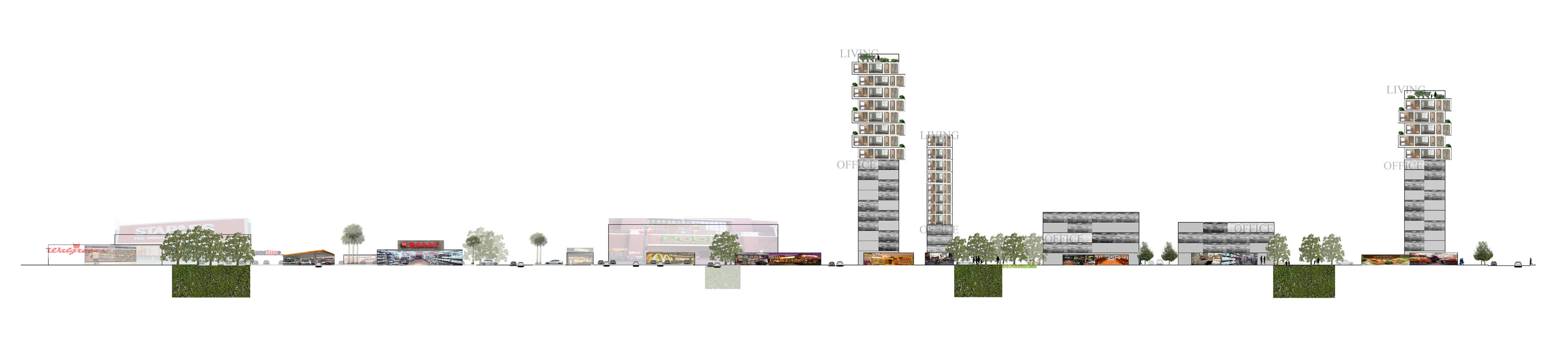
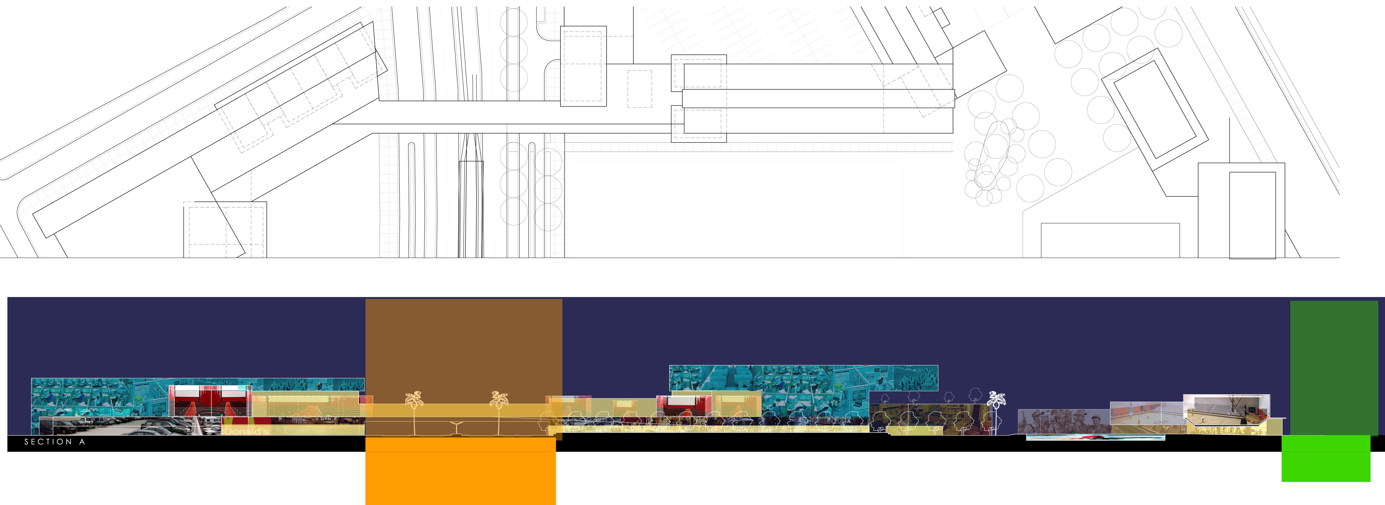
Meta-Architectural Morphologies – Adam Bettcher
This proposal optimizes the intersection at NE 8th Avenue and Waldo Road with new commercial entities that include a cinema. Traditional axial references, in conjunction with a public lawn, signalized pedestrian crossings and a new pedestrian overpass to provide a highly activated corner that can bridge between neighborhoods.
A combination of incorporating the existing Citizens’ Field program and the new program is organized around the amenities of outdoor spaces. Stormwater flow and associated habitat conditions are reintroduced into the site in conjunction with organized recreational activities.

An interesting strategy for the residential neighborhood grid is proposed that will allow landowners to subdivide their property to accommodate row-house typologies with garage apartments and garden courts. This potentially could increase the density by a factor of four while providing income generation for the existing landowners. The streets are reorganized into frontage (parallel parking and pedestrian) and alleys that would be dedicated to service. The renovated land use supports increased pedestrian activity that would flow into and out of Citizens’ Field.
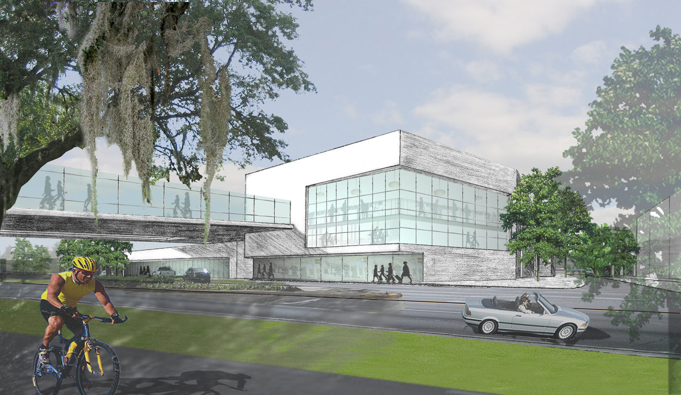
Bridging the Gap – Gareth Morgan
The ‘gap’ is the intersection of University Avenue and Waldo Road which is a substantial obstacle to cycle commuters making their way from east Gainesville to the downtown and University of Florida. The commercial program, such as a grocery and office in a mixed-use structure, supports garage parking with a green roof to elevate the greenway.
The elevated greenway allows a cyclist/pedestrian overpass to connect the elevated greenway across the street providing cycle/pedestrian continuity. The elevated greenway also provides needed recreational space for high-density residential above the commercial base and creates an ecological dialogue with the other ‘green’ corners such as the existing cemetery and SW corner pocket park.
The proposal suggests pedestrian frontage on the street grid with varied scales of mixed-use buildings. The riparian condition of the Rosewood Branch would be restored as an ecological focal point of the new activity center. The plans and sections included in this section illustrate the great potential of these strategies to transform this underutilized enclave.
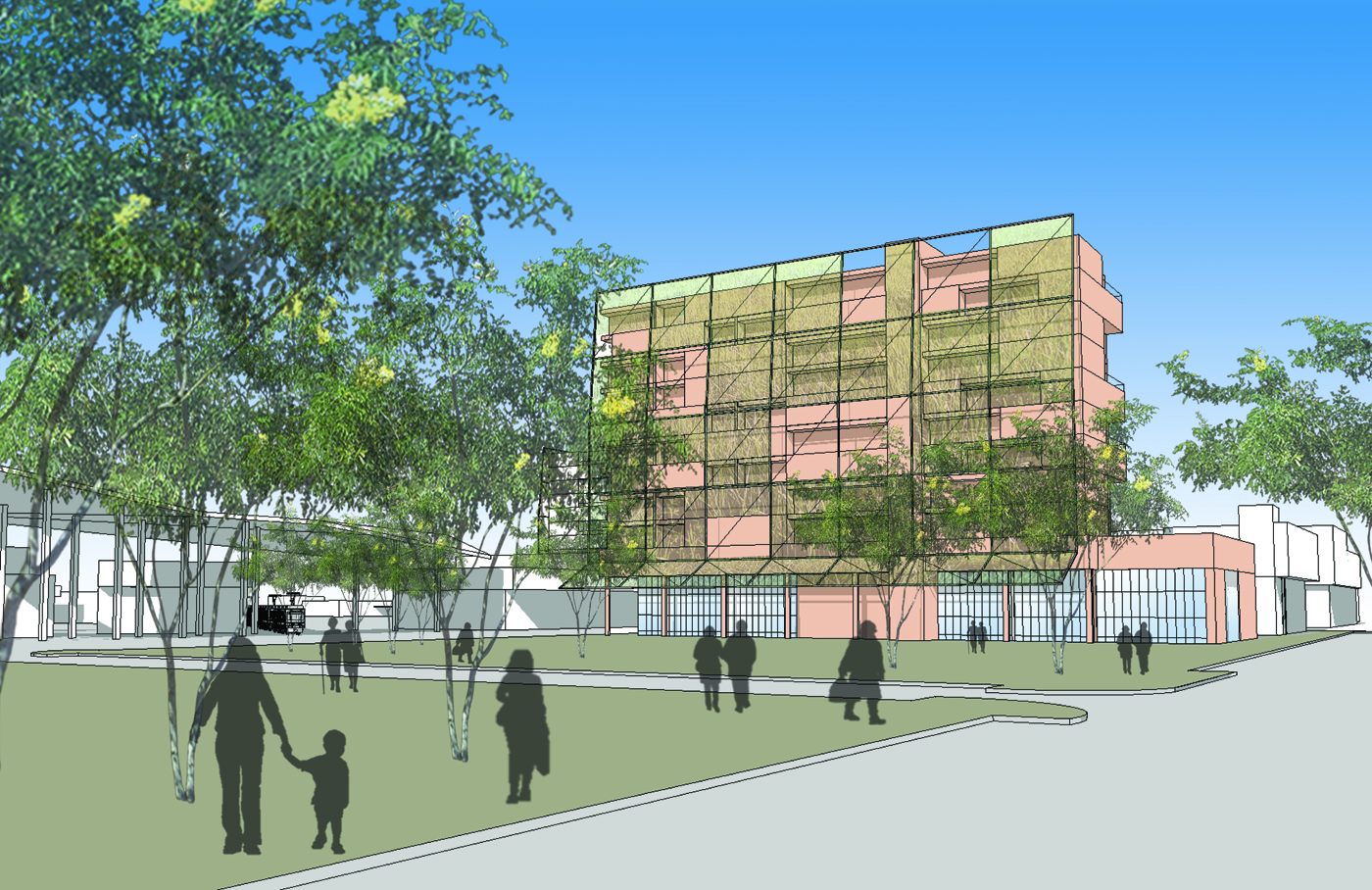
Green Braid – Robin Schindler
Translating green space into green facades symbolizes the intention and potency of this proposal. This development proposal for land adjoining the intersection of SE 2nd Avenue and SE Williston Road (south Waldo Road) establishes this important location as a vibrant activity center. Civic and recreational parks provide the core amenity while supporting practices of stormwater management with bioswales, green roofs, and riparian reconstruction. Green walls extend this concept to shade, cool, and promote the ‘brand’ of a sustainable community.
The proposal leverages the right-of-way for transit, existing green space, and the SE 2nd Street boulevard to anchor transit-oriented mixed-use development with high-, medium- and low-density housing to provide luxury, market-rate, and affordable housing. The proximity to the downtown provides a substantial amount of economic infrastructure within walking distance and what could be one rail or BRT stop.

Utilizing the existing transportation grid, the project pulls back to provide parks and limited surface parking (garage parking is included) and also optimizes on-street parking. A transit hub is provided north of SE 2nd Street that could accommodate the transfer of auto commuters and gather commuters from within the neighborhood. It is just a short walk from the transit hub to many historic structures such as the Cotton Club.

Alternative Neighborhood Design – Amber Wangle
Alternative Neighborhood Design (and…) is coined to convey the integration of smart-grown, transit-oriented design (TOD), low-impact development (LID), and leadership in energy and environmental design – neighborhood design (LEED-ND) strategies.
The proposal minimizes building footprints to provide green space while optimizing density to support non-automobile lifestyles. Residential towers and row housing is proposed to include varied scales and to allow mixes of uses in both horizontal and vertical configurations — living next to the office or above the office. This brings back the traditional ‘corner’ store with residential uses in mid-block locations.
A subtle but important aspect of the design is that it provides a formal civic park north of SE 4th Avenue as the ‘head’ of stormwater and recreational park system that filters runoff before it migrates south to Paynes Prairie. As a continuation of the rail trail, it utilizes and expands the design of existing park infrastructure in that area.